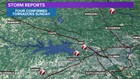

Columbia, SC (WLTX) - The National Weather Service in Columbia has confirmed four tornadoes struck the Midlands Sunday.
Monday evening the weather service issued their findings form the tornadic event.
A tornado formed near Gilbert in Lexington County a little after 2:00 PM Sunday. The tornado began near Hayes Crossing Road. The storm snapped and uprooted numerous trees.
The tornado also tore through seven chicken houses. A few structures, vehicles and two campers were damaged. Peak winds for this EF-2 tornado were estimated at 120 mph.
The second tornado in Lexington County started near Saddlebrooke Road around 2:15 PM. the track ended along Kenwood Drive. Trees were uprooted and snapped. Peak winds for this EF-0 tornado were estimated at 80 mph.
The third Lexington County tornado began just south of Corley Mill Road along Lee Kleckley Road. Trees were snapped and uprooted along the path of the tornado. The highest winds for this EF-1 tornado were estimated at 95 mph.
In Fairfield County a tornado developed about 15 minutes before 3 PM. The tornado formed about 8 miles north-northeast of Ridgeway, and it continued to the western shores of Lake Wateree.
The tornado produced damage just south of White Oak Church Road. It also uprooted and snapped numerous large trees near Gunsite Road. The strongest winds for this EF-1 tornado were estimated between 95-105 mph.
According to the National Weather Service, there were no fatalities or injuries from the tornadoes Sunday.
EF Scale: The Enhanced Fujita Scale classifies tornadoes into the
following categories:
EF0...Weak......65 to 85 mph
EF1...Weak......86 to 110 mph
EF2...Strong....111 to 135 mph
EF3...Strong....136 to 165 mph
EF4...Violent...166 to 200 mph
EF5...Violent...>200 mph