/cdn.vox-cdn.com/uploads/chorus_image/image/52269581/190116_15_46_50_5DSR2106.1481659306.jpg)
The area that’s currently being transformed into the Hudson Yards megaproject has functioned as many things in the city’s 400-year history: a military fortification, rail yards, an offloading area for slaughterhouses, and now, an enormous mixed-use development.
But how, exactly, did those transformations take place?
Before railroads
The 1782 British Head Quarters map shows an unidentified waterfront fortification on today’s West 34th Street, between 11th and 12th Avenues. Overlaying that map on the present-day shape of Manhattan reveals how much of today’s Hudson Yards site is built on fill.
An 1815 map of today’s Hudson Yards site shows a few isolated rows of houses around 34th Street. They were built on land owned by Dr. Samuel Watkins, a namesake of the upstate town Watkins Glen, and Isaac Moses, one of the most prominent Jews of the American Revolution. I couldn’t find additional information on who lived here or when the buildings were demolished; any evidence that might remain, such as crooked property lines, is hidden under the rail yards.
:format(webp):no_upscale()/cdn.vox-cdn.com/uploads/chorus_asset/file/7639329/1815_Blue_Book_Hudson_Yards.jpg)
New York’s first railroads
Opening in 1849, the Hudson River Railroad cut down the west side of Manhattan. Carrying passengers from as far as Albany, it followed 11th Avenue to the main terminal at 32nd Street; the route then shifted over to 10th Avenue, where passengers could continue to Chambers Street. Locomotives were banned south of 34th Street because their polluting smoke and propensity to spook horses were too risky for such a densely developed area. Instead, a “dumb engine”, which consumed its own smoke and made much less noise, led the cars on this leg of the journey.
In rejecting an 1863 proposal to return to horsepower, Mayor George Opdyke cited New Yorkers’ propensity to jaywalk as a reason to keep the train cars together: “Again: persons desirous of crossing a railroad track will wait for the rapid passage of a train of cars without making an attempt to pass over, while, if the same cars were drawn separately by horses, with a line extending with spaces a great distance back, instead of but two or three hundred feet, the same persons, rather than submit to the delay and inconvenience of waiting, would take the risk of attempting to cross between the cars. Besides, many will recklessly expose themselves their horses and vehicles to the risk of collision with a car drawn by horses who would be much more prudent as to a train of cars drawn by a locomotive.”
These trains ran alongside pedestrian and other traffic, frequently leading to carnage and the nickname “Death Avenue.” The grade-level tracks were replaced by the freight-carrying High Line in the 1930s.
Cornelius Vanderbilt purchased the Hudson River Railroad in 1864, soon folding it into his New York Central Railroad empire. The Commodore’s company would control direct railroad access to New York City for nearly fifty years, thanks to his acquisition that same year of the New York and Harlem Railroad, which fed into Grand Central Terminal.
:format(webp):no_upscale()/cdn.vox-cdn.com/uploads/chorus_asset/file/15956595/rr004860.jpg)
From docks to rails
That monopoly ended in 1910, when the NYCR’s arch-nemesis, the Pennsylvania Railroad, opened its North River Tunnels. Until then, anyone approaching New York from the west had to cross the Hudson by boat; several railroad companies had their own ferry terminals on both sides of the Hudson.
PRR passengers could now enjoy non-stop service from New Jersey to the beautiful McKim, Mead and White-designed Pennsylvania Station at 34th Street and 8th Avenue. But customers of competitors (such as the Baltimore & Ohio, Erie, and Central New Jersey) would still need to transfer to a ferry to cross into New York. While the openings of the Holland Tunnel (1927), George Washington Bridge (1931), and Lincoln Tunnel (1937) provided additional options to reach the city from points west and south, PRR kept the most convenient rail option all to itself.
Most freight, on the other hand, was floated across using transfer bridges. These let operators move train cars between land and ferry. Remnants of three such conveyances can be seen at 69th Street in Riverside Park and in Gantry State Park in Queens. Although they appear unwieldy, they were more efficient at unloading freight than today’s cranes.
The fall of private rail travel
After World War II, a confluence of unfavorable factors caused turmoil in the Northeast railroad industry. The development of the Interstate Highway System allowed easier short-range movement of goods and people by trucks, buses, and automobile; government regulations made it impossible for railroads to raise their prices, forcing them to slash costs to remain viable. Rivals NYCR and PRR merged as Penn Central in 1968, only to declare bankruptcy two years later.
Donald Trump purchased the company’s two Manhattan freight yards with an eye toward development. One became the site of the Jacob J. Javits Center, just north of Hudson Yards, in 1975; the other became the site of Riverside South/Trump Place in 1997, which the president-elect later sold. Penn Central’s passenger service in New York City, on the other hand, was soon taken over by government agencies, including Amtrak, New Jersey Transit, and Metro-North Railroad. These transfers would be key for future development on these properties.
:format(webp):no_upscale()/cdn.vox-cdn.com/uploads/chorus_asset/file/15956606/shutterstock_230801173.jpg)
Before the Hudson Yards project broke ground, the last significant build in the area was the John D. Caemmerer West Side Storage Yard, which opened in 1986. (Although it is officially named for the State Senator who pushed for funding for the $200 million project, it’s almost ubiquitously known as the West Side Yard.) Before the West Side Yard was built, LIRR trains arriving at Penn Station in the morning rush would have to be sent empty out to Long Island for lack of storage space.
The renovation also allowed for a new tunnel that connected Amtrak’s northbound Empire Service to connect directly to Penn Station. Cognizant of the valuable air rights of this new rail yard, the designers incorporated wide platform space so that something could be built over without disrupting the yard’s original use.
Hudson Yards rezoning and the 2012 Olympics
The area was originally called “Far West Midtown” in early redevelopment plans. The first mention of the name “Hudson Yards” in The New York Times came in 2001, as part of NYC 2012, the city’s bid for the 2012 Summer Olympics. City officials announced the full $3.7 billion package in February 2004, with a master vision that includes four main parts.
:format(webp):no_upscale()/cdn.vox-cdn.com/uploads/chorus_asset/file/15956610/150914_23_50_55_5DSR4963.jpg)
1. An extension of the 7 train: After several years of delays, the 34th Street–Hudson Yards station opened in September 2015, becoming the first new station on the New York City Subway network in 25 years. But this extension came with a missed opportunity: a second station at Tenth Avenue and 41st Street. Costs were estimated at $500 million when the project was killed in 2010; they’re now estimated at $1 billion, should the station be added at a later date.
2. Large-scale rezoning: The January 2005 rezoning report called Hudson Yards the “one last frontier available in Manhattan” for office development. Originally proposed to cover around 50 blocks between West 28th and 42nd Streets mostly west of Eighth Avenue, the “Special Hudson Yards District” ultimately encompassed around 30 blocks. The city’s plan was modeled, in part, by development on the East Side a century prior, after a 1903 state law barring exposed tracks in midtown led to the creation of the modern Park Avenue.
3. An expansion of the Javits Center: With 840,000 square feet of exhibition space, the Javits Center is miniscule compared with convention centers in other cities—he McCormick Center in Chicago, for example, offers 2.4 million square feet. The original proposal for Hudson Yards included an expansion of Javits Center to nearly double its size; although this possibility appeared dead for several years, Governor Andrew Cuomo revived it in 2016, selecting three firms to bid on the $1 billion expansion plan, which would add 1.2 million square feet to the site.
4. A new sports venue: The centerpiece of NYC 2012’s strategy was the West Side Stadium, an 85,000-seat arena directly above the West Side Yard. The stadium would be built with $600 million of public money and $800 million from the New York Jets football team, which would have called the facility home after the Olympics.
Reactions and results
A 2004 position paper from the Regional Plan Association called the combined Javits Center expansion and stadium “a suboptimum use of a site that is key to the long-term development of the district,” preferring instead commercial use. And a November 2004 Quinnipiac poll showed that while New York City voters favored the Hudson Yards rezoning, extending the 7 subway line, and expanding the Javits Center by large margins, but were overwhelmingly against building a new stadium.
The stadium passed nearly all of the hurdles to approval. It was stopped by Sheldon Silver, the speaker of the State Assembly, after an extended dance with the Bloomberg administration over redeveloping the World Trade Center site, which was in his district.
:format(webp):no_upscale()/cdn.vox-cdn.com/uploads/chorus_asset/file/15956613/190116_15_44_08_5DSR2100.jpg)
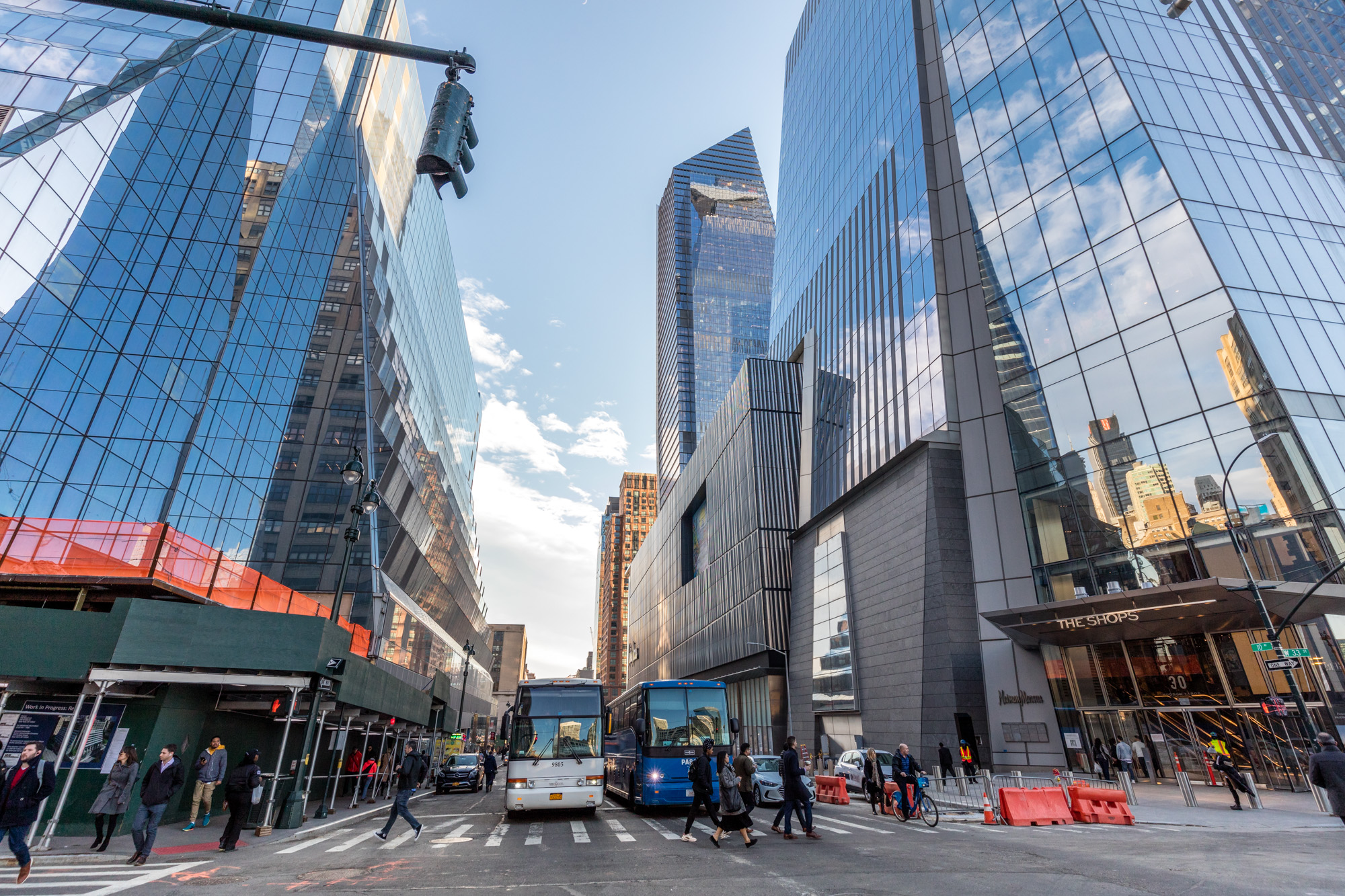
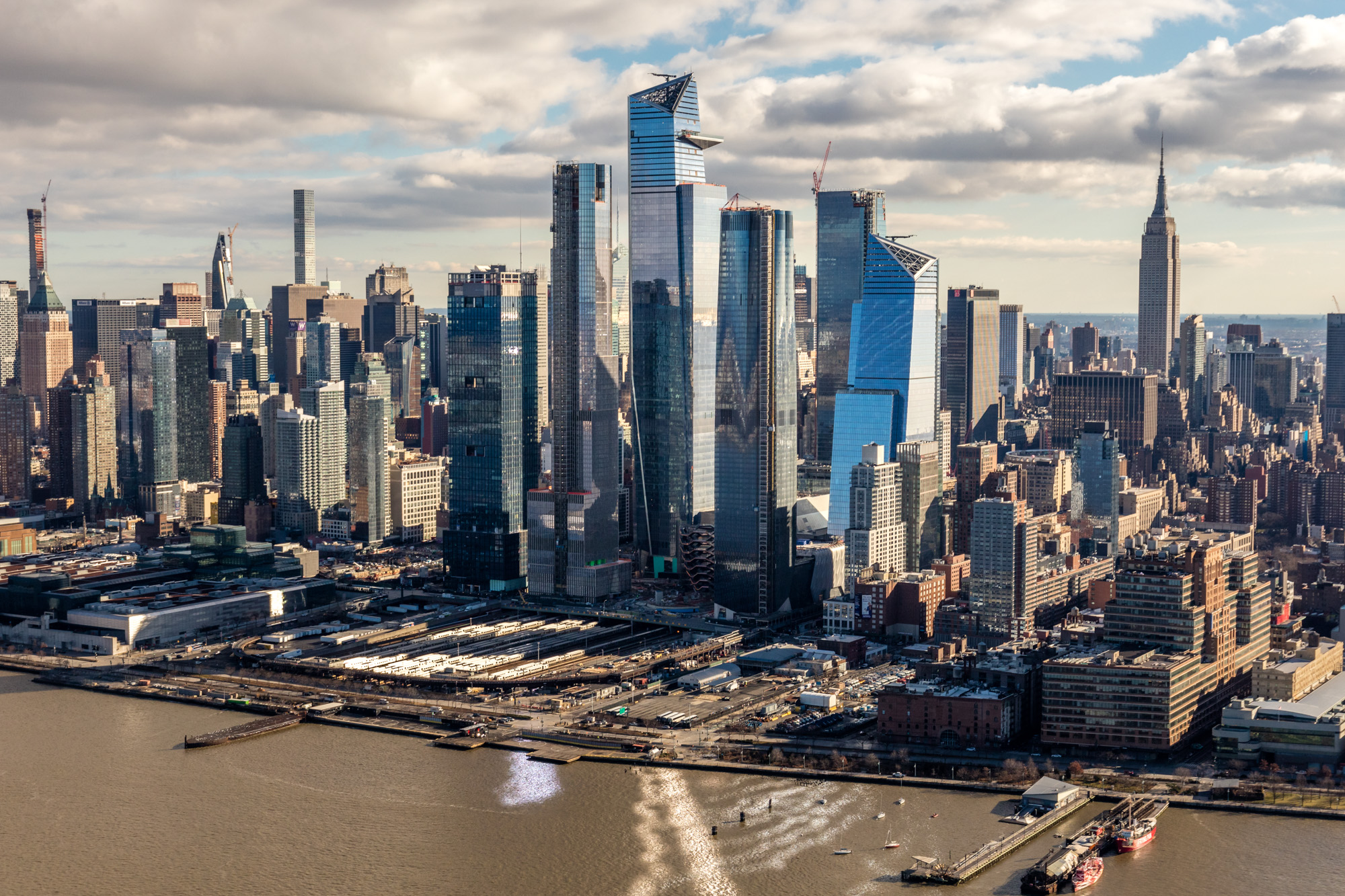
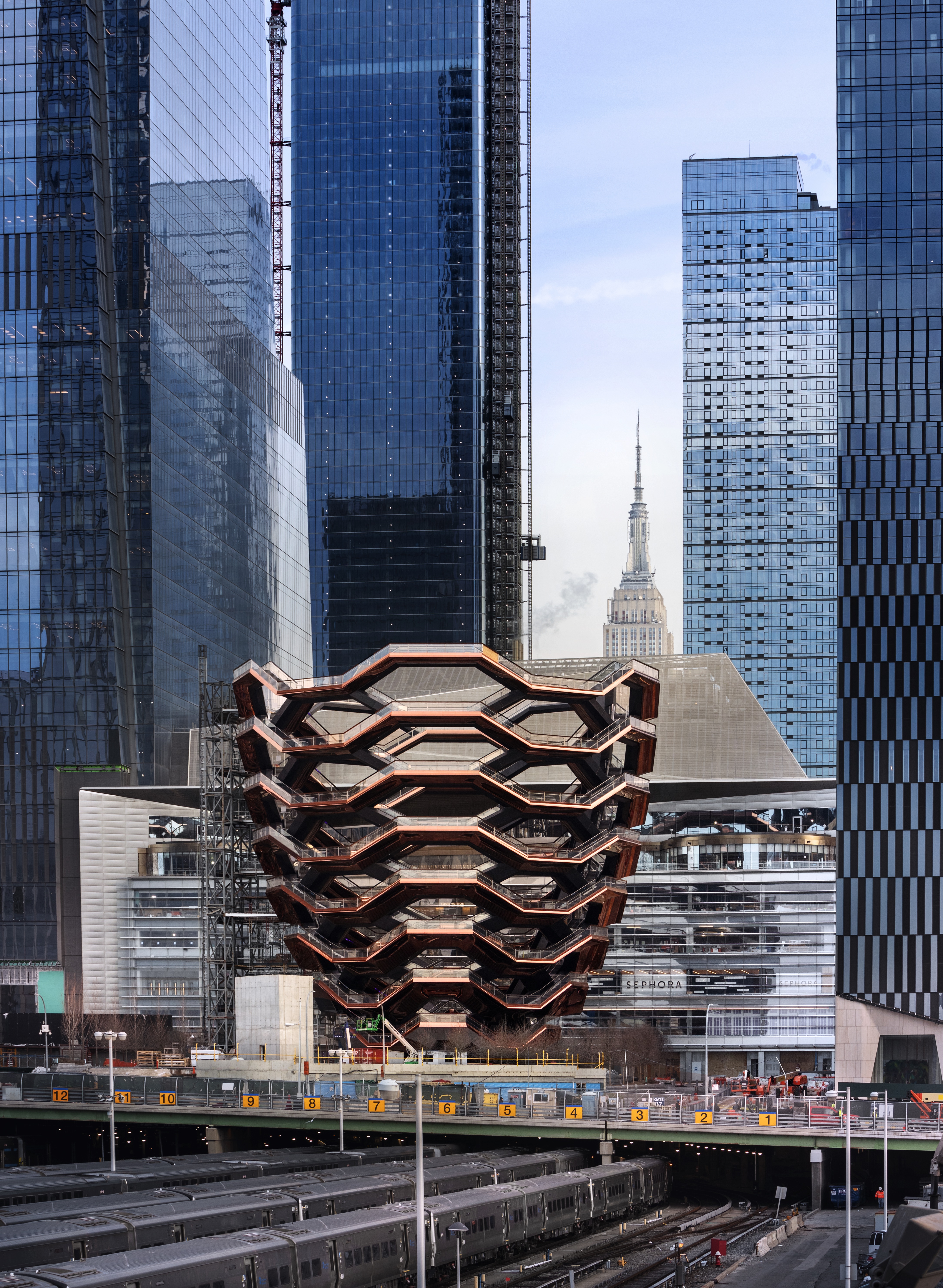
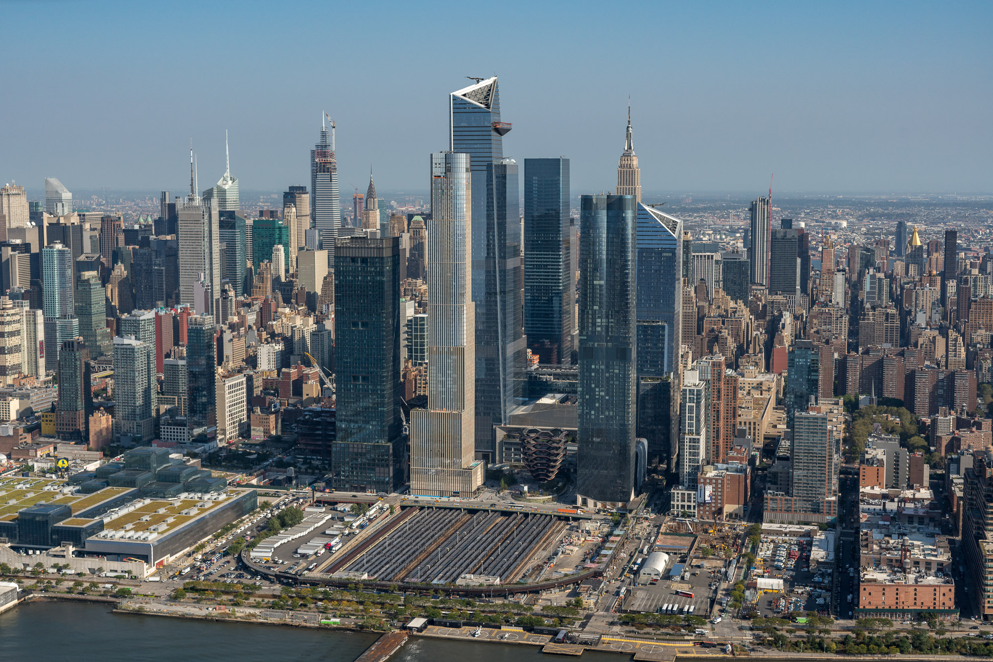
As a result, the Hudson Yards megaproject was developed in its current form—a multipurpose project with retail, cultural, and commercial spaces, along with housing and parks—and it got its groundbreaking in 2012. Construction has moved at a rapid clip since then, and the whole shebang is on pace to remake the west side once again—the first phase opens March 15.