Dangerous blizzard conditions impacting Sierra Nevada mountains
Up to 12 feet of snow could accumulate in the Sierra Nevada region.
A blizzard warning is in effect for much of California's Sierra Nevada mountains, which could see a storm total of up to 12 feet of snow in the coming days, according to the National Weather Service.
A "significant winter storm" is currently impacting much of the West, "including dangerous, blizzard conditions for the Sierra Nevada," the NWS said.

Winter alerts are in effect in nine states in the West due to this storm, which is bringing heavy snow and gusty winds. A blizzard warning is also in effect for the Ruby Mountains in eastern Nevada.
The NWS is calling for "extremely heavy snow rates" of 2 to 6 inches per hour. Four to 10 feet of snow could accumulate in the Sierra through Monday, the agency said. Snowfall totals could reach up to 12 feet by Wednesday, following another round of snow in the region.
So far, 42 inches of snow has been reported in Soda Springs, California, and 45 inches in Truckee, California, as of Saturday afternoon.


Strong winds gusting 60 to 80 mph are creating white-out conditions in the mountains, leading to nearly impossible travel on several roadways. The highest mountain peaks have recorded wind gusts of 100 to 167 mph.
In areas that aren't seeing the heaviest snow, there are still gusty winds of more than 50 mph across a huge portion of the West. Wind alerts are posted for more than 8 million people, from California to Colorado.
High avalanche danger is expected in the backcountry for the Eastern Sierra slopes, between Virginia Lakes and Bishop Creek, through 7 p.m. local time Sunday, the NWS said.
Several ski resorts in the Lake Tahoe area closed Saturday due to the storm conditions.
Yosemite National Park has also closed through at least midday Sunday due to the snow and high winds.
A portion of Interstate 80 near Lake Tahoe is closed as well amid whiteout conditions.
Blizzard conditions along I-80 temporarily trapped hundreds of vehicles overnight, California Highway Patrol officers told ABC News on Saturday. An estimated 200 to 300 vehicles -- including a mix of passenger cars and big rigs -- were stuck from approximately 5 p.m. PT Friday to 2:30 a.m. PT Saturday over Donner Summit, officers said. With the help of tow trucks, everyone was able to get out and no vehicles were abandoned, officers said. There were no injuries or medical emergencies reported.


Heavy snow is expected to continue Saturday night across the Sierra, as well as for parts of the Colorado and Utah Rockies.
The storm is expected to gradually taper down heading into Sunday, with the heaviest rain and snow breaking up into scattered showers during the day. The snow is expected to stop falling by early Monday morning, allowing for some cleanup and snow removal before the next round hits.
By Monday afternoon, the next round of moisture will bring heavy snow back to the Sierra and continue into Tuesday morning. The snow should come to an end for the Sierra by Tuesday night. Up to 12 feet could accumulate through Wednesday.
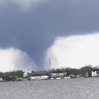
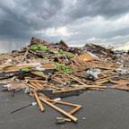
Amid the winter storm, a confirmed rare tornado hit Madera, California, on Friday. The tornado snapped some trees and caused damage to an elementary school. No injuries were reported.
The NWS said they will be conducting a storm survey Saturday to determine the tornado's path and strength.
ABC News' Alex Stone contributed to this report.


