


Did you know that there are over 100 different cloud types? Even though there are over 100, these cloud types can be grouped into smaller subtypes basic types depending on their general shape and height in the sky. Many of you have probably seen an oddly shaped cloud and wondered...what kind of cloud is that? Let's test to see how much you know about the different types of clouds. Try to guess the answer by first looking at the picture of the cloud type.
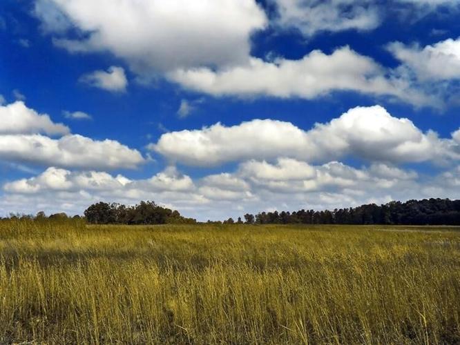
1.

Picture by wikipedia
The answer is....Cumulus Clouds!
How do they form?
All cumulus clouds form because of what is called convection. As the air heated at the ground is lifted up, the temperature drops causing the relative humidity to rise. Once the relative humidity reaches 100% at a certain level in the atmosphere, latent heat is released and the water vapor condenses. When the water vapor condenses on various nuclei present in the air, it helps form a cumulus cloud. This creates the characteristic flat-bottomed puffy shape associated with cumulus clouds. The height of the cloud (from its bottom to its top) depends on the temperature profile of the atmosphere and of the presence of any inversions. Cumulus clouds typically are around 1,000 to 7,000ft up in the sky. Cumulus clouds develop on clear, sunny days when the sun heats the ground directly below. This is where they get their nickname of "fair weather" clouds. They appear in the late morning, grow, and then disappear toward evening.
2.

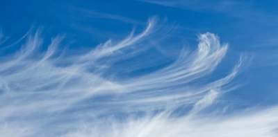
Picture by metoffice.gov/uk
The answer is...Cirrus Clouds!
How do they form?
Cirrus clouds form from the ascent of dry air, making the small quantity of water vapor in the air undergo deposition into ice (to change from a gas directly into a solid). Cirrus clouds are made up completely of ice crystals, which provides their white color and form in a wide range of shapes and sizes. These clouds are typically found at very high altitudes around 16,000 to 49,000 feet up in the atmosphere. Cirrus typically occur in fair weather. They can also form out ahead of warm fronts and large-scale storms like nor'easters and tropical cyclones, so seeing them can also indicate storms may be coming.
3.

Picture by Matthew Levine/Getty Images
The answer is...Stratus Clouds!
How do they form?
Stratus clouds form in calm, stable conditions when gentle breezes raise cool, moist air over colder land or ocean surfaces. These clouds can exist in a variety of thicknesses and are sometimes opaque enough to darken days, allowing for little light to pass through. These clouds can be formed by lifting of moist air masses in regions adjacent to fronts or over orography, and by warm advection of a moist layer over a cold surface. Stratus clouds are seen on dreary, overcast days and are associated with light mist or drizzle.
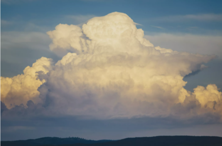
4.

Picture by Andrew Peacock/Getty Images
The answer is...Cumulonimbus Clouds!
How do they form?
Cumulonimbus clouds are one of the few clouds that span the low, middle, and high layers. They resemble the cumulus clouds from which they grow, except they rise into towers with bulging upper portions that look like cauliflower. Cumulonimbus cloud tops are usually always flattened in the shape of an anvil or plume. Their bottoms are often hazy and dark. Cumulonimbus clouds are thunderstorm clouds, so if you see one you can be sure there's a nearby threat of severe weather (short but heavy periods of rainfall, hail, and possibly even tornadoes.)
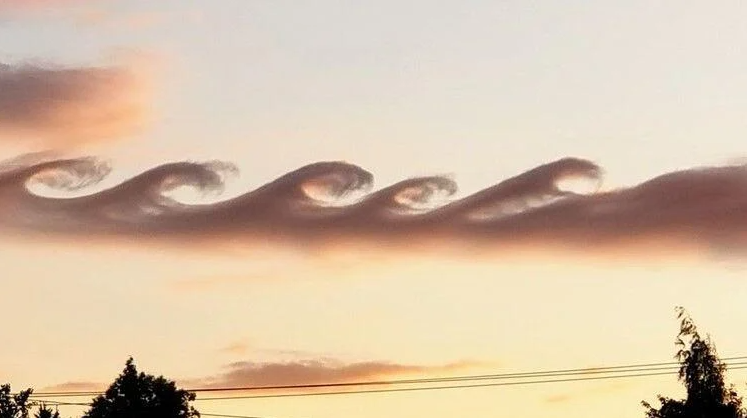
5.

Picture by Brian Schmit/KGW8
The answer is...Kelvin Helmholtz clouds!
How do they form?
These are one of the coolest looking clouds in meteorology and often catches people's attention because of the wave like structure that these clouds have. A Kelvin-Helmholtz instability forms where there’s a velocity difference across the interface between two fluids: for example, wind blowing over water. These clouds are at the mid to high levels in the atmosphere, typically above 16,500 feet above the surface. Your odds of seeing these clouds are better on windy days, when there’s a difference in densities of the air – for example, during a temperature inversion – when warm air flows over cooler air. You’re also more likely to see these clouds near sunrise or sunset, another time when the bottom of the clouds are cooler and the air above is warmer.
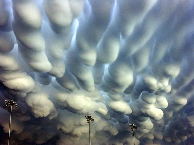
BONUS:

Picture by Wikimedia
The answer is...Mammatus Clouds!
How are they formed?
These clouds are personally my favorite, and many other Meteorologist's favorites across the world. Mammatus clouds are usually formed in association with large cumulonimbus clouds. Typically, turbulence within the cumulonimbus cloud will cause mammatus to form, especially on the underside of the projecting anvil as it rapidly descends to lower levels. These are another type of cloud that often grabs the attention of the public with its almost popcorn like features.
So, how did you do? Did you know these cloud types? Thank you for playing!


