Wintry cocktail spells trouble for travel, power in Atlantic Canada
A messy, wintry storm will threaten parts of the East Coast with 40 cm of snow or more, 30-60 mm of rainfall, freezing rain and intense wind gusts this weekend, so plan ahead and brace for travel difficulties and power outages
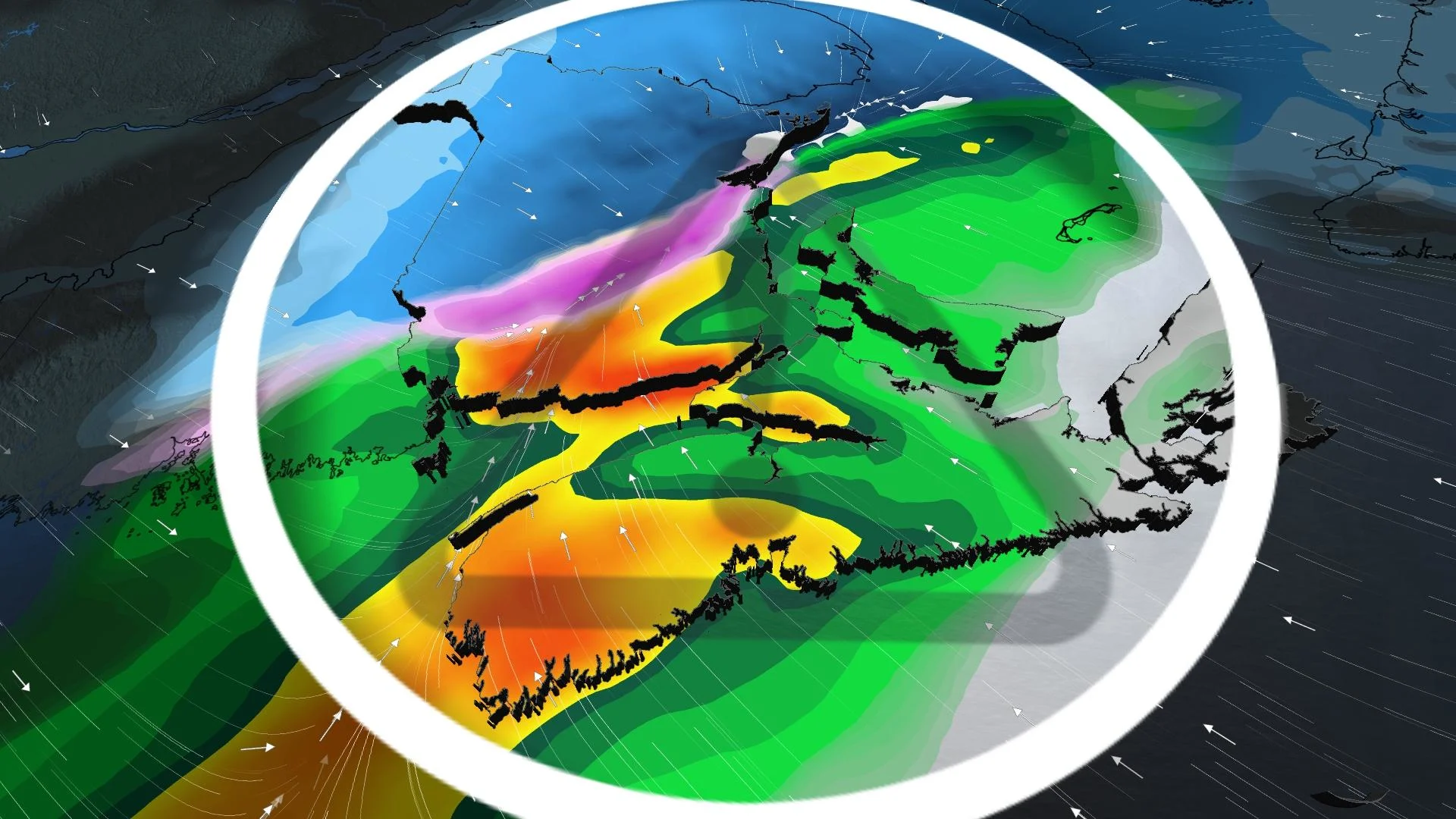
Spring has been put on pause in Atlantic Canada as a potent storm with more wintry aspects to it treks through the region this weekend, bringing enough amounts of precipitation and wind gusts to be rather disruptive.
Widespread winter storm and rainfall warnings are in place, along with special weather statements. Parts of New Brunswick are line to see 40 cm of snowfall or more, while other areas could see 40-60 mm of rainfall. There is also the risk of freezing rain for parts of New Brunswick and Nova Scotia, though the former has a greater chance of it.
MUST SEE: Rare widespread chill to hit Canada, kicking off an active pattern
Brace for quickly changing and deteriorating travel conditions. Drivers are urged to plan ahead and stay aware of local road conditions before heading out. As well, ensure your devices are charged as wind gusts up to 100 km/h on Sunday morning could result in power outages.
Saturday into Sunday: Heavy snow and rain spread across the Maritimes
A low-pressure system rolling in from the south will strengthen as it approaches the Bay of Fundy, scooping up subtropical moisture along the way.
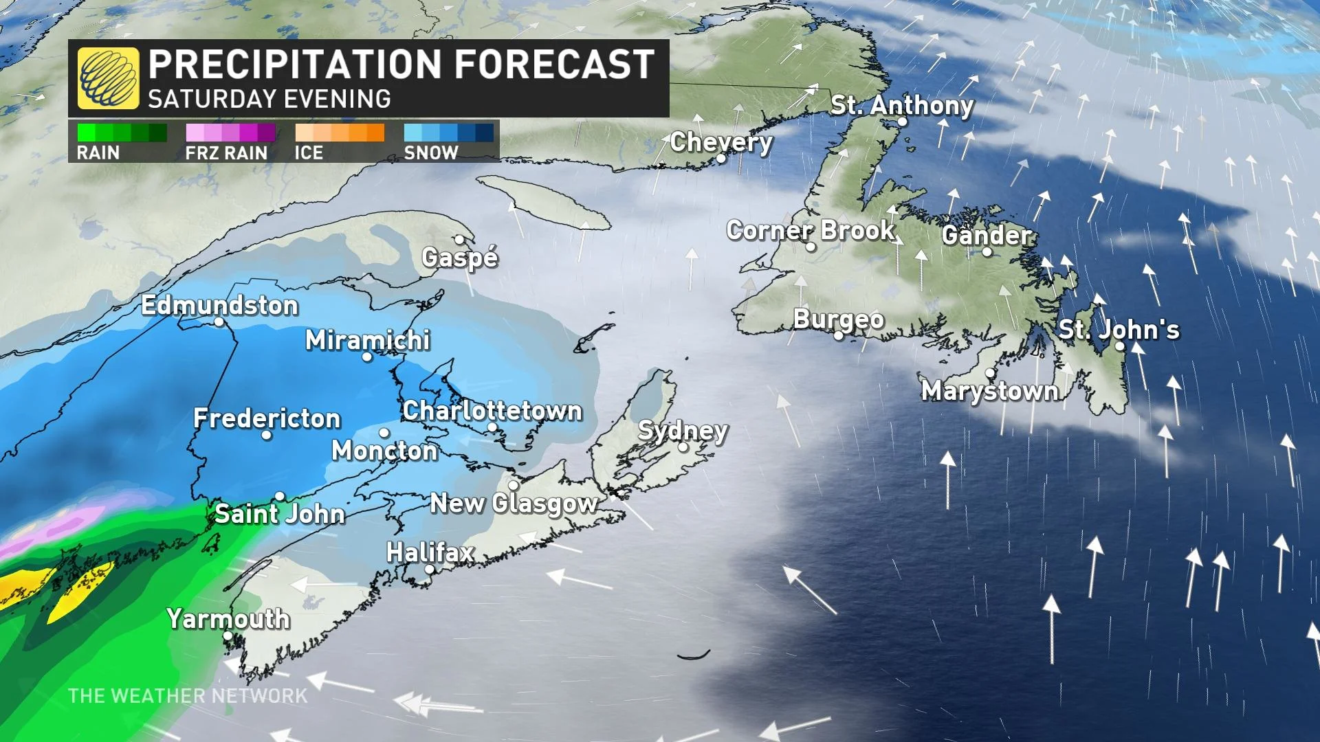
The system begins with snow that’ll spread across the Maritimes from west to east on Saturday. By Saturday evening, snow will change into rain in Nova Scotia’s southwest and the Bay of Fundy shores.
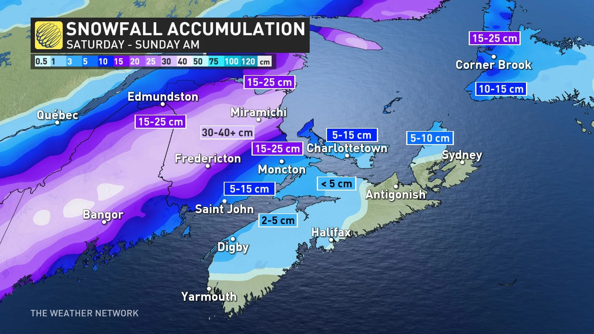
For northern and central New Brunswick, the precipitation will remain mostly heavy snow. The hardest-hit communities, including Fredericton, may see snowfall totals of 20-40+ cm by the end of the storm on Sunday.
New Brunswick motorists will want to avoid highways 8, 107, and 108 Saturday afternoon and evening.
Fredericton’s normal March snowfall is 49.4 cm, so the region could see nearly a month's worth of snow with this weekend’s storm alone.
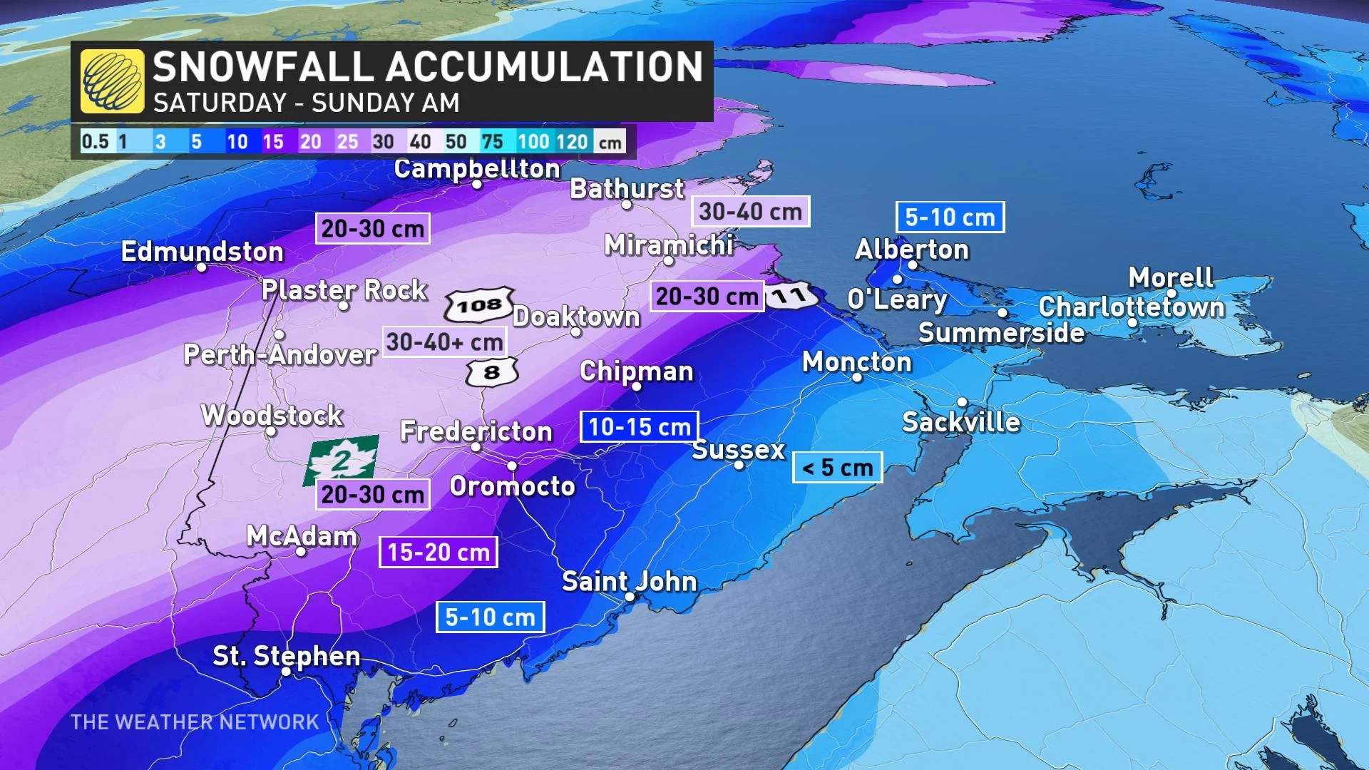
Northern and central New Brunswick could see snowfall rates up to 4 cm an hour. Widespread winter storm warnings are in effect for the province.
Through the overnight hours on Saturday, there is the chance for some mixing and ice accretion south of Fredericton and north of Saint John. On Sunday morning, a period of icing and mixed precipitation sinks south to Saint John as temperatures fall.
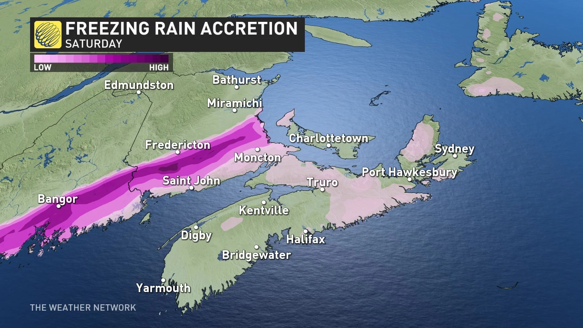
Exact ice accretion totals are uncertain at this time, as the track of the system could have an impact on precipitation types. The precipitation will change back to snow before gradually easing off through Sunday.
Drivers are being urged to plan ahead, and to adapt to the changing and rapidly deteriorating conditions. The heavy, wet snow and icy conditions could also heighten the risk for power outages.
Also, on Sunday morning, wind gusts up to 100 km/h are possible, elevating the risk of power outages. Make sure to keep all devices charged.
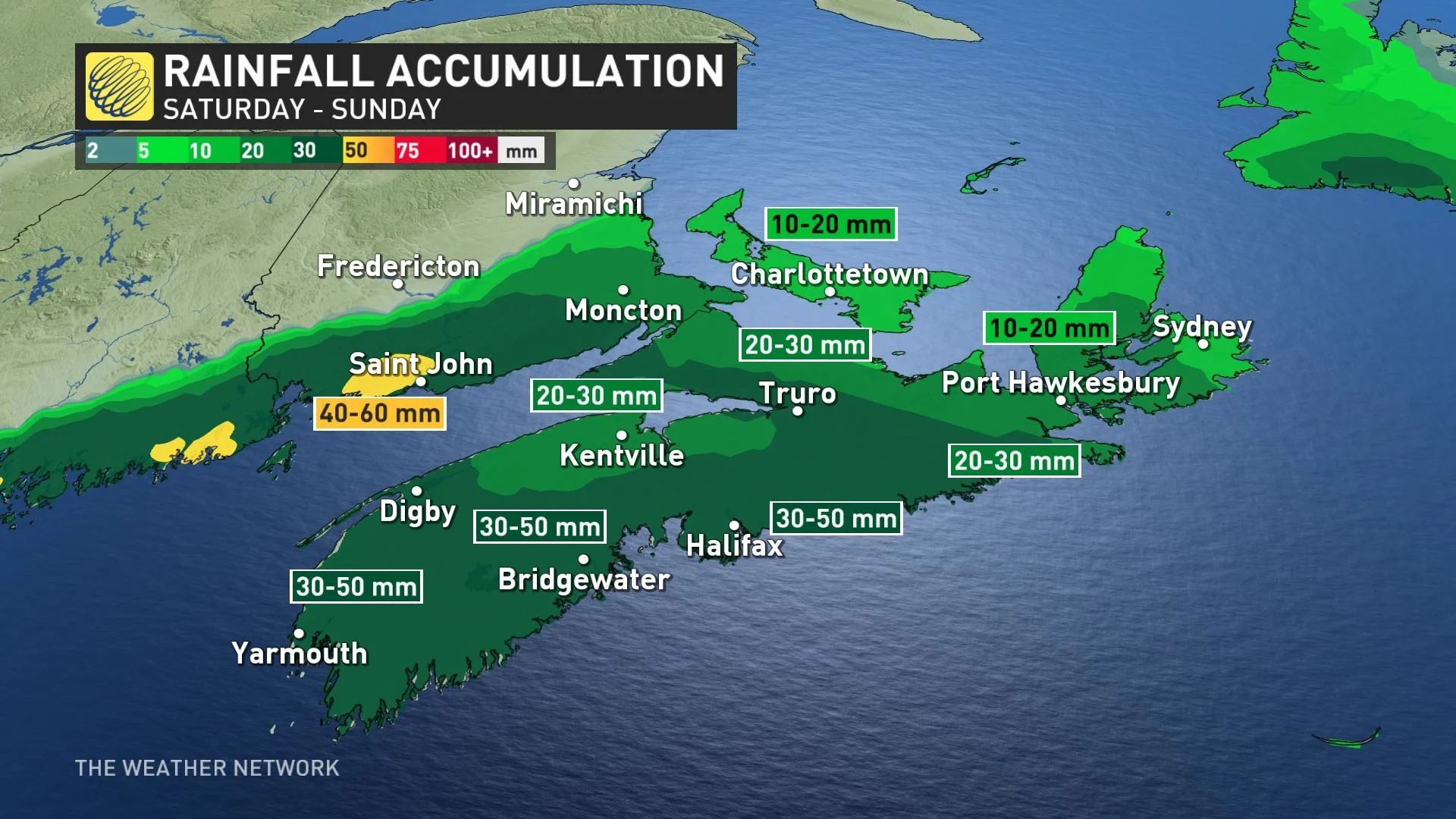
Across Nova Scotia, the primary threat with this system will be heavy rain, with the risk for localized flooding in some of the heaviest-hit areas. The rain will intensify through Sunday morning, with a brief period of mixed precipitation likely as the front slides out of the Maritimes.
A total of 30-50 mm of rain forecast through the weekend for southern Nova Scotia, but 40-60 mm is possible for southwestern New Brunswick. Localized flooding is a threat.
A couple more systems will bring unsettled weather for the second half of next week and into the weekend, with primarily rain and above seasonal temperatures forecast across the region.
Stay tuned to The Weather Network for the latest forecast updates for Eastern Canada.


