

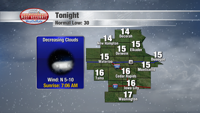


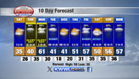

Tonight: Clouds this evening give way to a clear sky. The clear sky and new snow on the ground will allow lows to drop into the teens. Low: 15. Winds: N 5-10 mph.
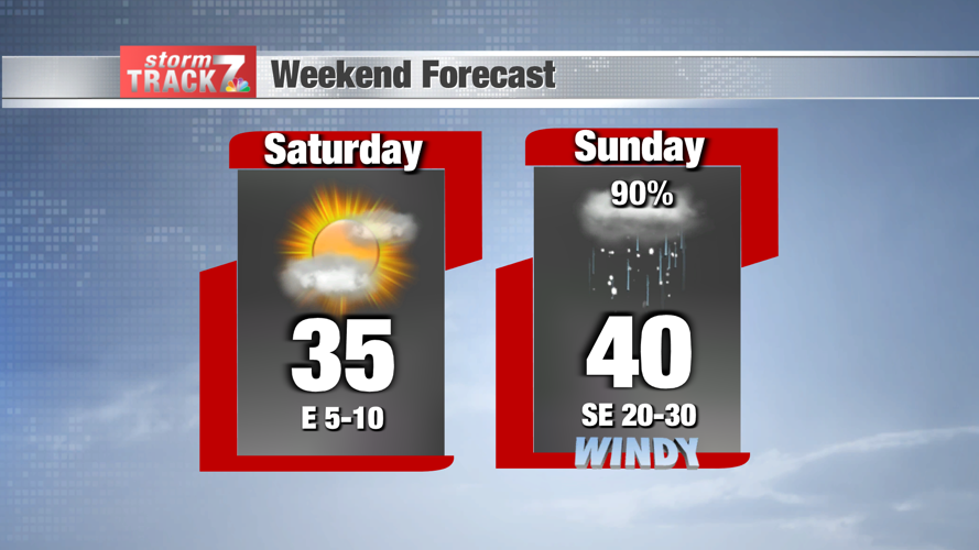
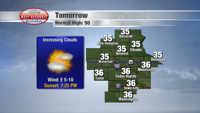
Saturday: The day starts out sunny, but clouds increase during the afternoon ahead of the next storm system. High: 35. Winds: E 5-10 mph.
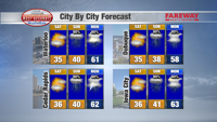
Saturday Night: A few snow showers are possible overnight. If there were to be any snow accumulation it would be light (less than 1”). Low: 26. Winds: SE 10-15 mph.
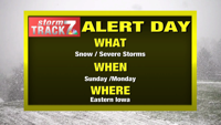
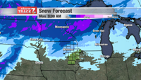
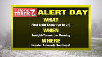
STORM TRACK 7 YELLOW ALERT DAY for snow Sunday. There is still some uncertainty as to how much and where snow will fall before it turns to rain.
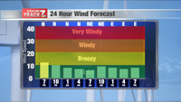
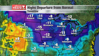
Sunday: Early indications show higher snow totals to be across northern Iowa. There is still some uncertainty as to how far south the accumulating snow comes. Very heavy snow is expected to be widespread north of Iowa. Here in eastern Iowa the snow turns to rain from south to north during the afternoon and evening. The wind is strong. Some of the gusts are near 40 mph from the south. High: 40. Low: 35.
STORM TRACK 7 YELLOW ALERT DAY for the potential for a few storms that could be strong to severe Monday.
Monday: Low pressure moves northeast across Iowa during the day. As it moves that way a cold front pushes through eastern Iowa in the afternoon. There is a chance for showers/storms. A few storms could be strong to severe. Away from the storms the wind is going to be strong from the south with gusts to near 50 mph. High: 61. Low: 30.


