Live Oklahoma eclipse traffic updates: See map of Oklahoma traffic during 2024 eclipse
Thousands of people are expected to descend on southeast Oklahoma to view the total solar eclipse.
Keep this map from the Oklahoma Department of Transportation handy to see where traffic is the worst, or what routes to avoid due to construction, while you're heading to your eclipse-viewing destination.
Live Oklahoma eclipse traffic map
What Oklahoma towns are in the path of totality?
While the entire state of Oklahoma will be able to see at least a partial eclipse on April 8, the best place to view the total solar eclipse is in the path of totality that runs through southeastern Oklahoma towns like Broken Bow, Idabel, Hugo and Antlers.
Oklahoma state parks in the path of the total eclipse include Lake Wister, Talimena, Clayton Lake, Beavers Bend and Raymond Gary.
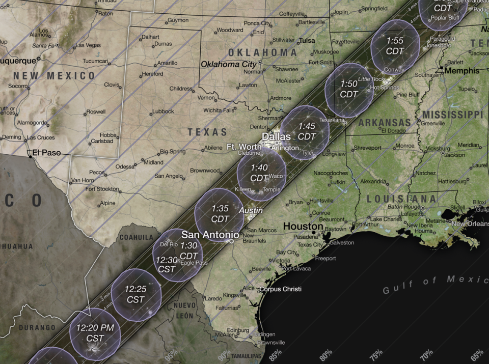
More: What time is the solar eclipse? Search your ZIP code for a viewing guide
What time will the 2024 eclipse be in Oklahoma?
The eclipse will enter Oklahoma as it crosses the Red River at about 12:27 p.m., and exit the state at about 3:07 p.m., according to National Eclipse.
But the total eclipse, the direct casting of the Moon's shadow, will only last from about 1:44 p.m. to 1:51 p.m. in the state, Great American Eclipse estimates.
The center path of the eclipse, where totality lasts the longest, travels through Oklahoma for a mere 31 miles, the shortest distance of any state through which the centerline travels.
This article originally appeared on Oklahoman: 2024 Eclipse: See live Oklahoma eclipse traffic with this map

