Cold front brings wind, rain to El Paso: National Weather Service
Cooler temperatures, wind and rain are expected in El Paso on Monday, March 18.
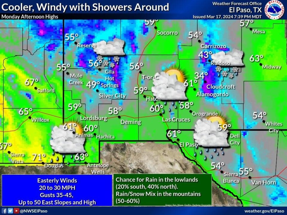
As a cold front moves into the area, winds could reach 20 to 30 miles per hour, with gusts of up to 45 miles per hour, according to the National Weather Service.
El Pasoans will also see overcast skies, with a high near 60 degrees and a 40% chance of showers, mainly before noon, according to the National Weather Service.
An isolated thunderstorm is also possible in the region. A mix of rain and snow is expected in the mountain areas.
Temperatures will drop around 47 degrees at night, with a quick warm up throughout the week.
Weather for rest of week
El Paso could see above-normal temperatures at the end of the week, with an expected high in the 80s on Saturday, according to the National Weather Service.
El Paso International Airport real-time status
Info provided by the Federal Aviation Administration's Air Traffic Control System Command Center.
Due to RWY-TAXI / CONSTRUCTION, departure traffic destined to San Francisco International Airport, San Francisco, CA (SFO) is currently experiencing delays averaging 33 minutes.
General Departure Delays: Traffic is experiencing gate hold and taxi delays lasting 15 minutes or less.
General Arrival Delays: Arrival traffic is experiencing airborne delays of 15 minutes or less
This article originally appeared on El Paso Times: El Paso weather: Gusts up to 45 mph expected Monday

