
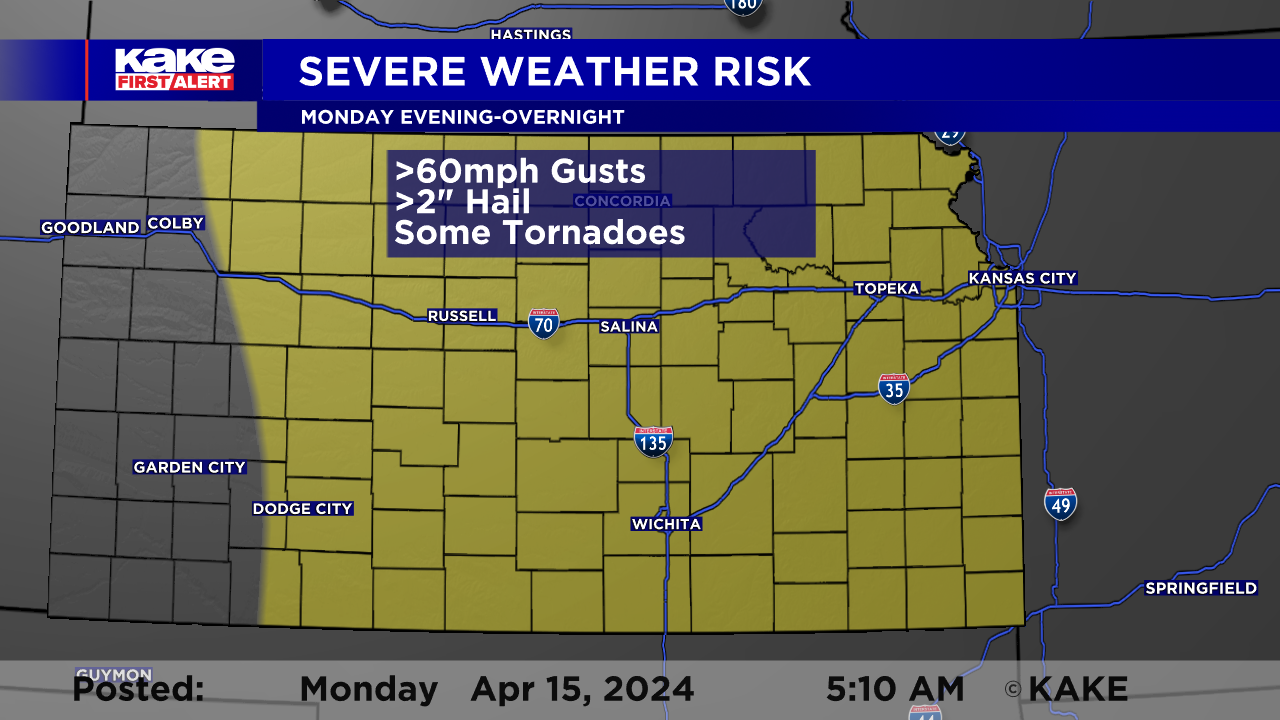
Strong to severe storms expected Monday evening and overnight
MONDAY AM UPDATE:
Another warm day on the way with wind picking back up for all of KAKEland. The vast majority of the day, Monday, will be dry with storms not expected until late in the day and into the overnight. Ingredients will be such, that storms could easily turn severe with large hail, high wind and even tornadoes possible! See the timing of today's storms in the post below:
Wind will be out of the south today across much of KAKEland and that will be enhancing the moisture across North and South Central Kansas. That moisture will help fuel the late day storms.
At this time, it appears that the storms will fire up along a dry line in the vicinity of US-283. the big question is, when will they fire up? If the storms manage to break the late afternoon cap, they could rapidly turn severe. The most likely threats will be large hail stones, possibly larger than eggs, about 2"! In addition to hail, high wind gusts over 60mph and tornadoes possible.
If storms do not fire up in the afternoon, they will likely develop during the overnight hours as the area of low pressure slides east and atmospheric forcing increases. These storms could still pack a punch into the overnight and into very early Tuesday morning.
Much of the storm activity is expected late, while many may be sleeping. It is important to have a way of receiving alerts should they be necessary while you are sleeping. The KAKE First Alert Weather App and a NOAA Weather Radio are great resources for times like this.
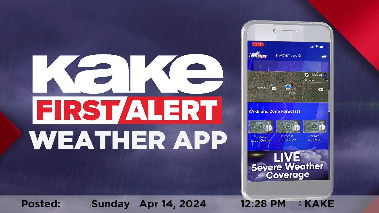
Stay tuned for details as the forecast evolves. We’ll keep you up to date with our Interactive Radar and LIVE weather coverage. Get those features and more on the free First Alert Weather App. With the app you can track storms in your area, stream the latest forecast videos and live severe weather coverage, and set customized alerts to keep you and your family informed and safe.
In the event of severe weather, click here to follow KAKE First Alert Storm Trackers in the field.
SUNDAY AM UPDATE:
After a weekend full of summer warmth in the 80s and 90s, our focus now turns to the potential for strong to severe storms on Monday. Posts about this severe threat have been circulating around on social media for days now, but these posts were made far outside of our window of accuracy. We are now within that window, where weather models are starting to agree and fine tune the details regarding our Monday severe threat. Here are our thoughts as of this morning.
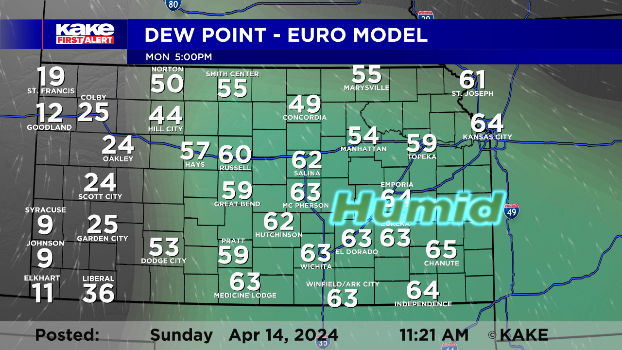
Temperatures are expected to be on the warm side again tomorrow with highs topping out in the 80s for most. Warmer air can hold more water, and moisture is a key ingredient for strong storms. Dew point temperatures are great to look at when it comes to observing how much moisture is present in the atmosphere. The higher the number, the more moisture in the atmosphere. Whenever this number gets to 60°, it starts to feel humid and sticky out. This is exactly what we are expecting Monday PM, thus we will have enough moisture for thunderstorms to develop.
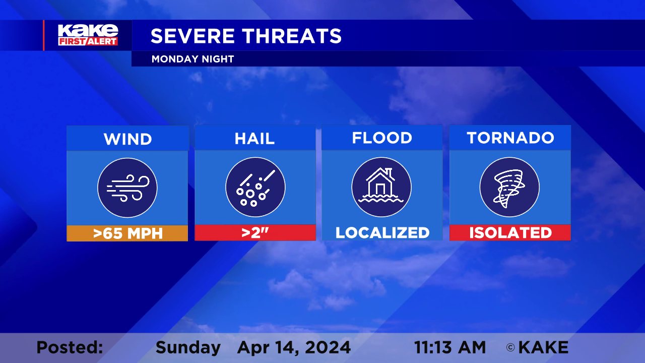
Instability and lift are the other key ingredients which we will have present tomorrow. Due to the level of unstable instability in the atmosphere tomorrow, we are expecting large hail to be one of the primary threats. The potential for a few tornadoes is also looking pretty likely so PLEASE stay weather aware tomorrow. Wind gusts will likely exceed 65 mph within these storms if they turn severe, too.
In terms of timing, storms are expected to fire up Monday evening. Most will likely not develop until after sunset and will continue to linger into the overnight hours. This is a BIG concern because a large portion of these storms will take place when many people are sleeping. Please have several ways to receive alerts and do NOT rely on outdoor tornado sirens. They are meant to warn people who are outdoors, and not people indoors. A weather radio is a great option and our KAKE First Alert Weather App is very useful. It will notify you of alerts and will give you an audible warning if you leave your volume on while sleeping.
Please continue to check back here for more updates as we fine tune the forecast.
Meteorologist Brittany Foster
@BrittFosterWx
