AUSTIN, Texas — This week, moisture filtered in from all directions, keeping things very muggy. But this weekend has been ushering in beneficial rain for most of Central Texas.

While we saw moisture in the form of humidity for most of the workweek, we are now tracking significant rain for this weekend.
Come Saturday night, another cold front will push into East and Central Texas. This disturbance will be much stronger and could give way to some severe weather late Saturday night through early Sunday morning.

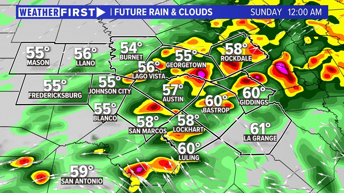
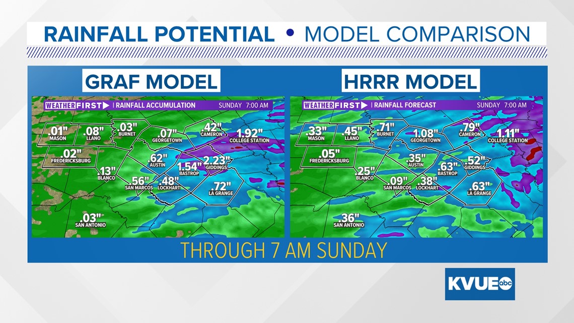
Rainfall totals for this event could fall between 1 to 3 inches. Localized totals could be much higher, and 4 to 5 inches is certainly possible.
Because this is the most significant rain event in the forecast, our seven-day rainfall comparison shows a good representation of what rainfall gauges could look like by the end of the event on Sunday morning.

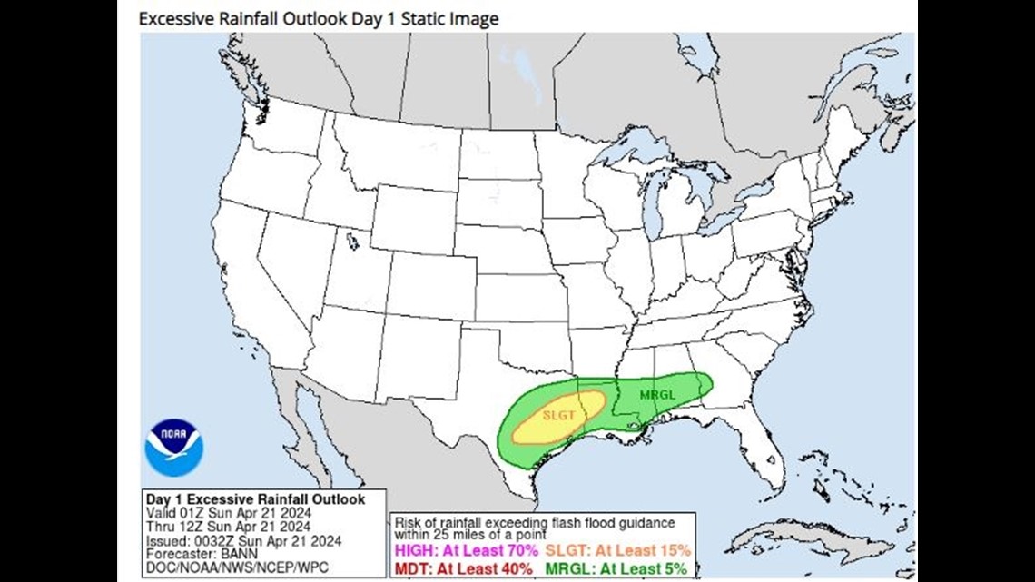
The Weather Prediction Center has already issued an elevated excessive rainfall outlook for Saturday night into Sunday. With some of the rain coming in past midnight, Sunday will have a "marginal" or "slight" – level 1 and 2 out of 4 – risk for flooding. Watch for ponding on roadways and rising water levels as we head through the weekend.

We'll continue to provide updates on air and online if this weekend's rain could pose a severe weather threat to the region.
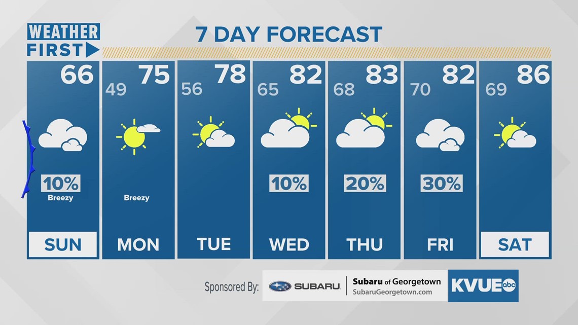
In the meantime, here is the most recent seven-day forecast: