

Stormy weather: Downpours and gusty winds possible for NJ
The Bottom Line
We have some stormy, nasty, inclement weather to talk about. Including minor alarm bells to ring for downpours and flooding, along with gusty winds and power outages.
Thursday daytime will be unsettled, warm, and even a touch humid, with only a few stray showers around.
The timing of the worst weather will be Thursday night.
And that overnight timing is actually a good thing. First of all, most New Jerseyans will be safe and sound at home, in bed. And second, the atmosphere loses a lot of "oomph" at night, after the sun sets and temperatures cool.
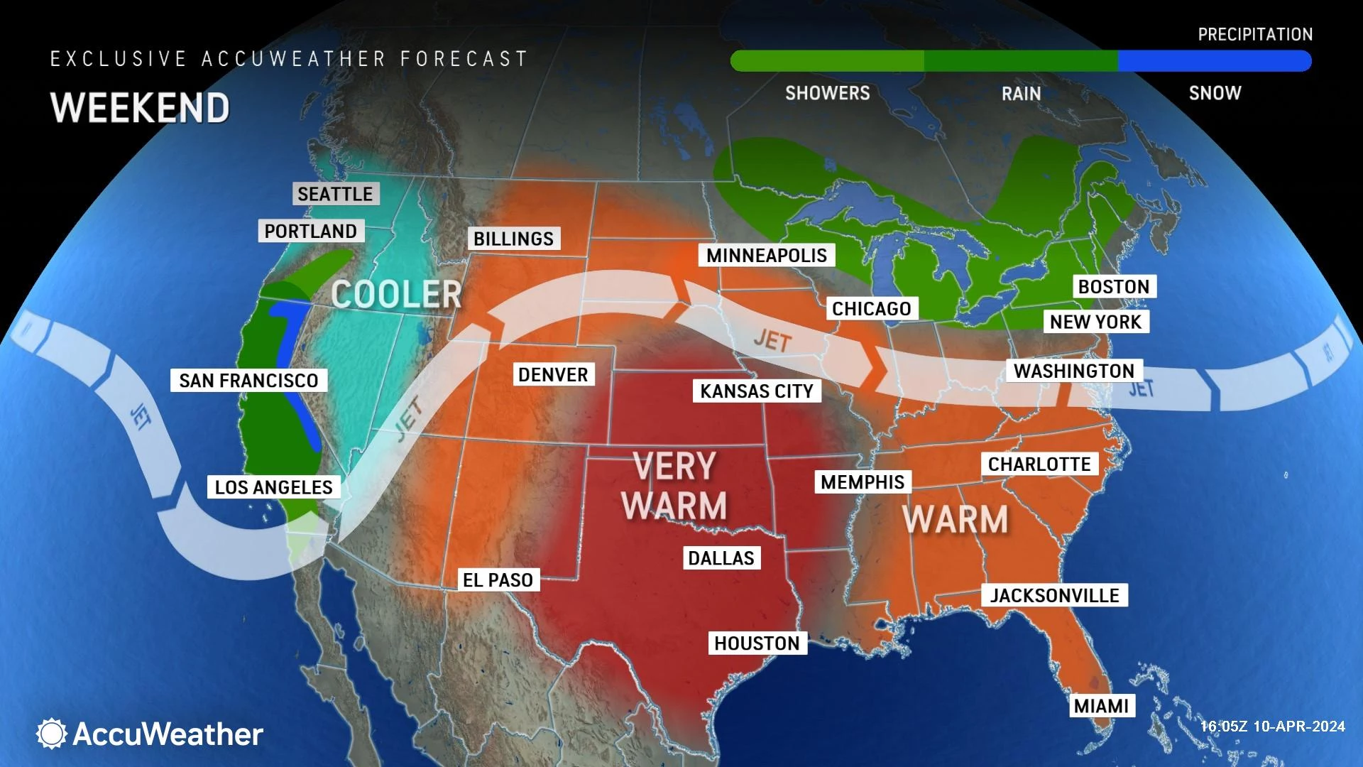
Beyond the storms, we face a windy day Friday, a cooler day Saturday, and then another warmup into early next week.

Thursday
This will be a classic "unsettled" spring day.
Already, we have some isolated showers and sprinkles in the neighborhood Thursday morning. With lots of clouds overhead.
But temperatures will be mild once again. Starting in the 50s, topping out mainly in the 60s. I could see a wide swath of inland South Jersey reaching the 70s once again.
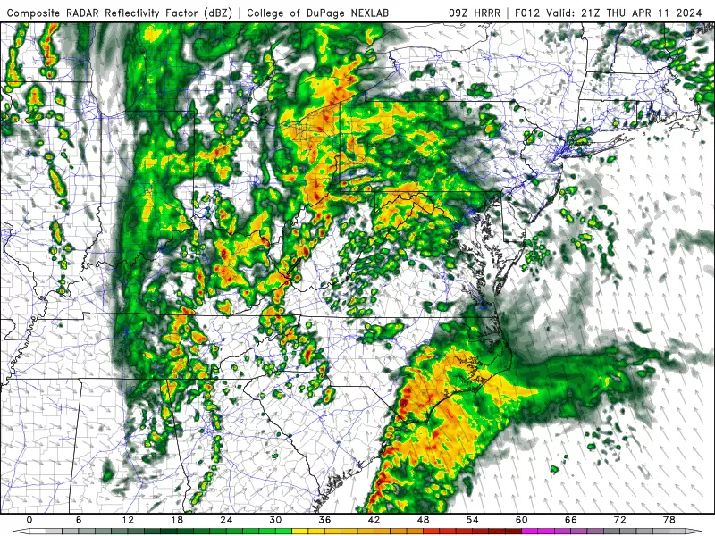
A spot shower will be possible at any time through the morning and afternoon hours. And then starting around 4 p.m., we will have to watch the western sky for a more organized batch of showers and thunderstorms to roll in. That will mark the start of the "main event" with widespread wet weather for NJ.
The big push of storms is expected later, from Thursday evening through early Friday morning.
That is when downpours could dump a quick inch of rain, leading to localized flooding of poor drainage areas. (Maybe a little more to the north, and less to the south.)
And the wind will really kick up during the overnight hours, with top gusts potentially exceeding 40 to 50 mph. Cloud-to-ground lightning is a possibility too.
Overnight low temperatures will only drop into the upper 50s or so, given the clouds, raindrops, and increased humidity in the air.
Friday
Scattered rain may linger through Friday morning's rush hour. But I am confident rain will largely wrap up by late morning, leading to drier conditions and breaks of blue sky Friday afternoon.
That dry-out is not a slam dunk though — some forecast models have hinted at lingering showers.
Friday will be a windy day, sustained at 15 to 25 mph for the duration. Meanwhile, we will still eke out a mild day, with high temperatures in the 60s.
Saturday
Cooler air returns to New Jersey for one day on Saturday. We're talking 40s in the morning and mid to upper 50s in the afternoon.
So not exactly "cold". But a far cry from those 80s earlier in the week.
There is a chance of a wraparound shower right around daybreak Saturday. But the rest of the day looks fine, mostly cloudy and still breezy.
Sunday
A southwesterly wind fuels our next warmup on Sunday, as high temperatures return to about 70 degrees for the end of the weekend. Most of the day looks quiet pleasant, with a mix of sun and clouds. But we will have to watch the sky around the early evening hours for a brief batch of showers and thunderstorms.
Monday & Beyond
Warmth builds again next week, with high temperatures in the 60s, 70s, and even 80s (Wednesday).
At the moment, guidance paints a dry forecast for Monday and Tuesday, with scattered showers and storms on Wednesday. But I am not going to bet the farm on a dry forecast at this point. An increase in heat and humidity almost always results in occasional popup showers and storms. That's what spring and especially summer are all about.
BEEP BEEP BEEP: These are the 13 types of Wireless Emergency Alerts auto-pushed to your phone
Gallery Credit: Dan Zarrow
Dan Zarrow is Chief Meteorologist for Townsquare Media New Jersey. Follow him on Facebook for the latest forecast and realtime weather updates.
LOOK: The priciest home for sale in every U.S. state
Gallery Credit: Stephen Lenz
More From New Jersey 101.5 FM


