STORM WATCH: Gloomy and cool weather conditions with some rain for NYC; tracking gusty thunderstorms
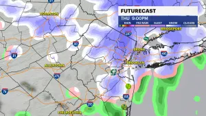
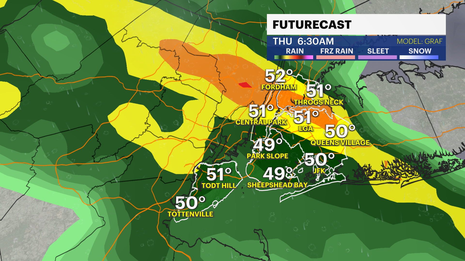
Storm Watch Team Meteorologist Allan Nosoff says to expect occasional thunderstorms with high winds throughout Thursday as the first part of a two-part storm.
News 12 Staff
•
Apr 10, 2024, 10:11 AM
•
Updated 19 days ago
Share:
More Stories
1:52
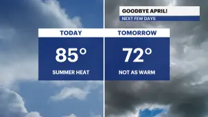
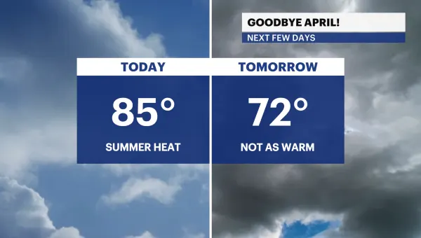
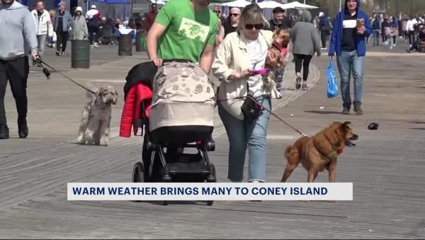
Summerlike temps in the 80s for NYC; tracking stray showers throughout the week
31m ago1:03

LIVE BLOG: News 12 weather updates
8h ago1:52

STORM WATCH: Chilly morning temperatures with light scattered showers Thursday
25ds ago0:49
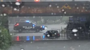
Guide: Flooding safety tips to follow
54ds ago2:14

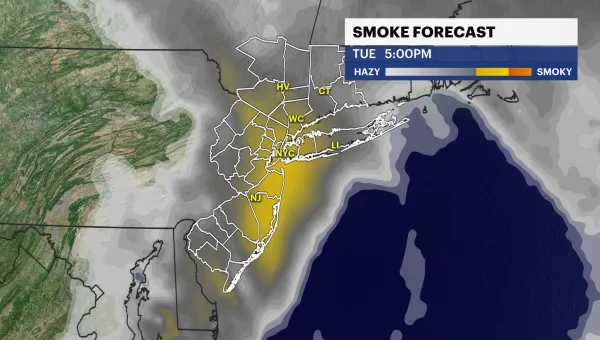
Wildfire smoke returns to tri-state due to major fires in southern US
62ds ago1:52
Cold temperatures and winds tonight, rain and possible snow arrive Thursday night
75ds ago1:52
Summerlike temps in the 80s for NYC; tracking stray showers throughout the week
31m ago1:03
LIVE BLOG: News 12 weather updates
8h ago1:52
STORM WATCH: Chilly morning temperatures with light scattered showers Thursday
25ds ago0:49
Guide: Flooding safety tips to follow
54ds ago2:14
Wildfire smoke returns to tri-state due to major fires in southern US
62ds ago1:52
Cold temperatures and winds tonight, rain and possible snow arrive Thursday night
75ds agoStorm Watch Team Meteorologist Allan Nosoff says to expect occasional thunderstorms with high winds throughout Thursday as the first part of a two-part storm.
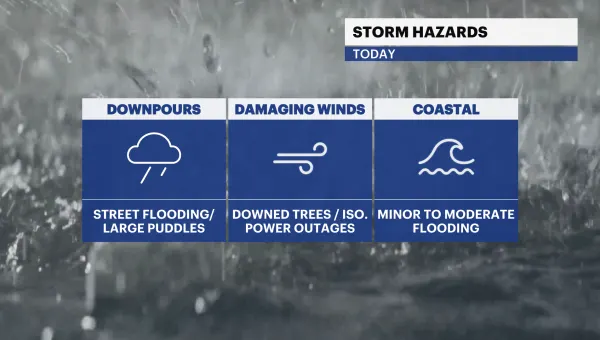
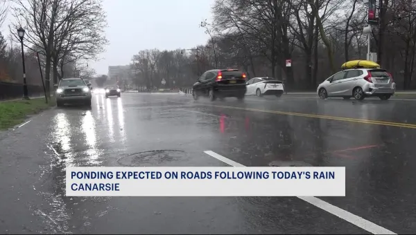
NEXT: Showers blossom over the city for the Thursday morning commute. Expect a mainly cloudy sky with occasional rain on/off throughout the day. The worst of the storm will be Thursday night into Friday morning (After 10 p.m. - 3 a.m.) Heavy rain and gusty thunderstorms are likely. Isolated flooding for the most flood prone areas, strong gusts can knock down tree limbs/branches and blinding rain will bring hazardous road conditions. Friday won't be a washout, but clouds linger with scattered showers (heavy at times) and gusty winds throughout the day.

Catch the Brooklyn forecast below:
TONIGHT: Cloudy and cool. Showers hold off until after 5-6AM. Lows near 52.

TOMORROW - STORM WATCH PM: Showers for the morning commute, maybe an isolated downpour, but this will be fast-moving. Showers end by about 10AM. Temps slowly climb through the 50s up to 63 after sunset. Then rain & downpours arrive after 8PM, with strong-to-severe thunderstorms possible between 12 and 3AM. Temps hover near 62. Wind picks up with gusts of 40 mph likely, embedded gusts of 60 mph in some t-storms.


FRIDAY - STORM WATCH AM: Storms quickly clear by the AM commute, but a few isolated popcorn showers & downpours possible through the early afternoon. Still windy with 30-35 mph gusts. Highs near 67. Lows drop to 47.


SATURDAY: Mix of sun and clouds, chilly and still breezy. Highs near 60, feeling colder with 20-25 mph gusts. Lows near 49.
SUNDAY: Sun to clouds. A few showers possible late. Warmer, with highs up to 66. Lows near 55.

EARLY NEXT WEEK: A good chance to feel like early summer again! Depending on the position of a backdoor cold front, we should be on the warmer side of it. Highs likely in the 70s, with 80s not too far behind. Lows in the mid 50s.