West Coast Wet Season Ending: Looking Back at Storms

Above - a landslide in Studio City, CA during the February 4-6 Atmospheric River event that hit southern California.
The West Coast wet season is coming to a close after another busy winter and early Spring. The Center for Western Weather and Water Extremes (CW3E) took a look back at the number of atmospheric rivers of the 2023-2024 season starting when the water year began in October.
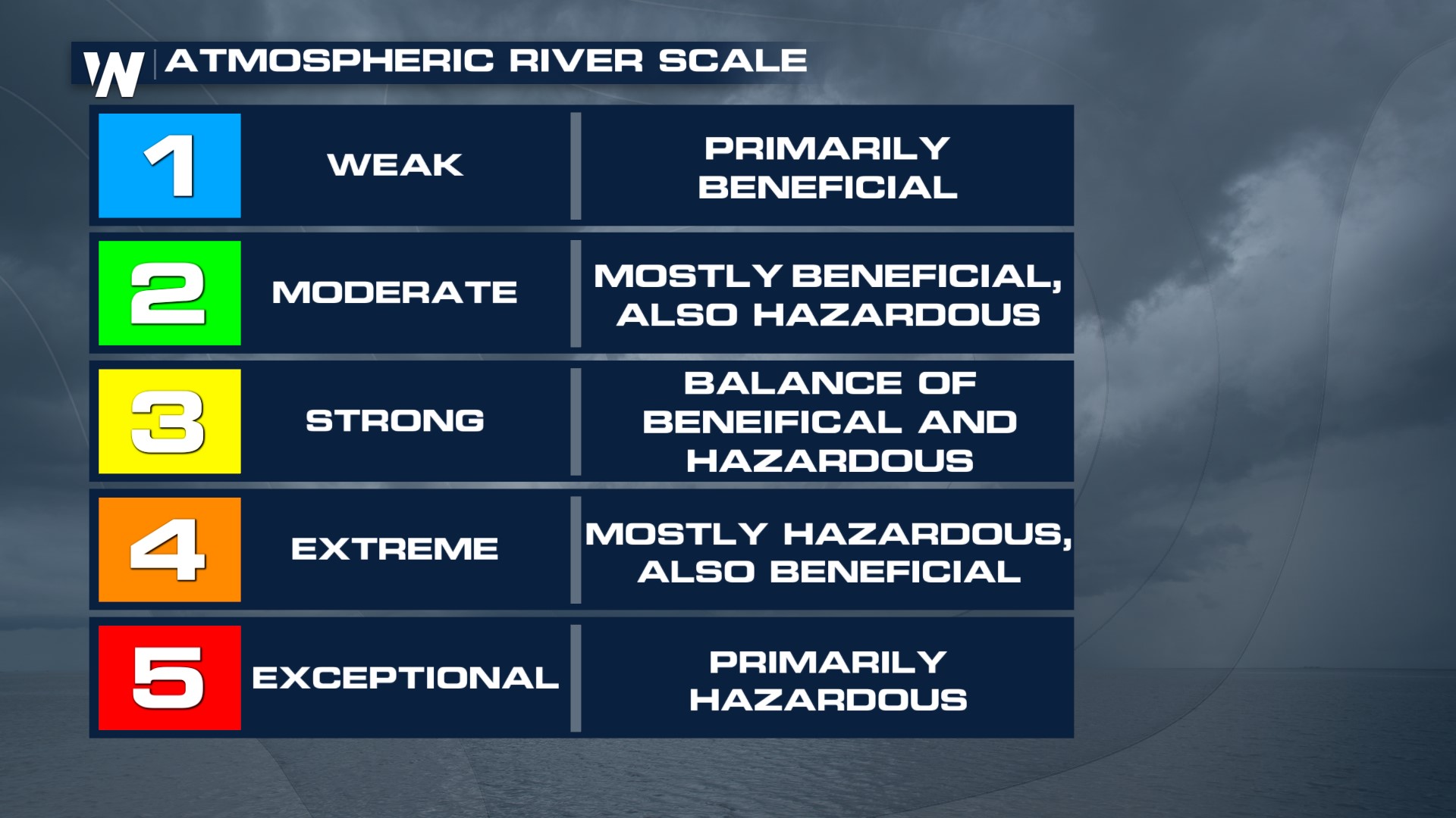
 An atmospheric river is a concentrated plume of moisture in the mid-levels of the atmosphere that transports large amounts of moisture onshore. When the plume hits the higher elevations of the West Coast the moisture then falls in the form of rain and snow. Atmospheric rivers are responsible for large rain and snow accumulation during the Winter and Spring months and are essential for filling reservoirs on the West Coast.
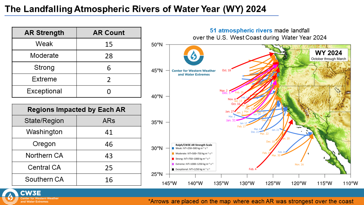
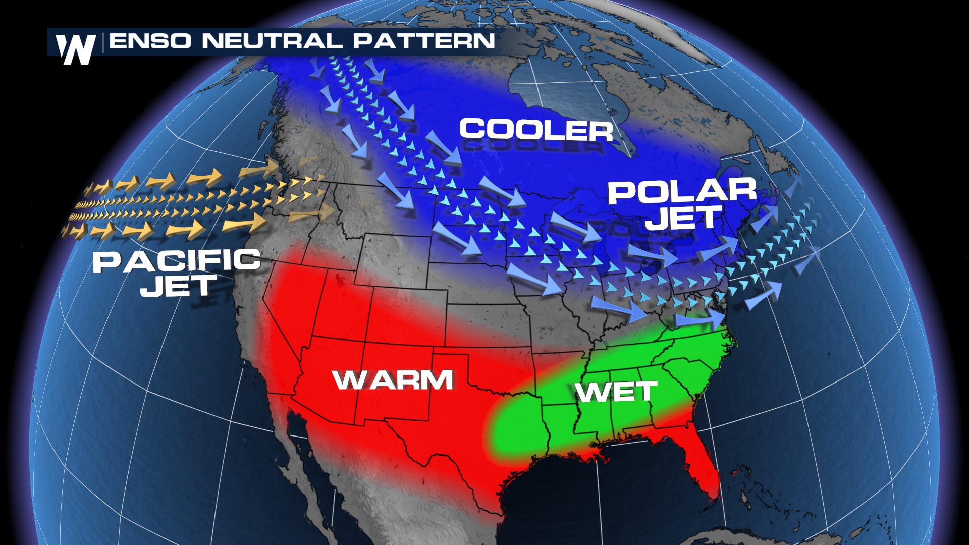
A total of 51 Atmospheric Rivers hit the West Coast this year, including two extreme events, one on December 5th along the Washington/Oregon border and another on January 31st in Oregon. Far more were the number of moderate atmospheric rivers that hit up and down the West Coast. This year the vast majority of landfilling ARs were in Washington, Oregon, and northern California, in part because of an ENSO neutral pattern where the Pacific Jet is typically aligned with the Northwest.
 Though 2023-2024 had 13 more atmospheric rivers than the impactful 2022-23 season, this year brought a smaller number of extreme AR events and fewer to southern and central California (due to the jet stream track mentioned above). The 2022-23 season's few numbers of extreme AR events mean the state of California was at 200% of the average for precipitation. The 2023-24 season, though characterized by fewer strong and extreme events had plenty of weak ARs to leave the states at or slightly above precipitation for the winter months.
 So what does this mean for California's all important reservoirs? At last update, reservoirs are at 117% of average state-wide thanks to slightly above average rainfall this winter and snowpack sitting at 111% of average state-wide. For the most up to date conditions on reservoirs and snowpack, you can visit California's tracking page here. There is concern for ground water supply, especially in the central valley where soil moisture is dry as of mid-April. Snowmelt in the Spring should help to boost those levels.
According to the CW3E, "The strongest atmospheric river to impact Central and Southern California occurred on February 4-6 ... Downtown Los Angeles received 8.51 inches of rain, which was the second wettest 3-day stretch on record. This event was a great example how only a few strong storms over Southern California can make or break a water year." The heavy rain caused numerous water rescues around the city of L.A. with tornado warnings just east of San Diego. Mudslides and debris flow around the L.A. suburbs also closed roadways and created damage for neighborhoods. In the mountains, impressive snowfall came down in the Sierra Nevada!
Another notable atmospheric river event was in early December 2023, when an extreme AR hit Oregon and Washington state. Water rescues were performed in Washington and Oregon and flooding was seen in Seattle on I-5.
For the latest on forecast storms, rain and snow, stay with WeatherNation for the latest information.


