Three late-season winter storms will batter California this weekend and next week, further boosting the state's snowpack levels and helping it reach a milestone it hasn't seen in 14 years: back-to-back years with above-average snowpack.
The average snowpack throughout the state of California has skyrocketed since early January. At the start of the year, snowpack levels were much lower than expected. A series of atmospheric rivers have since brought torrential rain and heavy snowfall to the state, and the snowpack is now near 100 percent of its average, good news after the state battled years of drought that severely depleted its reservoirs.
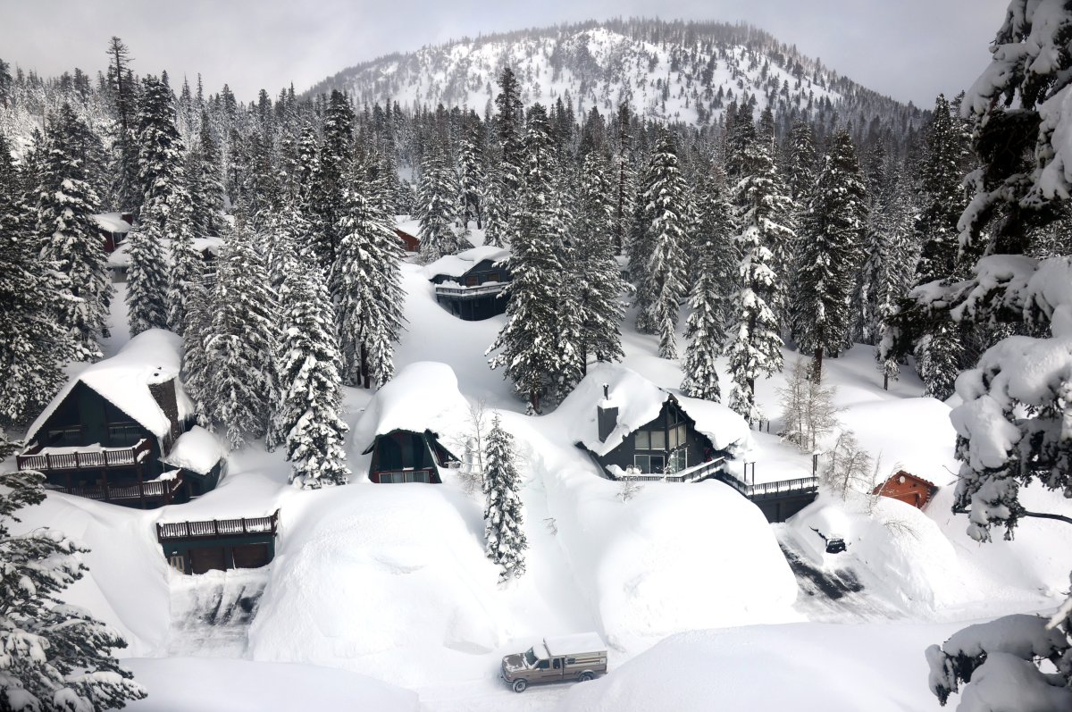
A series of storms will bring even more snow to high elevations in the Sierra Nevada mountains over the next week.
"Three storms will hit California over the next 10 days, dropping 2-5+ feet of snow across the Sierra and bringing widespread moderate rain across much of the state," storm chaser and weather expert Colin McCarthy posted on X, formerly Twitter, on Thursday night. "This series of storms guarantees that California will see its first back-to-back above-average snowpack years since 2010-2011. Winter is not done yet."
According to a report by the California Department of Water Resources, the average snowpack is 98 percent of the average statewide. Snowpack is 109 percent of the average in the northern Sierra Nevada, 93 percent in the central mountains, and 87 percent of normal in the south. The incoming storms are expected to boost those levels.
Newsweek reached out to the California Department of Water Resources via email for comment.
The first storm will begin producing heavy snowfall by 7 p.m. local time near Sacramento on Friday evening, National Weather Service (NWS) meteorologist Chelsea Peters previously told Newsweek. Snow will fall at a high rate of 1 to 3 inches per hour.
For the West Slope Northern Sierra Nevada, including Interstate 80 over Donner Pass and Highway 50 over Echo Summit, snow could exceed 4 feet, although snowfall rates will slow after Friday night.
The incoming storm prompted NWS meteorologists to issue a winter weather warning for part of California early Friday morning. The warning will remain in place until Sunday morning.
A second storm is forecast to begin on Tuesday afternoon, bringing more snow. A third storm could hit the region late next week, although details remain unclear.
The improved snowpack is good news for the state, considering that low snowpack could signal the return of water struggles when hot, dry weather arrives as the state relies on snowmelt to supplement a third of its water supply. Many of the state's reservoirs are in a much-improved condition when compared to 2022 water levels, and their levels are expected to rise again as the snow begins to melt in the spring.
Uncommon Knowledge
Newsweek is committed to challenging conventional wisdom and finding connections in the search for common ground.
Newsweek is committed to challenging conventional wisdom and finding connections in the search for common ground.
About the writer
Anna Skinner is a Newsweek senior reporter based in Indianapolis. Her focus is reporting on the climate, environment and weather ... Read more
To read how Newsweek uses AI as a newsroom tool, Click here.