First Alert Weather: Wet weather returns on Wednesday
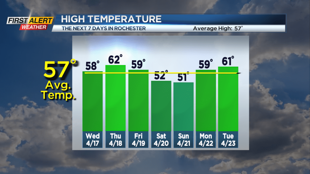
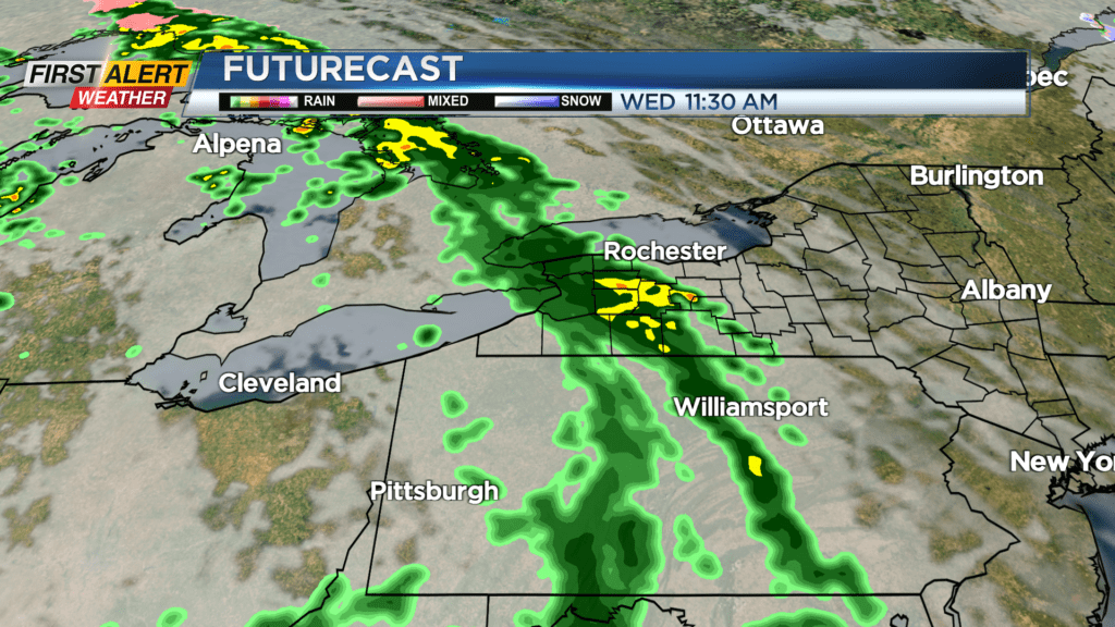
We saw a lovely start to the week work with dry weather and a lot of sun, but that will be changing for the rest of the week. First, we’ll remain dry overnight and into the morning hours on Wednesday, but a round of showers and rain will move in late morning into the early afternoon hours. This will shift east, leaving us with a drying trend for a few hours, before another round of rain and perhaps a few rumbles move in late in the evening and first part of the overnight. This is part of the same system that is bringing severe weather to the Midwest and Plains states. These storms will weaken by the time they reach us, so we don’t expect severe weather. We’ll see an occasional shower on Thursday, but overall a drier day, followed by some more showers with a cold front on Friday.
This cold front will set the stage for a cooler weekend with temperatures dropping back into the lower 50s, but a mix of clouds and sun and mainly dry weather. We’ll warm up a little bit early next week with some 60s making a return to the area.