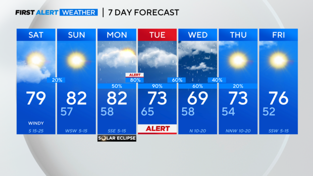
Warm, windy, pleasant weekend in North Texas
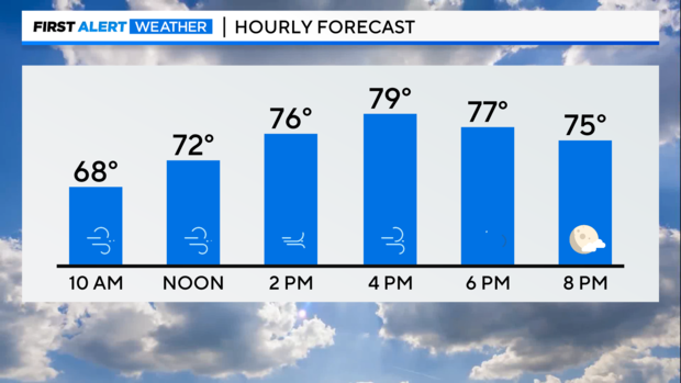
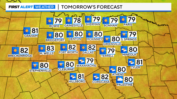
NORTH TEXAS — Clouds have moved back into the area helping to keep temperatures up overnight, so we are still mild in the lower 60s. We have a partly cloudy day ahead with temperatures warming into the upper 70s.
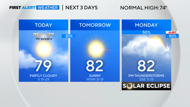
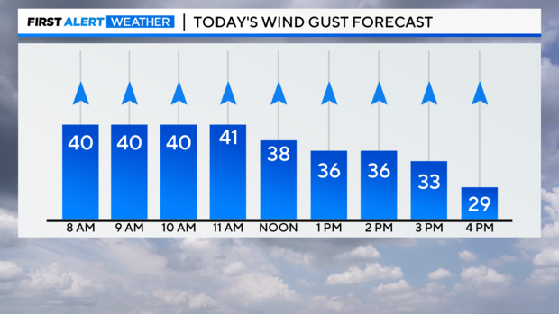
Hold on to your hats today as southerly winds remain sustained 15-25 mph with gusts to 40 mph.
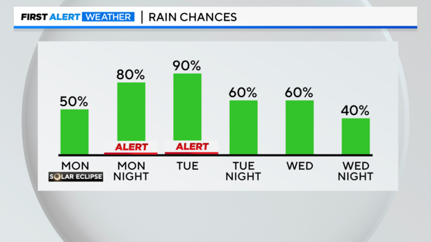
A few showers are possible after sunset into early Sunday morning, but most areas will remain dry with any preicpitation clearing out by daybreak Sunday. Drier air then settles tomorrow keeping our skies sunny all day and helping to boost temperatures back into the lower 80s.
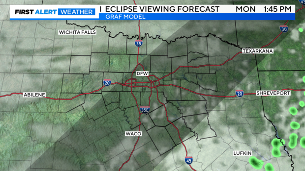
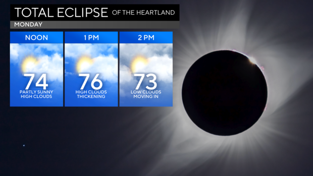
I wish the clear blue skies would stick around for the eclipse, but clouds will be on the increase as we head towards totality. Monday morning starts with thin clouds, creating filtered sunshine but it looks like they will begin to thicken the closer we get to the eclipse. We will also be tracking low clouds moving north from Central Texas and it is possible they will be along or just north of I-20 as we near totality.
Even with the clouds around it will still get dark at totality, we just may not be able to see the eclipse.
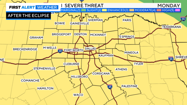
Once the Eclipse is over a Weather Alert goes into place for the potential of severe storms late afternoon into the overnight hours.

Please consider packing up any campgrounds and moving into a sturdy structure for Monday night as the storms could produce large hail, damaging winds and even tornadoes. All of North Texas is under a Level 2, Slight Risk, of severe storms.
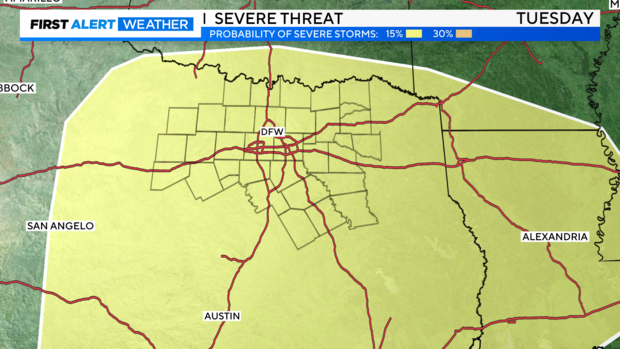
It's not just Monday afternoon we are watching for the potential of severe storms, the risk continues into early Tuesday morning with another round possible Tuesday afternoon. The Storm Prediction Center has the area highlighted for the potential of all hazards, including large hail, damaging winds, and tornadoes.
As the rain continues into Wednesday our flooding threat will begin to increase.
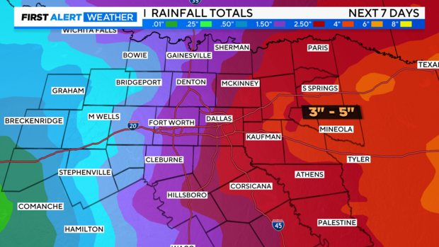
Areas along and East of I-35 will likely see the highest rainfall totals close to 3" - 5" while the rest of the area picks up closer to 1" - 2" . Please remember to Turn Around, Don't Drown. Never try to drive through water-covered roadways, you don't how deep the water is, and it could turn into a life-threatening situation if you try to drive through it.
The rain will finally come to an end by Thursday morning, and we will enjoy a quiet end to the work week with temperatures in the 70s and sunny skies.