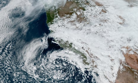
Thunderstorms and tornadoes are expected to sweep eastward across the US in the coming days after a rainy season in California.
According to the storm prediction center at the National Weather Service (NWS), severe weather is expected to spread from the southern plains and into the mid-Atlantic and Gulf coast states over the next three days. The warnings applied to about 50 million Americans to kick off what are traditionally the three months that are typically the most active in terms of tornadoes in the US each year.
In addition to thunderstorms, the NWS warned that wind damage and isolated large hail would be possible across a broad area. And the forecaster warned that a tornado threat was expected to be the greatest from central Kentucky east-north-eastward and into West Virginia.
The NWS warned of a slight risk of severe thunderstorms starting from Sunday afternoon through Sunday night from northern Missouri to central Illinois and Indiana, with a few of the storms potentially producing large hail. Isolated large hail, as well as wind damage may also likely occur across southern West Virginia into south central Virginia.
“We’re talking size of baseballs,” the Fox Weather meteorologist Kendall Smith said. He added: “So you need to take those precautions today and make sure that you are ready for [Monday].”
The risk of thunderstorms is expected to increase on Monday from central Oklahoma and into the lower Ohio Valley, with the possibility of large to very large hail, as well as damaging winds and tornadoes. According to the NWS, the threat is expected to peak in the afternoon and evening in the southern Plains, with the greatest threat for the Ohio Valley vicinity being the evening and overnight period.
In an alert on Twitter/X, the NWS office in Paducah, Kentucky, warned that the main potential for severe storms would begin over south-east Missouri and southern Illinois late Monday afternoon and then spread eastward through the night.
The NWS has also warned that a severe threat is expected on Tuesday from the Ohio and Tennessee Valleys and eastward.
Posting on X, the meteorologist Michael Behrens of Ohio’s WBNS news station wrote: “It was a stormy night around #CentralOhio and we got numerous #hail reports and even a #FunnelCloud report! More storms possible through Tuesday, so make sure you stay weather aware!”
after newsletter promotion
Moreover, with the greatest tornado threat expected to be from central Kentucky and east-northeastward into West Virginia, Paducah’s NWS office warned that damaging winds in excess of 60mph and large hail of over 1in in diameter and greater would be the primary concerns.
Across the central Gulf coast states, an upper-level trough, or an elongated area of relatively low atmospheric pressure, is expected to spread as a cold front advances eastward across the lower Mississippi Valley, the NWS warned.
