Storm chances increase Tuesday night
INDIANAPOLIS (WISH) — Additional rainfall amounts should be light across much of central Indiana through Wednesday night.
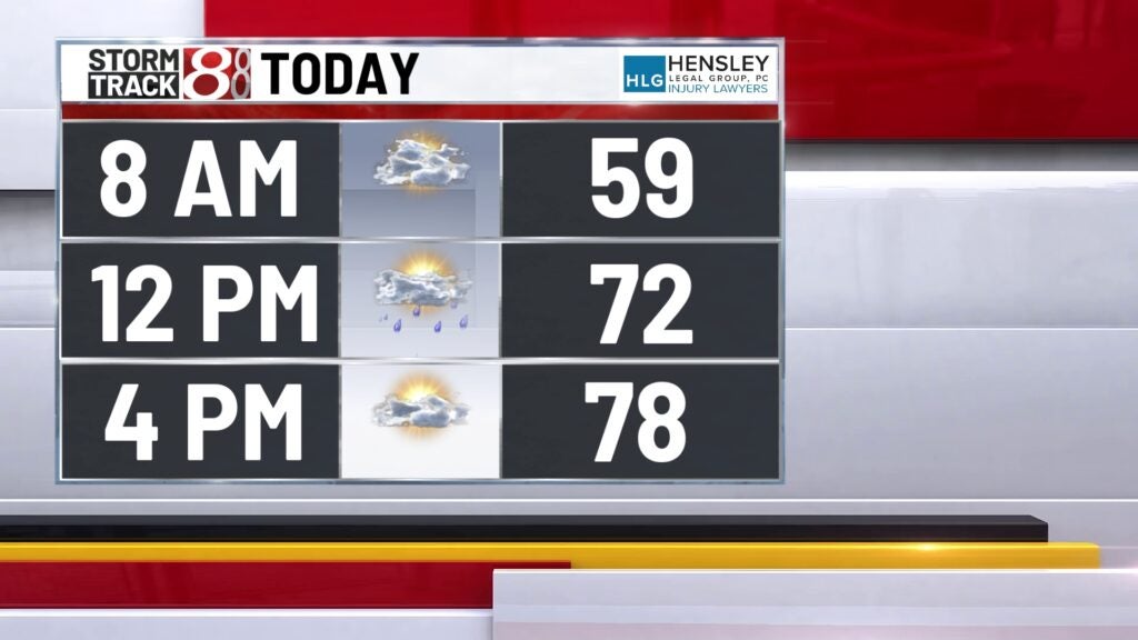
This morning:
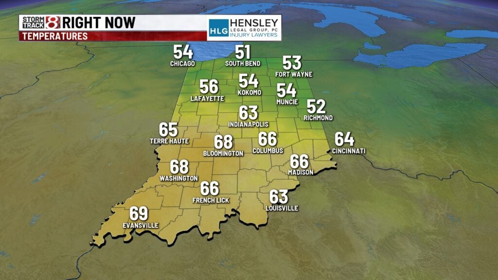
We’re starting the morning off quiet, with partly cloudy skies and very mild temperatures across the state.
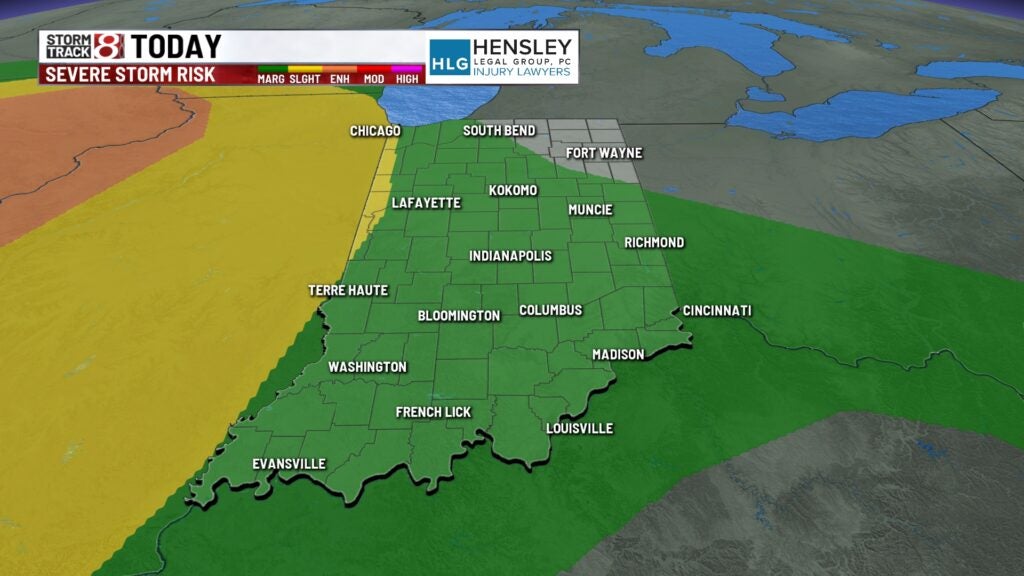
Tuesday:
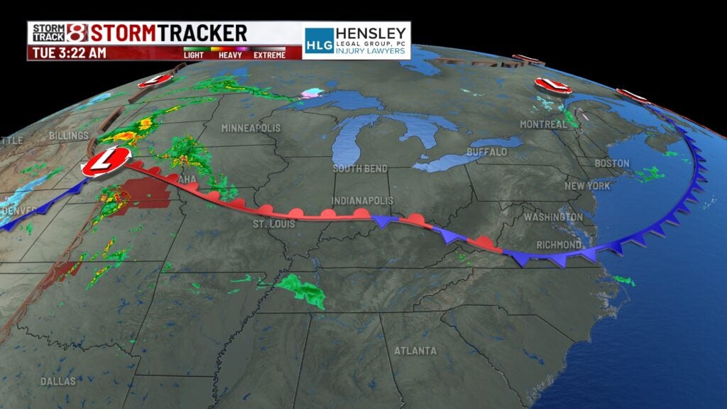
Much of the day is likely dry, with partly cloudy skies. With a boundary down to the south, there is a chance of a few isolated showers, and thunderstorms could develop through the late morning and early afternoon hours.
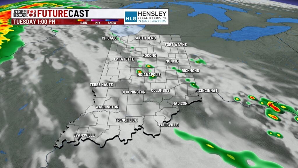
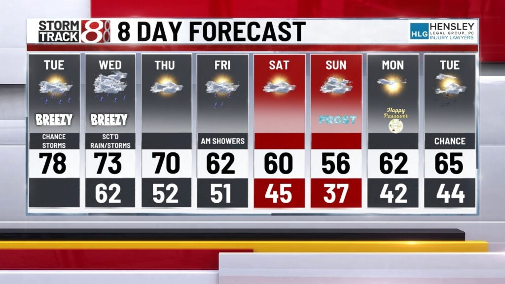
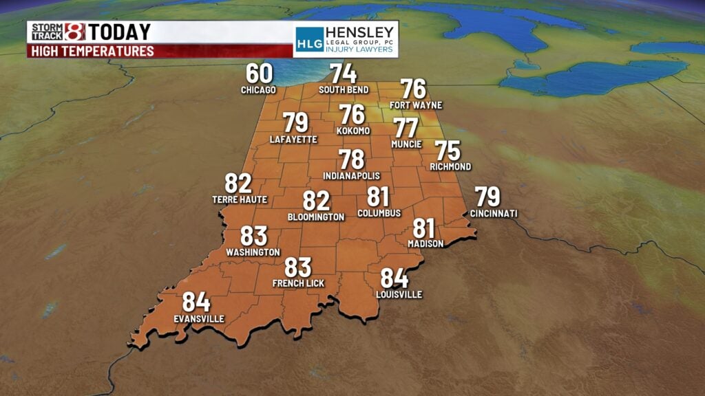
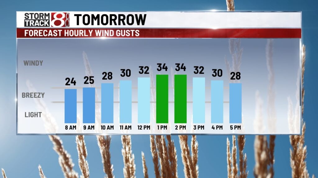
High temperatures will reach back to the upper 70s and lower 80s this afternoon. Gus will increase to 20 to 30 mph this afternoon.
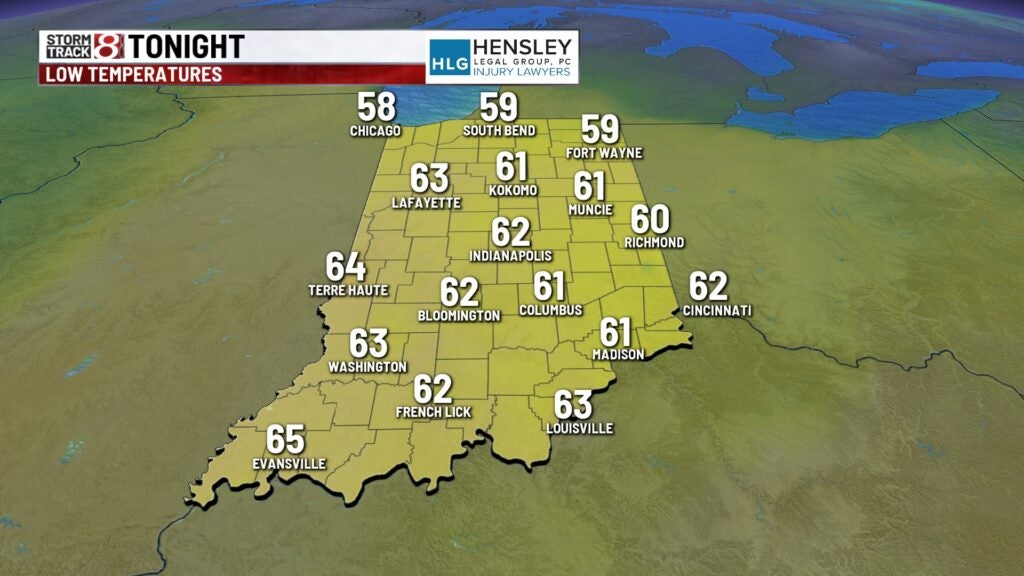
Tuesday night:
The surface level will approach from the west, bringing more widespread showers and thunderstorms starting this evening and continuing into the overnight hours. There is a low chance that a few storms could have gusty winds and large hail. We don’t expect widespread severe weather through the overnight hours.
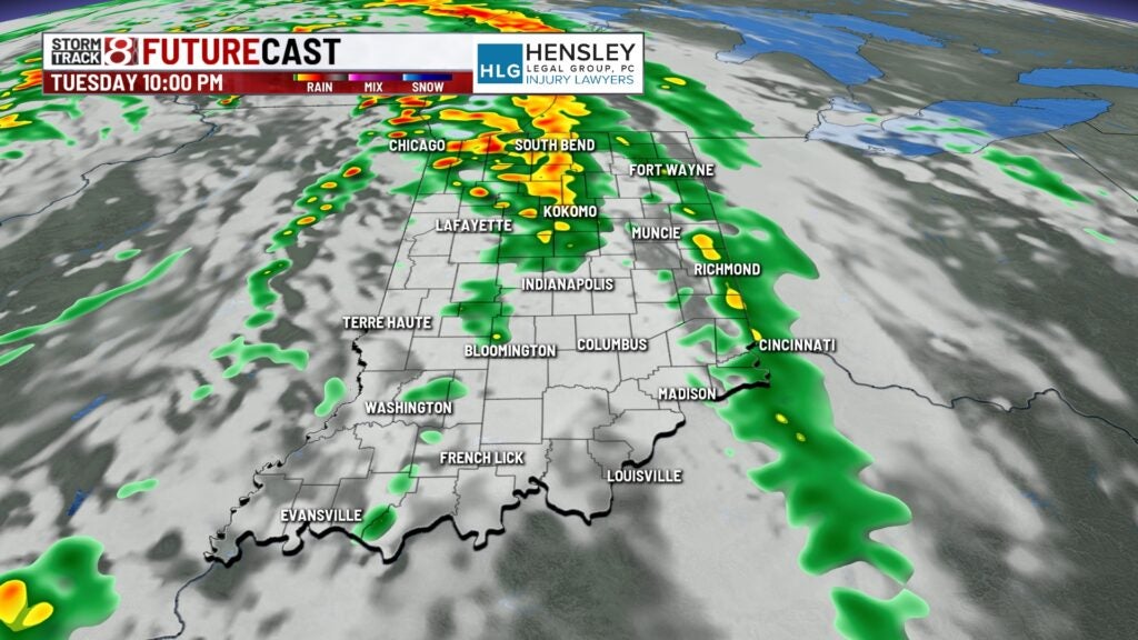
Overnight lows only fall to the mid-60s.
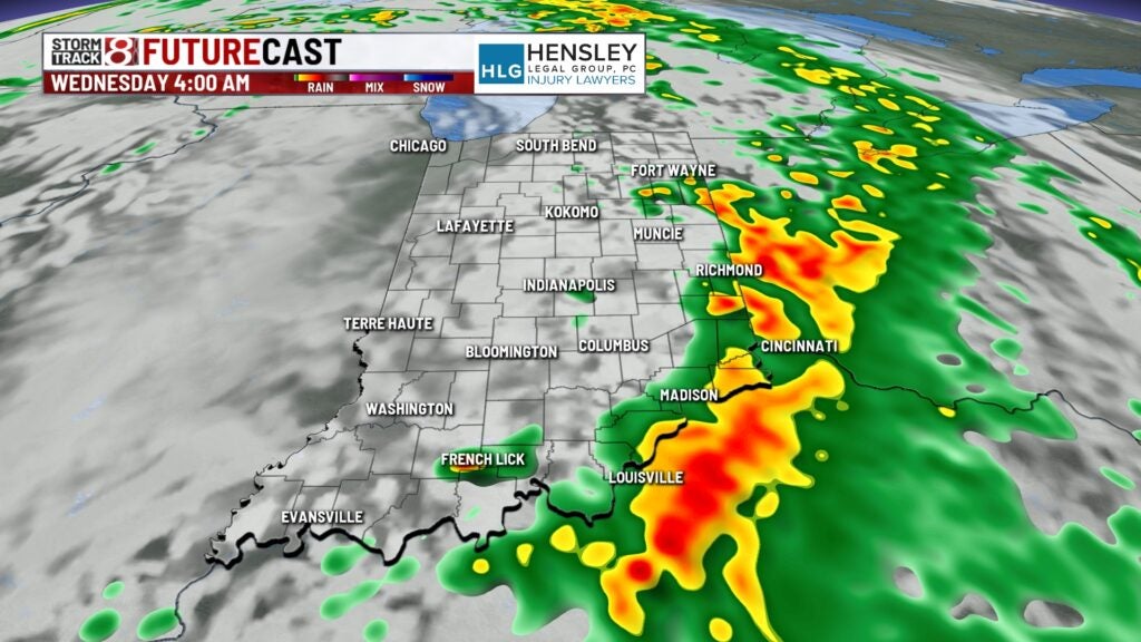
Wednesday:
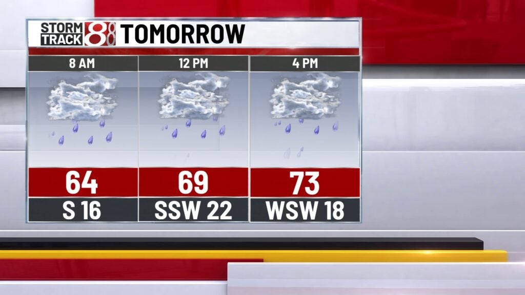
On Wednesday morning, showers will move out. We will await a cold front passing through early to mid-afternoon, which will likely bring showers and thunderstorms to the area. A few of those storms could be on the severe side. Hail will be the primary threat with severe storms that will continue through Wednesday afternoon.
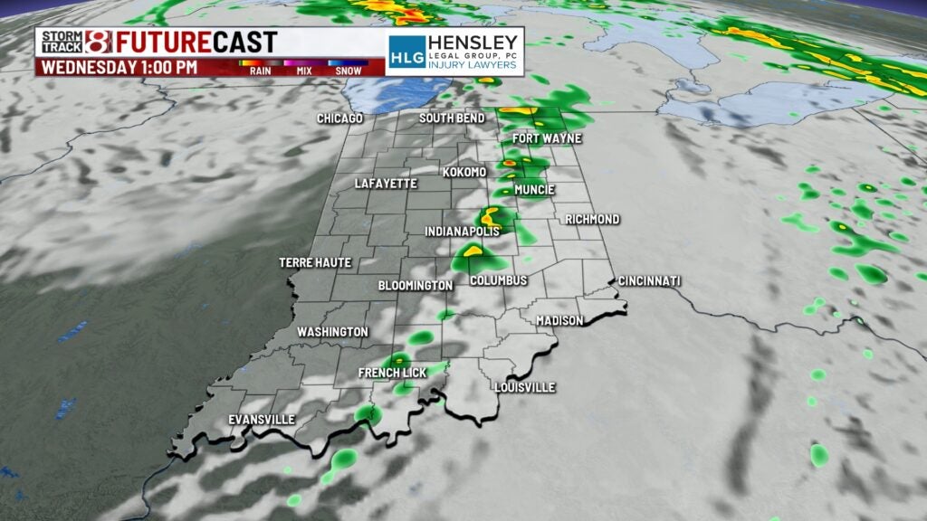
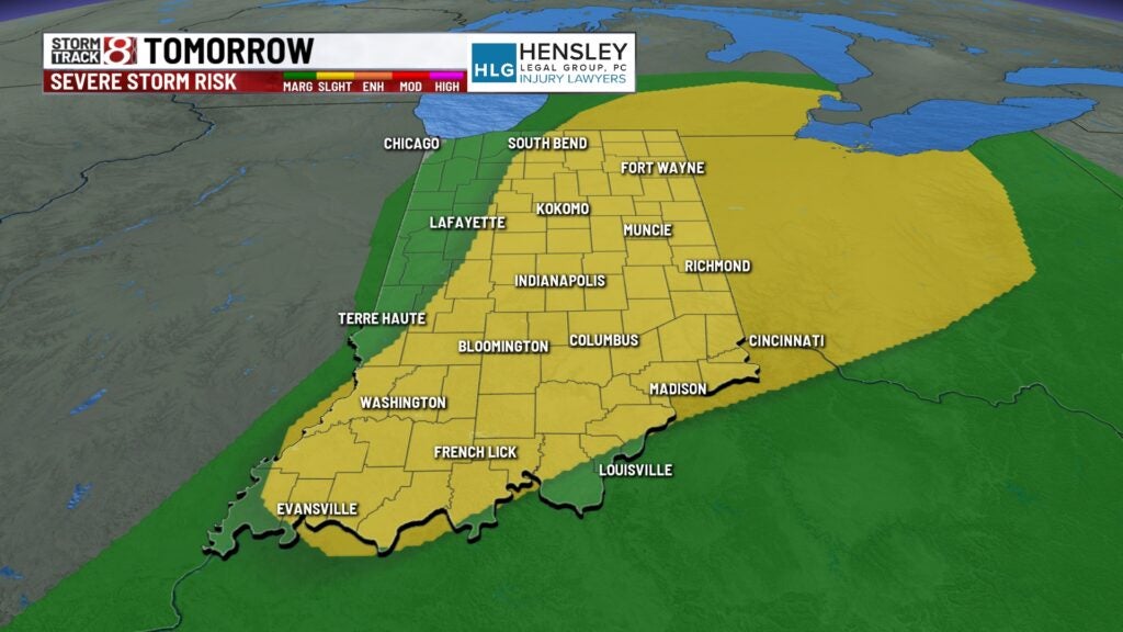
Also, expect wind gusts to increase to 30 to 35 mph for much of the day.
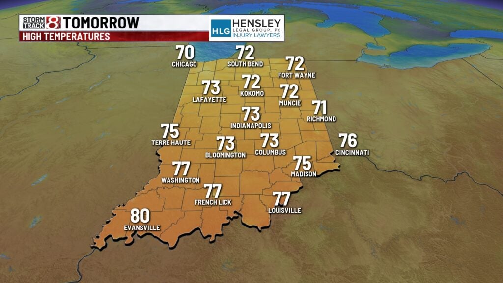
High temperatures will top out in the low to mid-70s.
Late week:
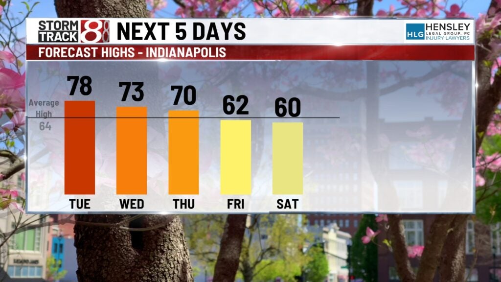
A larger system rolling through Thursday night into Friday will bring another round of showers to the area. It will also bring much cooler temperatures to central Indiana. Will top out around 70 on Thursday and only the lower 60s on Friday.
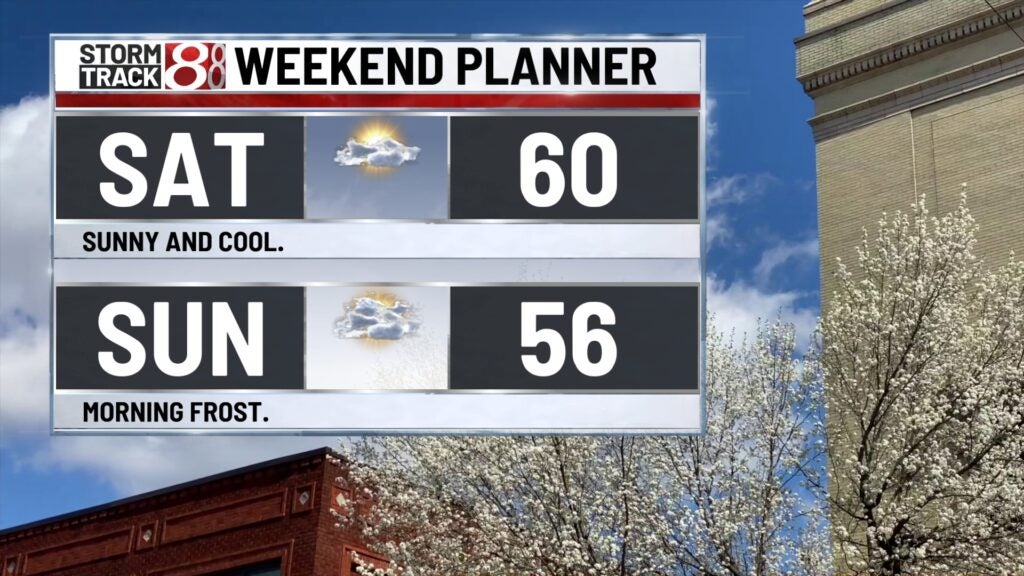
This weekend:
The weekend looks dry but much cooler, with a high of around 60 on Saturday. We will likely turn cold enough Saturday night into Sunday morning that some Apache areas of frost will be possible, especially for the northern half of the state. High temperatures only hit the mid-50s on Sunday afternoon.
8 day forecast:
We will look to rebound temperature-wise heading into next week. Highs will be back to the lower 60s for Monday and into the middle 60s for Tuesday of next week.