Update:
This story was updated with the most recent satellite images available. Check back for updates as the solar eclipse develops.
Editor’s note: This story is part of The Dallas Morning News’ coverage of the 2024 total solar eclipse. For more, visit dallasnews.com/eclipse.
The solar eclipse that will occur Monday, April 8, has North Texas in the path of totality, where the day will turn into the night for a few minutes. But an old enemy lurks: sky visibility.
Clouds, wildfire smoke, city smog and blowing dust are some elements that interfere with sky visibility, obscuring the sun (or moon) from a totally clear view.
The National Weather Service’s office in Fort Worth forecast this Friday said storm chances are increasing Monday after the eclipse, including threats of heavy rain and flooding throughout North Texas. As of 9:00 a.m., reported sky cover was of 57% for Dallas and Fort Worth.
Look at these satellite and forecast maps to see the weather and sky visibility conditions in real-time ahead of the eclipse.
Sky cover is the expected amount of opaque clouds covering the sky. This map shows the percentage of sky cover valid for the indicated hour only.
As the sky is covered with heavy clouds, precipitation probability increases. Similar to the sky cover map, this map forecasts the likelihood of precipitation in percentage, valid for the next 12 hours after being issued.
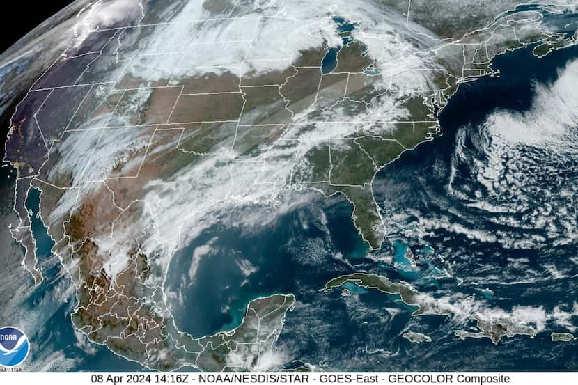
The following satellite view comes from the Geostationary Operational Environmental Satelite-R (GOES), a collaboration of NASA and NOAA. According to product documentation, this GeoColor imagery allows for an intuitive interpretation of meteorological and surface-based features.
GeoColor images update every five minutes at the source and will document sky visibility conditions in real-time on April 8.
A real-time map will also follow the path of the eclipse with updates every minute, while another composition offers a general view of the U.S. and Mexico.
Here’s how the cloud conditions have been looking during the weekend.
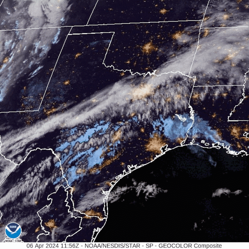
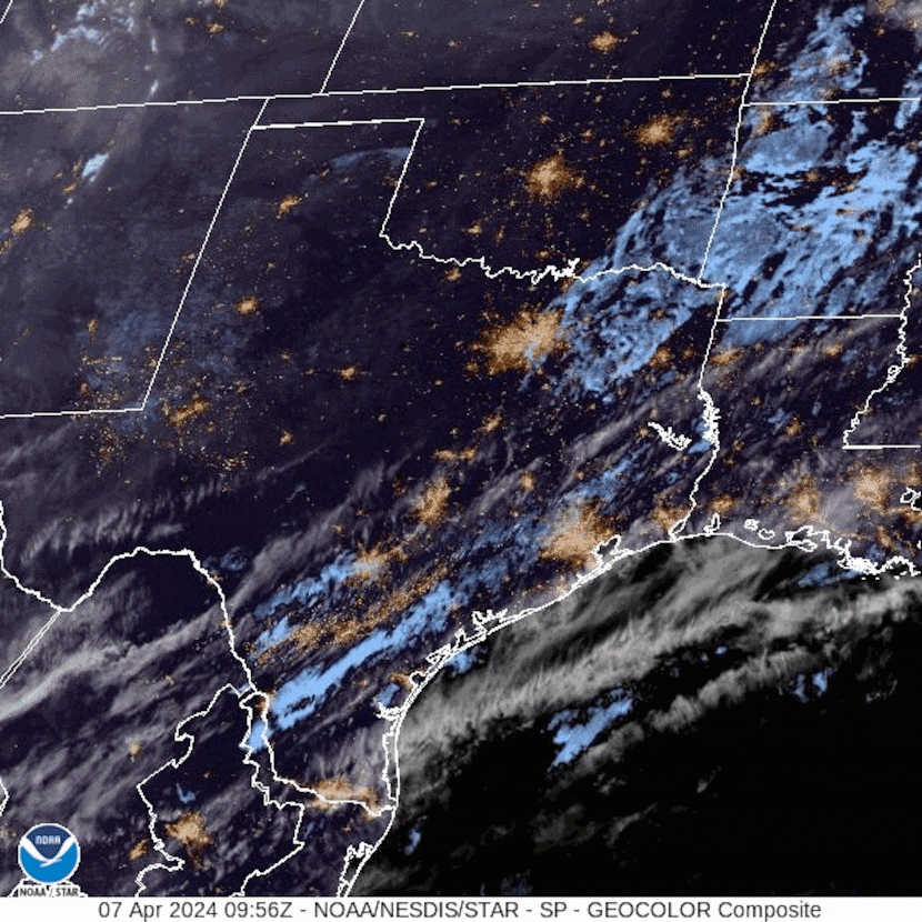
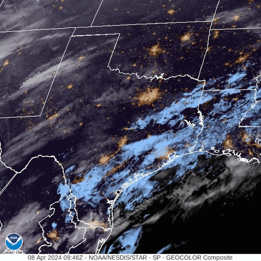
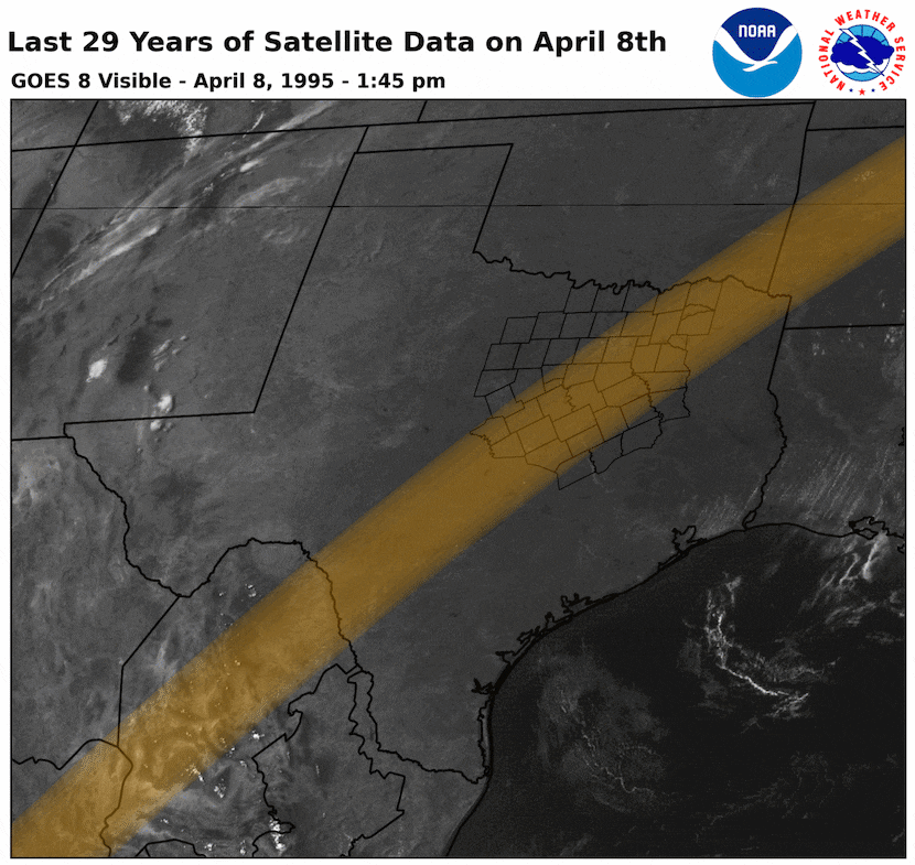
Cloudy days are typical during the first half of April, according to NWS Forth Worth. Mostly clear skies have occurred less than 30% of the time, at least from the last 23 years of historical data within 1 hour of eclipse time.
This map, compiled with GOES imagery, records how April 8 skies have looked around 1:40 p.m., the time when the totality of the upcoming solar eclipse will occur.

/cloudfront-us-east-1.images.arcpublishing.com/dmn/CQPLHKK6FJEXFKJPRVXQNYSYFQ.jpg)
/cloudfront-us-east-1.images.arcpublishing.com/dmn/H22LMPJEBTOCVH4OW5GVZ5V3YY.jpg)
/cloudfront-us-east-1.images.arcpublishing.com/dmn/FYO743PZDACXSNXK4TGBCM4ZGE.jpg)
/cloudfront-us-east-1.images.arcpublishing.com/dmn/BX32KUYCJVBITHITH7A467IFBM.jpg)
/cloudfront-us-east-1.images.arcpublishing.com/dmn/P2BDWCQMSSF4MUOM3GNM44NIVQ.jpg)