Atlantic hurricane season will be 'extremely active' in 2024, forecasters warn
Forecasters at Colorado State University are unusually confident of this year's forecast because the conditions are so "favourable" for hurricanes. Those factors are due to warmth in the Atlantic and a change to the current El Nino weather pattern.

Monday 8 April 2024 13:05, UK
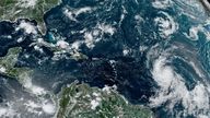
The 2024 Atlantic hurricane season is likely to be one of the most active on record, a forecasting service has said.
Meteorologists from Colorado State University called it unusually early and with unusual confidence, because the conditions are so "favourable" for hurricanes this year.
That is due to record heat in parts of the Atlantic this year, and the La Nina weather pattern expected to take hold at the height of the season.
The Atlantic hurricane season is classed as the period from 1 June to 30 November.
The forecasters are expecting up to 23 named storms, of which 11 could become hurricanes and five major hurricanes.
These are "well above" the average of for the 1991-2020 period of 14 named storms, seven hurricanes and three major hurricanes.
Read more:
2023 was world's hottest year on record - and 2024 could be hotter
'Exceptionally intense' Saharan dust cloud hits Europe
'Ray of hope' as forest destruction in Brazil falls 'dramatically'

The scientists cautioned it was "impossible" to precisely predict activity in April.
But their long-range forecast is designed to help raise awareness of the potential danger, they said.
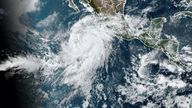
The chances of major hurricanes making landfall along the continental United States coastline and in the Caribbean are "well above average", the US-based team warned.
Why is the 2024 Atlantic hurricane season expected to be so intense?
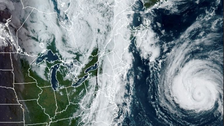
Water on the ocean surface in the eastern and central Atlantic has reached record warm levels, and is anticipated to remain well above average for the upcoming hurricane season.
It is heat in the ocean that drives hurricanes, giving them their energy.
Meanwhile, the current warming El Nino weather pattern is expected to die down in the coming weeks, with La Nina conditions kicking in by the peak of the Atlantic hurricane season.
La Nina tends to ramp up Atlantic hurricanes by decreasing vertical wind shear.
By looking at other recent years with similar conditions, the scientists produced a forecast of record intensity for this year.

Are hurricanes affected by climate change?
Cyclones and hurricanes existed well before human activity began to warm the climate.
Climate change also has not influenced the number of tropical cyclones per year, according to World Weather Attribution, which assesses the link between climate change and extreme weather.
However, climate change has increased the number of intense and destructive storms, they say.
That is because it has warmed the oceans, providing storms with more energy, and warmed the air, so it now holds more moisture and can unleash more heavy rain.
It is also pushing up sea levels, which can make storm surge along coastlines more damaging.
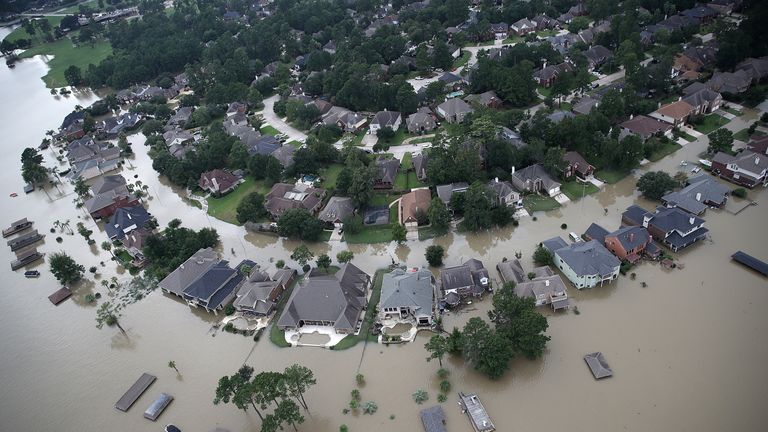
Climate change made rainfall from the 2005 Hurricane Katrina 4% more intense, and from Hurricane Harvey in 2017 15% more intense, according to peer-reviewed studies.
Be the first to get Breaking News
Install the Sky News app for free

