

Meteorologist April Loveland's First Warning Forecast
Less wind and more sunshine on today. Temperatures will top out in the upper 50s and low 60s.
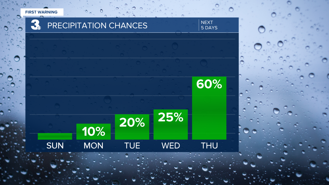
A warming trend will kick in on Monday. Skies will turn partly cloudy and temperatures will warm to the upper 60s, which is normal for this time of year.

More clouds will build in on Tuesday, but it will be warm with highs in the mid 70s. A spotty shower is not out of the question.
A few spotty showers will be possible on Wednesday. Highs will once again warm to the mid 70s.
A better chance for showers by Thursday as a cold front moves in. Temperatures will top out in the low 70s. It will be breezy, with winds out of the south at 10-20 mph. Gusts up to 30 mph will be possible.
A few showers will linger into the morning hours on Friday. Temperatures will be similar with highs in the low 70s. We should see some clearing by the afternoon.

Meteorologist April Loveland
For weather updates on Facebook: HERE
Follow me on Twitter: HERE
Follow me on Instagram HERE
Check out the Interactive Radar on WTKR.com: Interactive Radar
