

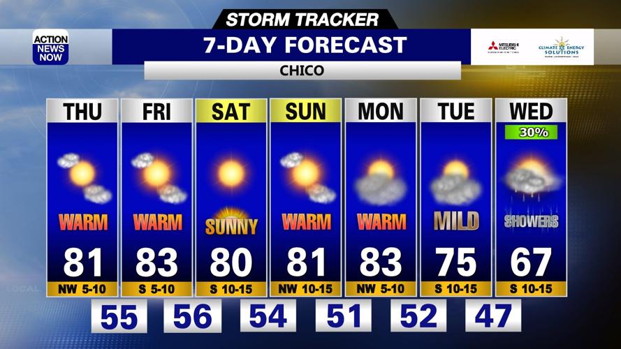
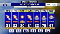


It's another good day to throw on light layers, grab your sunglasses and pack some extra water before you head out the door Thursday. We have a bright and mild morning, and a warm and cloudy afternoon on tap for today. Mild mornings, warm afternoons, dry weather and mostly sunny skies are projected for Friday through this weekend. A cooling trend and the potential for showers will return in your extended forecast.
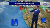
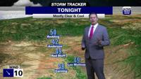
It's another good day to throw on light layers, grab your sunglasses and pack some extra water before you head out the door Thursday. High pressure off the coast will continue to dominate the weather pattern across the entire West Coast today, and will leave us with similar conditions through your weekend. A cool and wet system well off the coast in the Pacific will push some clouds over our region as it tracks closer to the Pacific Northwest Thursday, but we'll stay dry and warm. We've had clear skies across our region overnight, and will start out bright and sunny Thursday. Cloud cover will begin to increase later this morning, and then we'll end up partly to mostly cloudy by late this afternoon. Temperatures are starting out in the the upper 40's to lower 60's in the valley, 40's to mid 50's in the foothills, and 20's to 30's in our mountain zones this morning. Winds will be out of the north to 15mph, and gusts up into the 20mph to 30mph range will be possible early today. We'll then have north winds to around 10mph this afternoon. High temperatures are projected to range from the upper 70's to mid 80's in the valley, and mid 60's to mid 70's in most foothill and mountain zones Thursday afternoon. We'll have cloudy skies, but warm and dry conditions on tap for anyone heading out to the Thursday Night Market in Chico this evening.
The main influence to our weather pattern will continue to be high pressure building into northern California from the eastern Pacific from Friday through this weekend, and that will leave us with more warm and dry conditions over the next several days. Temperatures will start out in the low to mid 50's in the valley, 40's to 50's in the foothills, and 30's to 40's in our mountain zones each morning from Friday through Monday. We'll have sunshine returning Friday and persisting Saturday, but some clouds will brush across our region Sunday and we'll have partly cloudy skies on Monday. Winds will stay modest into this weekend, but will end up breezy Saturday night into early Sunday. High temperatures are projected to climb into the low to mid 80's in the valley, and 60's to 70's each afternoon from Friday through Monday.
The ridge of high pressure that's bringing our very warm and dry conditions through this weekend will then start to track east of our region from Monday afternoon through the middle of next week. That will open up the door for increasing influence from a cool and wet system off the coast. We'll end up with temperatures back down to around average with dry conditions and partly cloudy skies on Tuesday. Projections then bring the return of below average high temperatures and the potential for showers back into your forecast from Wednesday through the end of next week. High temperatures will top out in the mid 70's in the valley on Tuesday and then mid 60's in the valley on Wednesday.