


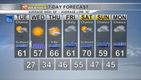

Before the skies turned overcast and some of us saw a few rain showers, temperatures soared well into the 60s with a few spots falling just shy of 70.

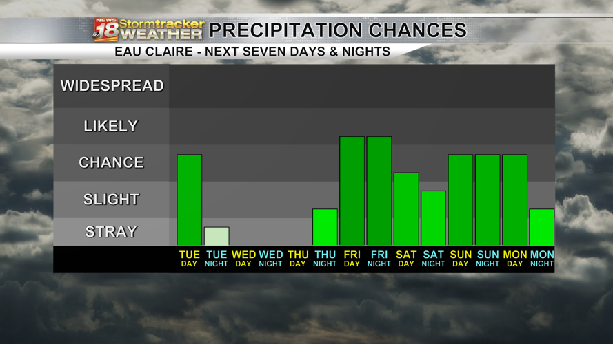
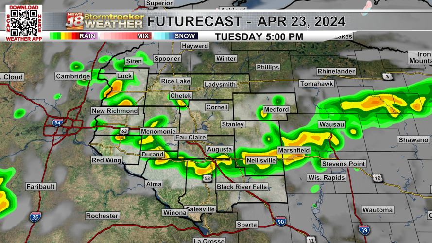
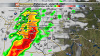
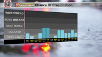
I'm tracking another round of showers and isolated thunderstorms in your Tuesday forecast. This is thanks to an area of low pressure and a cold front that sweep southeast throughout the day.

The morning hours will be quiet but cloud cover will increase and after about 11 AM, we'll start to see some scattered showers and possibly a few thunderstorms develop and track through. This will continue through the afternoon hours before coming to an end by 7-8 PM.


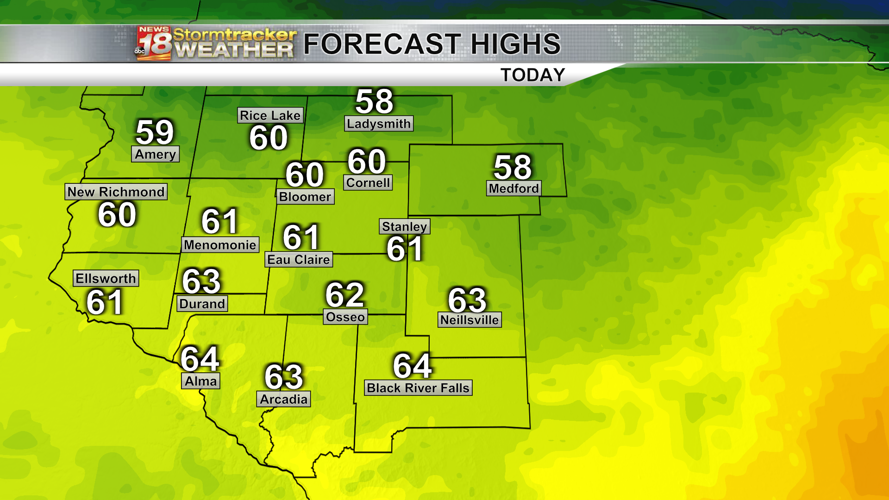
Highs will climb into the upper 50s and lower 60s with a breezy westerly wind turning more northerly as the cold front passes through.

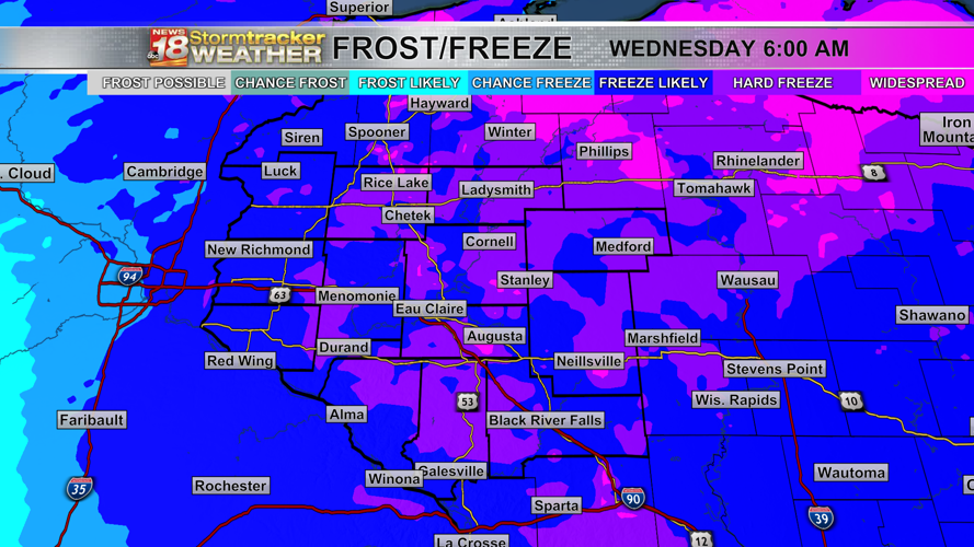
Skies become clear tonight and winds will eventually become light to calm, leading to temperatures falling pretty quickly. We'll be down into the mid to upper 20s, so we'll likely be dealing with a freeze and some spots even seeing a hard freeze.

Wednesday overall looks great with sunny skies, light to calm winds and highs in the mid to upper 50s.


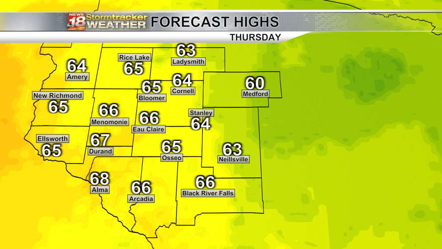
Thursday will be a little warmer with highs back into the 60s and a mostly sunny sky... however the wind will become breezy once again during the afternoon hours.

Please remember that despite the recent rainfall we've had over the last few weeks, the fire danger remains very high across the area, so please refrain from burning or anything of the kind for the time being.

As we head into the weekend, the weather pattern will be turning rather active as we'll be watching two storm systems that'll develop and track towards the Upper Midwest.

The first one will impact our area Friday into Saturday with the second one impacting us Sunday into Monday. The exact details of how everything will play out is still up in the air as the system has not quite made landfall in the U.S. but once that happens, we'll get a better idea on what to expect.


The way things look right now, we'll see periods of rain and some thunder Friday into Saturday morning, then the rain scatters out a bit Saturday afternoon through Sunday morning before the next wave moves in. In addition, we'll see gusty winds with gusts up to 40 mph possible.

I can't rule out the possibility of strong (to possibly severe) storms but right now those chances are very low. The best chances for severe weather will be from the Quad Cities into the southern Plains. The track and strength of both systems will be key in how things play out. I encourage you to check back with us for updates as newer data becomes available.


