


Three Forest City High School students and FFA members, supported by FFA Advisor Ryan Faught and others, have worked hard to bring an innovative project to life.
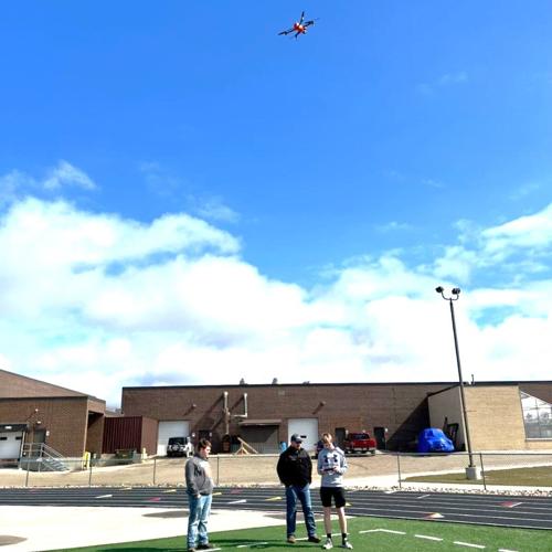
Jacob Beenken, Landon Patten, and Chase Sorensen embarked on a journey several months ago to raise funds to purchase a land surveying drone. The goal was to offer aerial photography and surveying services for area farmers.
They started by compiling a business plan and then successfully raised $5,600 from donors to support this project. The funding covered the cost of the recently purchased Autel 2 Evo Pro V3 drone, which is a land surveying drone with a 6K camera. It not only takes high-quality aerial photos but can also provide precise land surveying information to create prescriptions, spot irregularities in crops, and create detailed growth maps.
To promote their services, the students have created a website, www.forestcityffaaerialphotography.com. They offer survey options as a cost per acre and various aerial photography packages.
People are also reading…
Drone technology is a rapidly growing part of the commercial ag industry. It provides many occupational opportunities and new, more productive ways to produce crops.
Jacob Beenken, as part of the requirement to launch this project, obtained his Part 107 Remote Pilot License from the Federal Aviation Administration to fly the drone. This training covered topics including regulations related to small (unmanned) aircraft systems, operating requirements, emergency procedures, and privacy.
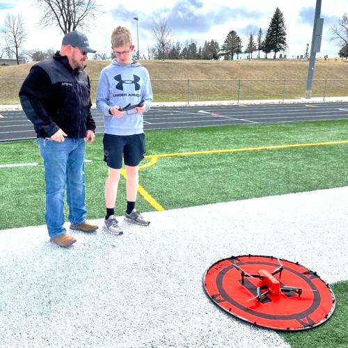
Beenken and Patten also worked with Matt Maus, of HTS Ag, who delivered the drone to the group and provided training on its setup, software, and operation. They said they are not aware of another FFA group that has tacked a project such as this. They noted being excited to bring this technology to local farmers and to gain real-world experience.


