AUSTIN, Texas — Editor's note: This article is no longer being updated. For the latest weather news, click here.
After a brief stretch of dry weather, storms are back in the forecast for Friday afternoon and Friday night. In fact, some of these storms could be strong to severe with damaging wind gusts, large hail and an isolated tornado.
Here's a look at the Watches and Warnings currently issued for the area:
12 a.m. – Bluebonnet Electric is reporting 195 outages affecting 3,500 customers.
Meanwhile, Austin Energy said most of Friday night's outages have been caused by storm damage to poles and power lines. Crews will work through the night to restore power.
11 p.m. – Bluebonnet Electric said it is working to restore power to 200 outages affecting 4,800 customers.
10:25 p.m. – A Severe Thunderstorm Warning is in effect for Caldwell, Fayette, Bastrop and Hays counties until 11:30 p.m.
10:20 p.m. – Bluebonnet Electric said as of 10 p.m. it is working to restore power to 187 outages affecting 6,000 members.
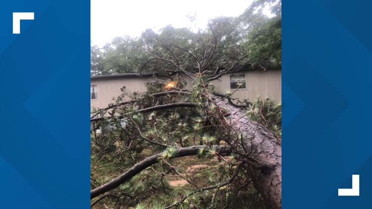
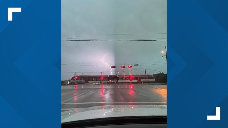
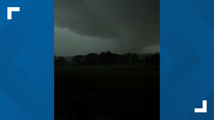
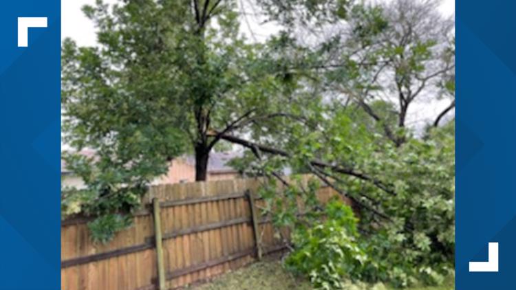
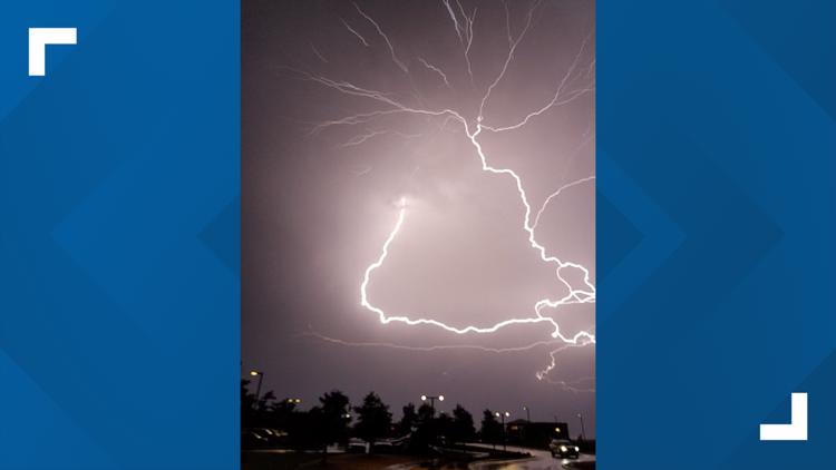
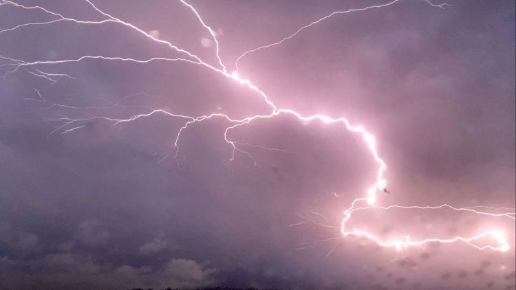
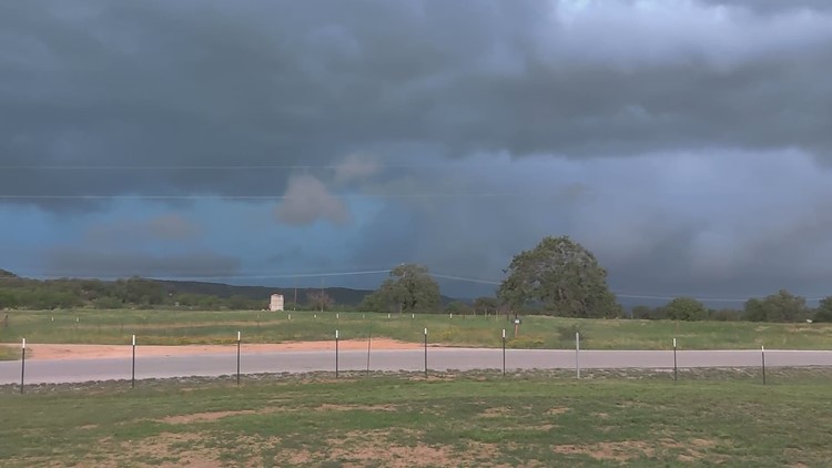
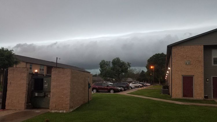
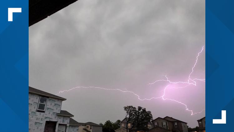
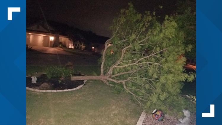
10:15 p.m. – Here's a look at some photos viewers have sent from Friday night's storms:
PHOTOS: Your pictures from Friday night's severe storms


9:55 p.m. – Much of the KVUE area, including Travis County, has been removed from the Severe Thunderstorm Watch. It remains in effect for Hays, Caldwell and Fayette counties.
9:40 p.m. – A Severe Thunderstorm Warning has been issued for an area including Hays and Caldwell counties until 10:30 p.m., including Kyle, New Braunfels and San Marcos.
9 p.m. – A Tornado Warning for La Grange, Fayetteville and Ellinger has expired.
8:53 p.m. – The Red Rock General Store suffered damage from tonight's storm in Bastrop County.


8:46 p.m. – A Severe Thunderstorm Warning has been issued for Giddings, La Grange and Schulenburg until 9:30 p.m.
8:40 p.m. – A Severe Thunderstorm Warning for Fayette, Lee and Lavaca County is in effect until 9:30 p.m.
8:30 p.m. – A Tornado Warning has been issued for La Grange, Fayetteville and Ellinger until 9 p.m.
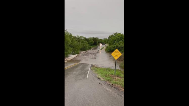
8:25 p.m. – A Flash Flood Warning has been issued for the Austin area until 11:30 p.m.
A Severe Thunderstorm Warning has been issued for New Braunfels, San Marcos and Lockhart until 9:30 p.m.
8:17 p.m. – The Tornado Warning for Bastrop, Caldwell and Fayette County has expired.
8:11 p.m. – According to ATXfloods.com, about 55 low water crossings are closed.
7:57 p.m. – A Severe Thunderstorm Warning has been issued for Bastrop, Camp Swift and Giddings until 9 p.m.
More than 30,000 Austin Energy customers are now without power.
7:51 p.m. – A Severe Thunderstorm Warning has been issued for Kerr, Bandera, Real and Gillespie County until 8:45 p.m.
7:45 p.m. – A Tornado Warning has been issued for Bastrop, Caldwell and Fayette County until 8:15 p.m.
7:34 p.m. – Around 26,000 Austin Energy customers are without power. Click here for a map.
Bluebonnet Electric reports about 920 members are impacted by an outage in Bastrop County.
7:15 p.m. – Reports of water rescues are underway in the Austin area:
7:02 p.m. – A Severe Thunderstorm Warning has been extended for the Austin, Round Rock and Pflugerville areas until 8 p.m.
6:51 p.m. – Wind gusts of up to 67 mph have been reported in western Travis County.
6:50 p.m. – Some local graduation ceremonies have been postponed, including Hays CISD, Georgetown ISD and Dripping Springs ISD.
6:40 p.m. – A Severe Thunderstorm Warning has been issued for Johnson City, Stonewall and Albert until 7:45 p.m.
A Severe Thunderstorm Warning has been issued for Blanco and Gillespie County until 7:45 p.m.
6:38 p.m. – A 90 mph wind gust has been reported in Lago Vista.
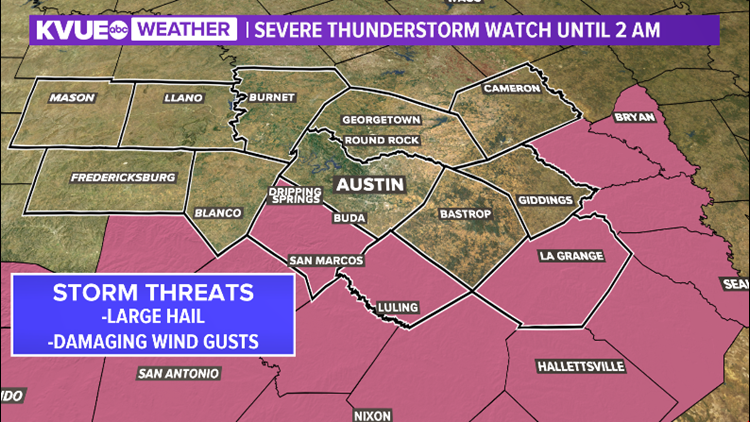
6:24 p.m. – The Severe Thunderstorm Watch for Central Texas has expanded to include the entire KVUE viewing area until 2 a.m.
6:12 p.m. – Austin, Round Rock and Cedar Park are now included in a Severe Thunderstorm Warning until 7:15 p.m.
5:51 p.m. – A Severe Thunderstorm Warning for Llano County is in effect until 6:30 p.m.
5:28 p.m. – Mable Falls, Kingsland and Burnet are all included in a Thunderstorm Warning until 6:30 p.m.
5:15 p.m. – Marble Falls, Kingsland and Granite Shoals are included in a Thunderstorm Warning until 6:15 p.m.
5:11 p.m – A very dangerous storm moved into Burnet County shortly after 5 p.m., with hail up to baseball size and winds up to 60 mph possible.
5:16 p.m. – A Severe Thunderstorm Warning has been issued for Burnet and Llano County until 6:15 p.m.
2:58 p.m. – A Severe Thunderstorm Watch is in effect for many of our northern counties until 7 p.m.
MORE:
The Storm Prediction Center has upgraded Mason and Llano counties to the "enhanced" – level 3 of 5 – risk for strong to severe storms for this afternoon and tonight.
The rest of the KVUE area is included in the "slight" – level 2 of 5 – risk for strong to severe storms.


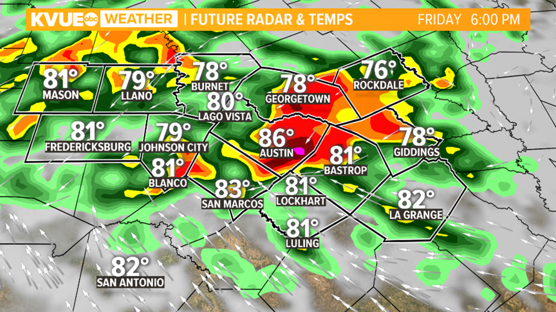
Timing for the arrival of the stormiest weather remains fluid but, generally speaking, we're expecting widespread storms through the late afternoon and evening hours.
We're expecting the main risk for storms after about 3 p.m. this afternoon with the storms expanding southward through late afternoon and evening. With that being said, it's also possible that storms don't move into Central Texas until later in the evening.
Due to the high uncertainty, please make sure you have a way to get weather alerts starting this afternoon, especially if you have plans to get outdoors.

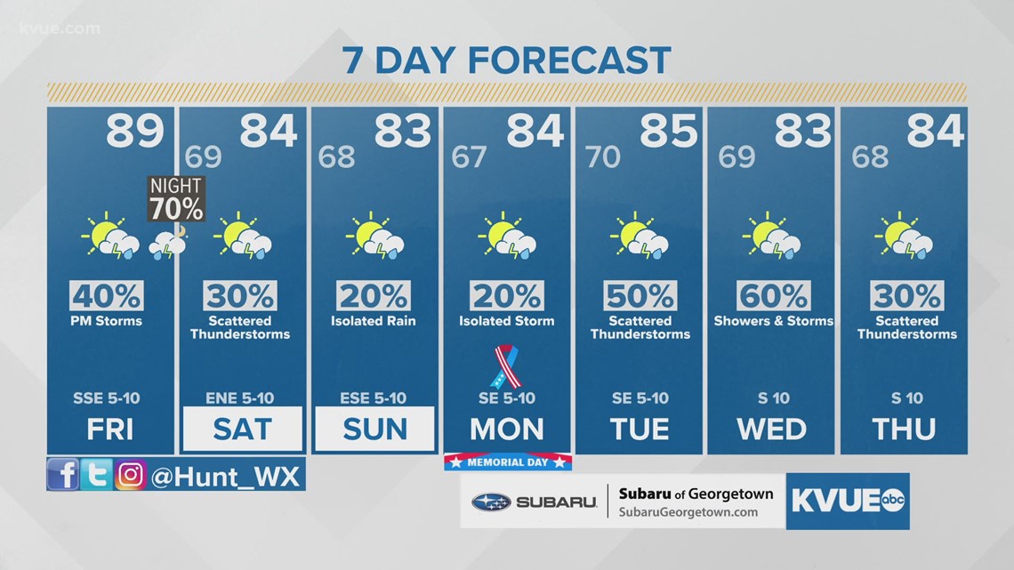
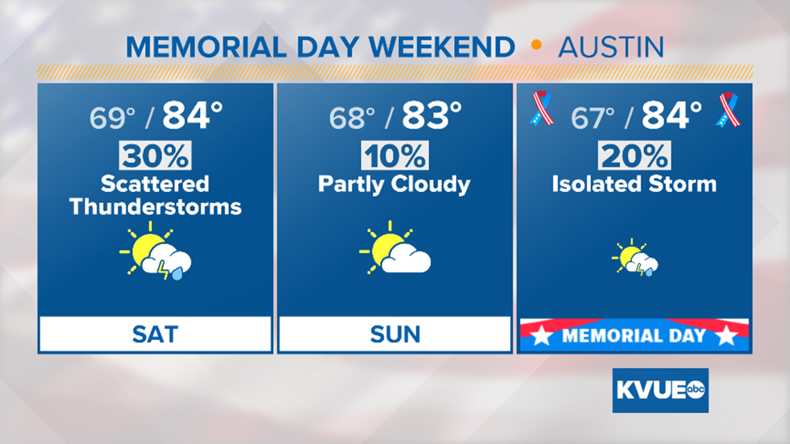
Although this evening and tonight will be stormy, we're not expecting a washout for Memorial Day weekend. By Saturday, we're left with just a 30% chance of lingering showers and storms, especially early in the day.
Sunday and Memorial Day will both have a chance for an isolated shower or storm, but both days should be primarily dry with the rain chance around 20%. Highs this weekend will also trend a bit cooler with mid-80s in the forecast.

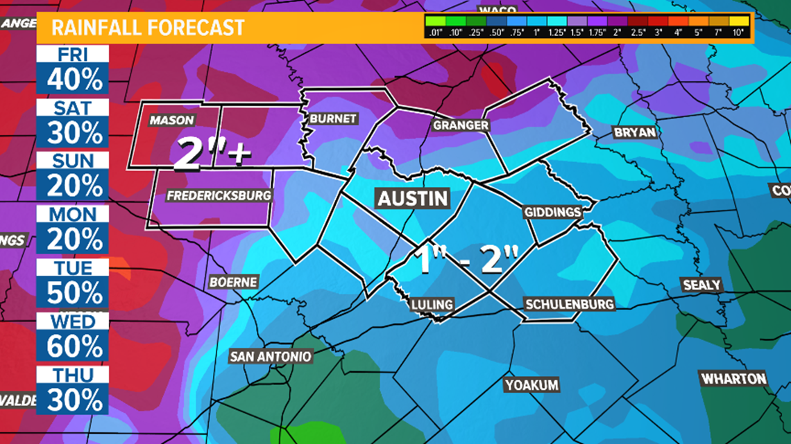
Beyond Memorial Day, a stormy pattern likely sets up through the middle of next week. Rainfall totals in excess of 2 inches will be possible in the next 7 days across the Hill Country. Lower totals between 1 and 2 inches are more likely along and east of the Interstate 35 corridor.

The KVUE Storm Team will continue to monitor this developing forecast.
In the meantime, the extended forecast can be found below: