
SOAKING START TO TUESDAY
A lull in the rainfall here Tuesday afternoon and it is welcome. For many, drenching downpours brought a lot of rain early Tuesday. Big rain totals early Tuesday include 4.43″ in Reagan, 3.22″ in Frankfort and 2.22″ in Michigantown.


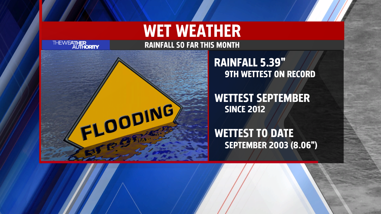
Rainfall today brings the total for September in Indianapolis to 5.39″, the most for a Sept. to date since 2012 and 9th WETTEST on record thru the 25th.
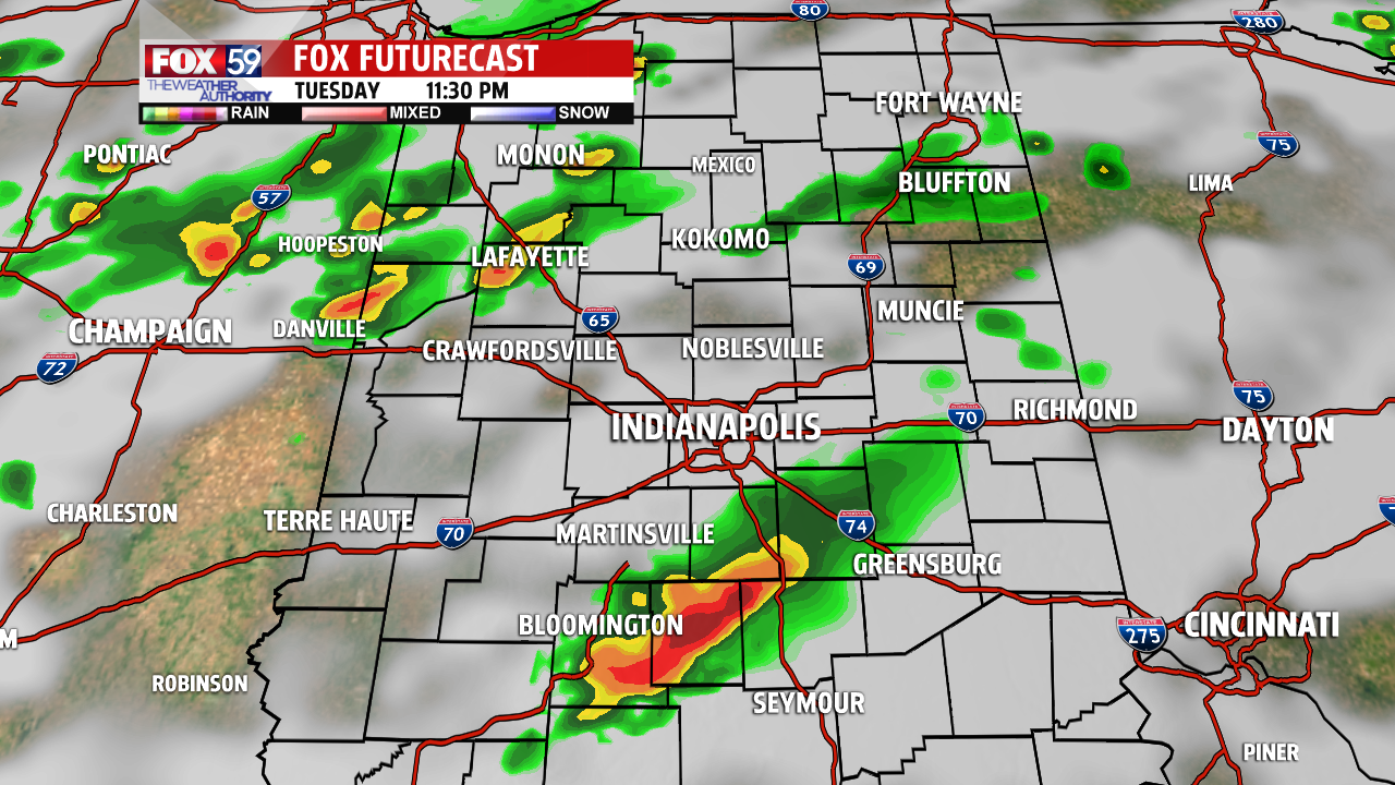
STORM THREAT WANES BUT CONTINUES
A cold front is coming but before it arrives a few new scattered storms are expected. A few gusty storms may still come together in rather isolated fashion, so we are not completely cleared of a strong storm threat until after 11 p.m.
The SPC (Storm Prediction Center) outlook continues for a portion of northern Indiana through sunrise Wednesday. Currently, a squall line of storms in northwest Illinois has prompted a Severe Thunderstorm Watch. That line of storms could reach northwest Indiana later tonight. Intensity will be in question after sunset, but the threat of storms will persist before the cold front passes pre-dawn Wednesday.


Behind a wind shifting cold front early Wednesday comes refreshingly milder air! The dew point – a measure of moisture in the air will drop sharply starting Wednesday morning. With drier and cooler air in place, early morning low temperatures will likely reach the mid/upper 40s outlying Thursday morning. This will be the start of a mild and mostly sunny stretch to end the work week and perhaps last through the weekend!


