San Diego tracking ‘urban heat islands’ in low-income neighborhoods as temperatures rise

Inland communities can suffer temperatures 20 degrees hotter than more affluent coastal enclaves, according to NOAA
Students and other volunteers strapped heat sensors on cars and bicycles Monday before setting out to gather temperature data in low-income neighborhoods across the city of San Diego.
The event, organized by the city in collaboration with The San Diego Foundation and National Oceanic and Atmospheric Administration, is part of a campaign to protect vulnerable residents from dangerously hot temperatures as the planet continues to warm.
Areas with large swaths of pavement and concrete, coupled with sparse tree cover, have been hit the hardest, such as City Heights and Southeast San Diego. These neighborhoods have been dubbed “urban heat islands,” where, according to NOAA research, temperatures can reach up to 20 degrees hotter than in more affluent coastal communities.
Bryant Baker returned to High Tech High in Liberty Station around 2 p.m. after spending the morning taking heat measurements in San Ysidro near the border with Mexico. As a Black youth, he said he’s particularly concerned about the impacts of extreme heat on underserved communities of color.
“I’m so lucky to live by the water compared to inland. It’s just so hot there,” said the 16-year-old who resides in downtown San Diego. “Most of the low-income communities can only afford those areas, and we need to do something about that.”

A new study of tree coverage shows a disparity in San Diego neighborhoods, with wealthier, Whiter areas having more leafy coverage than less-affluent, non-White ones
The city plans to use the data collected on Monday to help draft an adaptation plan called Climate Resilient SD. The blueprint, which is slated to be released for public review this fall, is aimed at protecting those residents most vulnerable to climate change. Proposed strategies include planting trees, building shade structures, covering rooftops with plants or reflective materials, as well as designating more libraries and other air-conditioned buildings where people can take refuge during punishing heatwaves.
“We’re seeing more people die from extreme heat every year,” said Heidi Vonblum, deputy director of the city’s planning department, who oversaw the data collection effort. “There is definitely an urgency to address this now.”
Along with wildfire and flooding, urban heat has become a leading cause of weather-related death, according to a 2017 study published in the journal Environmental Epidemiology. Heatwaves can also cause heatstroke, exacerbate respiratory and heart problems, as well as drive up utility bills.
Vonblum said the city is looking at ways to make homes coolers as well as more energy efficient, so that heatwaves don’t burden residents with large air-conditioning bills.
“A lot of the older buildings, especially in the underserved communities, cannot withstand these types of temperatures,” she said. “It gets hot in these homes.”
While San Diego has historically enjoyed mild weather, heat waves have in recent years sent temperatures soaring over 104 degrees. Over the last century, six of the 10 warmest years in the region have occurred since 2014, according to data from the National Weather Service.
While the city prepares for rising temperatures, heat islands have also been identified in other parts of the county. Older residents of El Cajon and Lakeside, for example, are among those with the highest risk in the region for heat-related illnesses, according to the California Environmental Protection Agency.
Get Essential San Diego, weekday mornings
Get top headlines from the Union-Tribune in your inbox weekday mornings, including top news, local, sports, business, entertainment and opinion.
You may occasionally receive promotional content from the San Diego Union-Tribune.

More from this Author


More in this section
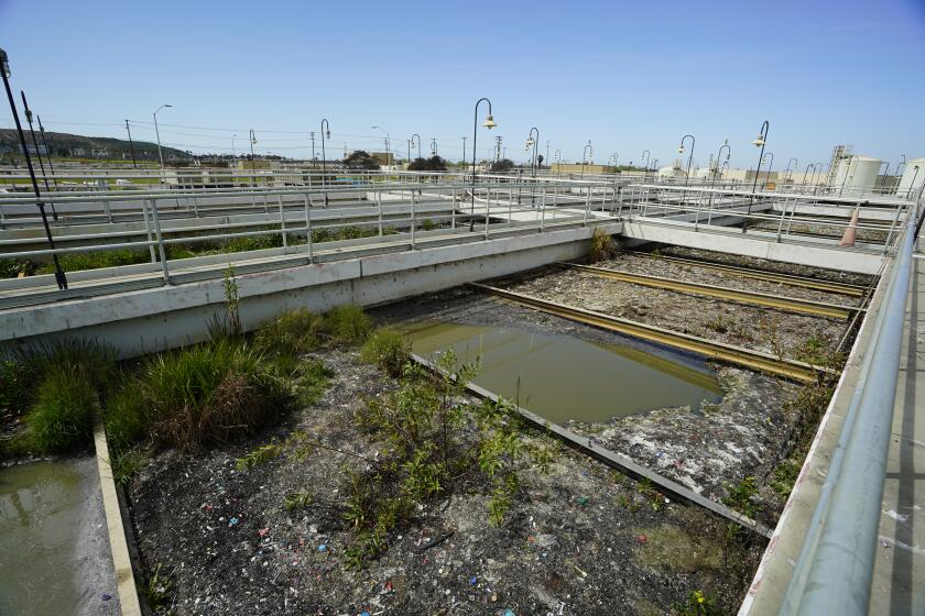
Biden appointee tasked with fixing aging infrastructure contributing to longstanding pollution at U.S.-Mexico border. ‘Priority No. 1 is safety.’
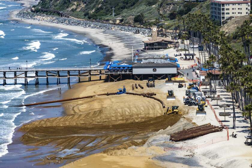
Beachgoers who visit the San Clemente Pier area this summer should see some extra towel space on the sand.

Velella velellas have been spotted all over Southern California

State and federal regulators have rolled out tighter emission rules, pushing commercial operators toward zero-emission vehicles

Yun Chuan and Xin Zao will arrive in San Diego, possibly by summer. Officials say the new loan agreement supports a “shared goal of creating a sustainable future for giant pandas”
Coronado lifeguard is leading effort to establish safety standards. ‘This is the lifeguard’s cancer.’


