Colorado Weather: Turning Windy Monday With Fire Danger West, Cold And Snow East
DENVER (CBS4) - The weather over the next 24-36 hours will be the tale of two seasons in the Rocky Mountains of Colorado as a strong cold front moves south from Canada. Ahead of it we'll be dry and mild on Sunday with highs close to where they should be for this time of year.
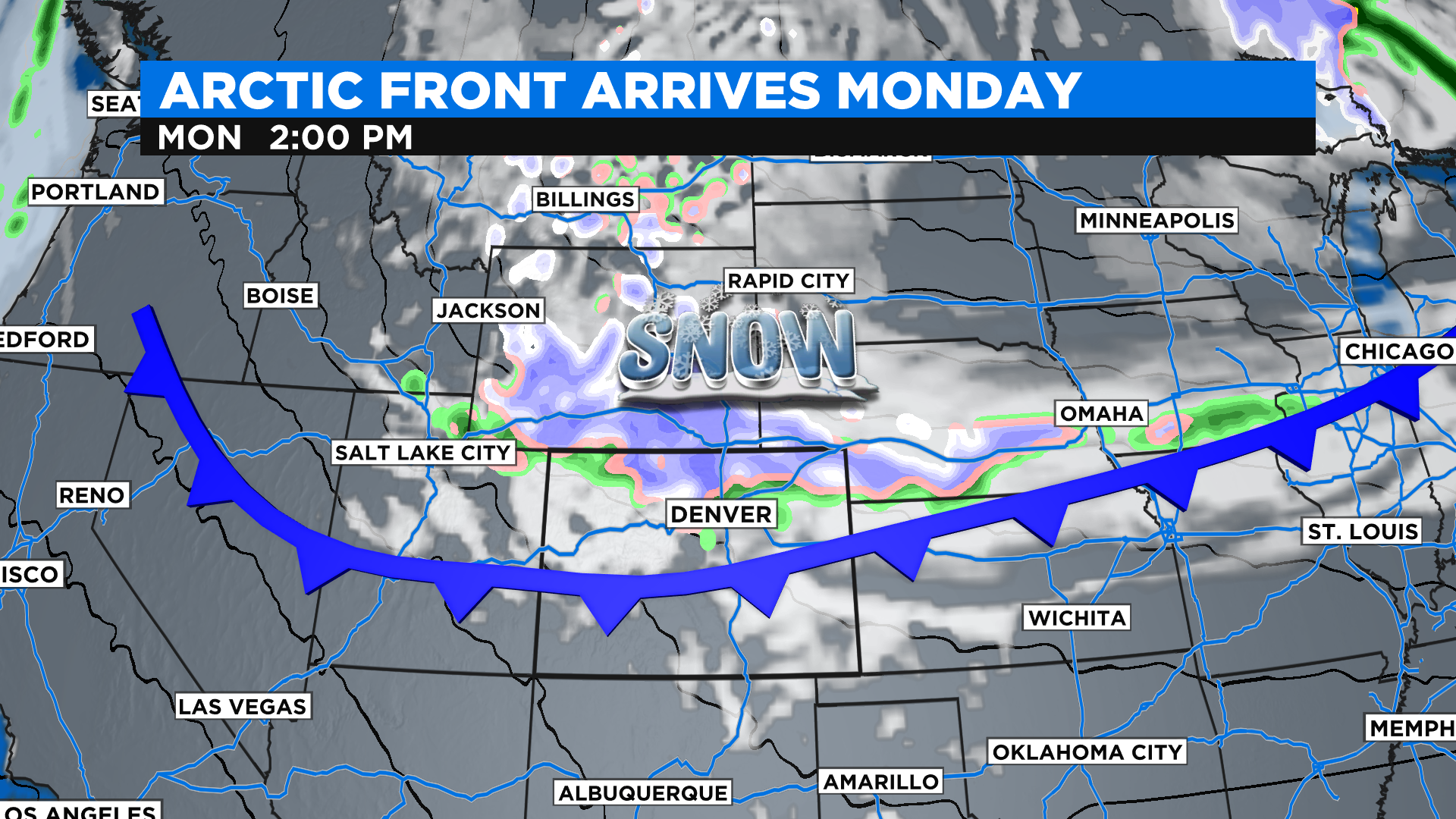
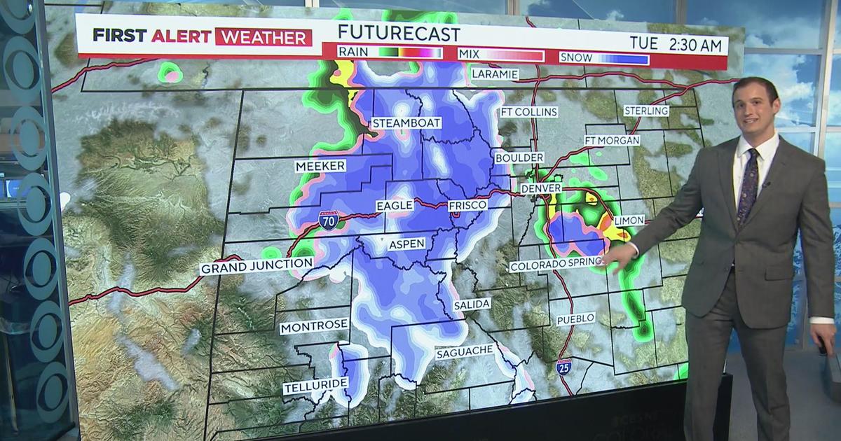
The cold front will move into northern Colorado sometime between sunrise and noon on Monday. It could have a few rain showers that will quickly change over to snow. The front will also produce a lot of wind statewide.
RELATED: Denver Weather: Arctic Blast Of Snow, Near Record Cold Arrives Monday
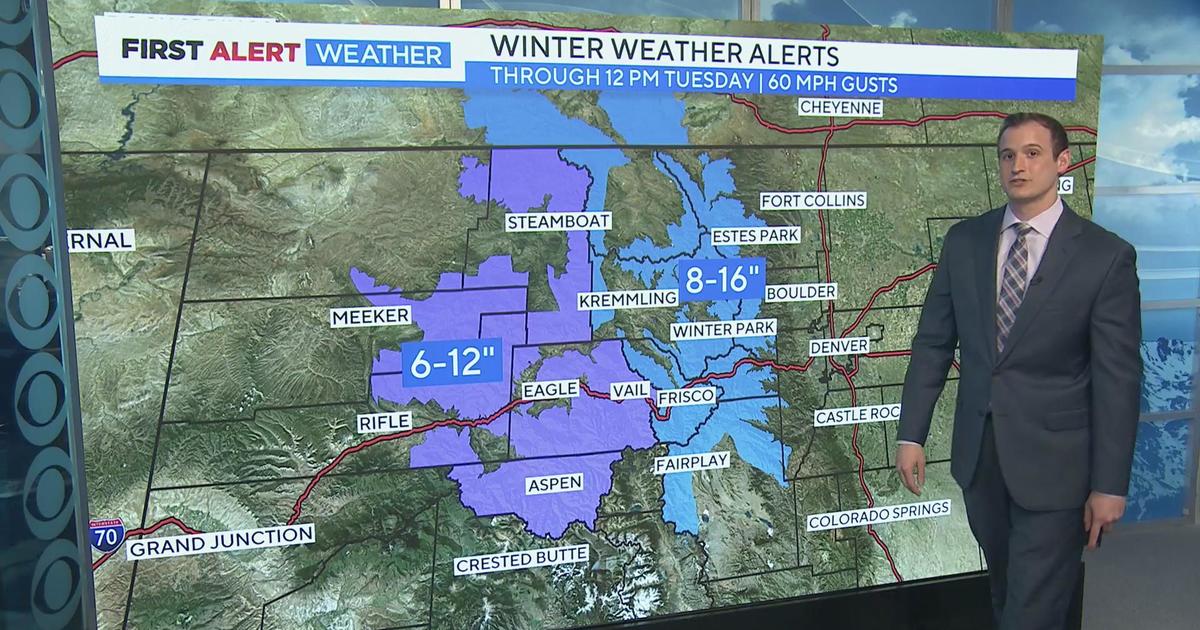
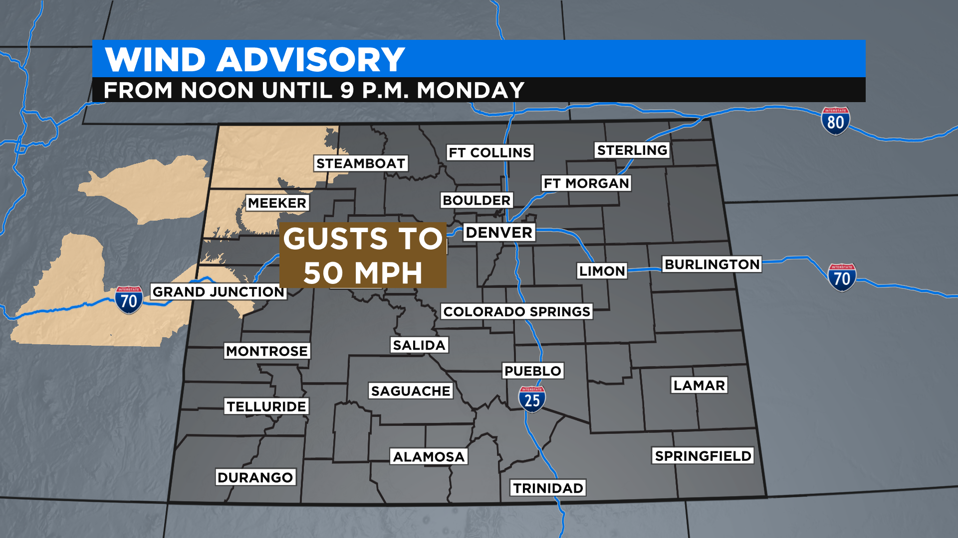
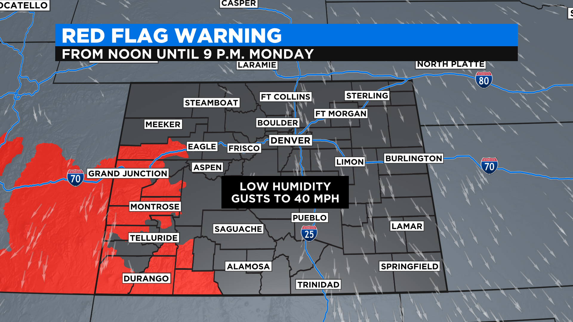
The National Weather Service has issued a Wind Advisory for northwest Colorado starting at 12 p.m. Monday because wind gusts could reach 50 mph. With the ongoing drought on the western slope this will drive the fire danger up considerably, especially for areas around Grand Junction and points to the south where a Red Flag Warning has been issued.
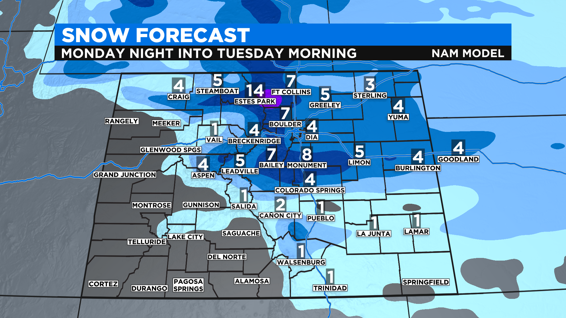
Most of the snow with this storm will fall along and east of the Continental Divide with the highest amounts in the northern Front Range Mountains and Foothills. Lighter totals are expected on the eastern plains.
The weather will stay unsettled for Wednesday and Thursday with a continued chance for rain and snow showers along with chilly temperatures. A warming and drying trend will settle into the state for the upcoming weekend.