


Last in a four-part series.
The river continued to fall.
Communities along the Mississippi River and its tributaries had met the challenge of a record-setting flood with varying degrees of success. While none were totally devastated, none went totally untouched. And although by the third week of April 1965 the crest had passed, the danger lingered.
“We still have a flood that’s far above that of 1952,” Mayor R.K. Ellings warned. “We can’t relax for a minute – not until the water is down to the point where it can’t do any damage even if the dikes were to break.”
Ellings’ caution was well-taken. Even as the river dropped to 20 feet, a break in the dikes or uncontrollable backflow through the storm sewer system could put three-fourths of the city in jeopardy.
People are also reading…
National Weather Service river forecaster Joseph Strub cautioned that it could be a long wait for the river to return to its banks.
“There’s so much water all over everywhere that it will have to be a slow drop,” Strub said, taking note that there was water “bluff to bluff” in some places along the river.
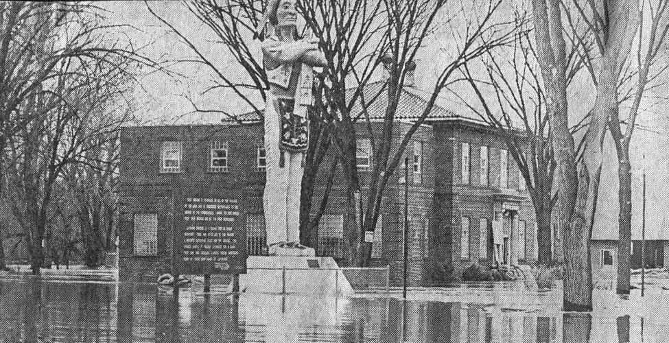
La Crosse was one of those places, as the river extended from the bluffs north of La Crescent, Minn., across the west and main channels and through the La Crosse River marsh to Hwy. 16 as it runs along the Wisconsin bluffs.
In response to the ongoing crisis, Minnesota Gov. Karl Rolvaag asked that 11 more counties be included in the federal disaster declaration already promising recovery assistance to 46 of the state’s 87 counties.
A reluctance to call a hasty victory netted Winona schoolchildren and college students an additional week away from the classroom. School and college officials agreed to delay reopening schools closed for an Easter week recess until the following Monday to allow the river to drop, in order to lessen the risk of a dike break and sudden flood, and reduce the stress on the city’s already overtaxed sewer system.
Wabasha was described as a “ghost town.” Water over the roads cut the city off from all but emergency contact with the outside world.
In La Crosse, National Guardsmen continued their tense watch over the city’s sodden dikes, concentrating on breaks and washouts that put areas of the North Side under water as the river rose. “Problems will remain as long as water stays up,” warned Corps of Engineers hydrologist Henry Langer.
In time, the water did go down. By April 25, the river was down to 17.3 feet in La Crosse and falling. The National Guard ended its dike patrol, and two days later, the city began dismantling the temporary flood defenses.
Winona officials were slower to relax. Back pressure on the city sewer system had caused several collapsed mains, and seepage through the Crooked Slough dike required eight pumps running around the clock to keep the land between Huff Street and the Prairie Island Road reasonably dry while 24-hour-a-day dike patrols continued.
It was only on April 27, 2½ weeks after the mayor’s call to action, that pressure on the dikes had eased to the extent that the city could begin lowering its guard. As the river continued to recede, dike gates at Prairie Island were opened and dike patrols ended. Two days later, the National Guard was relieved of duty and the secondary dike on Fifth Street, erected to contain a potential breach along Crooked Slough, was dismantled. The Crooked Slough dike had held. No water reached the neighborhoods between the dikes.
Rudy Schneider untied his boat as he and Clara moved back into their Winona home.
The flood resulted in permanent changes to both La Crosse and Winona.
In La Crosse, much of the dike system that contained the 1965 flood is still in place, extending from north of Interstate 90 to Riverside Park. For the most part, the dikes are inconspicuous, serving a double function as railbeds, streets and highways. In north La Crosse, Hwy. 35 and Rose Street not only carry heavy traffic every day, but are built to withstand a rising river when the Mississippi floods again.
Downtown La Crosse also saw dramatic change in the wake of the flooding. Much of the area around Riverside Park was redeveloped, resulting in the Harborview complex, built well above any anticipated high water.
In Winona, “we can go to bed at night and know we won’t be flooded out,” said Ellings, Winona’s mayor during the record-setting 1965 flood, during a 1988 ceremony marking completion of the city’s permanent dike system.
“The city is completely protected from Mississippi River flooding,” said Bob Bollant, former Winona public works director. “We’re very fortunate.”
After the desperate battle to hold back the river, there was a resolve in the city not to be put in that position again. No sooner did the water recede than work went ahead on Stage I of the city’s flood-control project — six miles of levee stretching from Minnesota City to Huff Street.
“It’s a good thing the ’65 flood happened when it did,” Bollant said — that year’s 20.75-foot crest convinced project engineers to add two feet to the Stage I dike to cope with avoiding any repeat of the unprecedented flood.
Stage I was completed in 1967 at a cost of slightly more than $2 million.
But from Huff Street to Homer Road large portions of temporary dikes still stood, left over from 1965. They would remain the city’s first line of defense for 17 years.
And with the completion of Stage I, the project stalled at Levee Park. Historically considered the city’s front door, many were reluctant to sacrifice the graceful riverfront park to an earthen dike and concrete flood barriers.
A 19.4-foot crest in April 1969 helped to resolve the issue — just in time for the project to run afoul of another obstacle. Legislation intended to protect the natural environment had passed the Congress, and that legislation now stood in the way of the project the Congress had approved a decade earlier.
The project would be on hold for five years, while an environmental impact statement was prepared and filed. Approval of the statement was not enough to start earth moving.
With the legal obstacle out of the way, federal funding had to be obtained. Then-Mayor Earl Laufenburger had to go to Congress every year to ask for money.
With federal funding eventually approved, construction of the first phase of the project — Reach A, from Walnut to Vine Street — was begun in 1979.
The groundbreaking was an act of faith on the part of the city.
Federal funding would cover all but 1.9 percent of the project cost, but the city was committed to a $1.238 million contribution — money the city did not have in hand.
To fund the lion’s share of that commitment, the city was counting on a $900,000 bond issue, but those bonds would have to be approved by the voters.
Nathan Grossell, running for council in 1979, summed up the feelings of many residents in a pre-election interview: “The people who went through the flood of 1965 will remember the work, loss of sleep and other efforts to sandbag and keep the city dry.”
The people of Winona remembered well: On Election Day, Dec. 4, 1979, 91.4 percent of the voters voted for the permanent dike.
The work moved ahead on the 4.5 miles of dike needed to protect the city. The project was completed ahead of schedule and within budget.
The worth of that investment was demonstrated in the spring of 2001. That year the river began rising on April Fools Day and wouldn’t return to its banks until after the Fourth of July. On April 11 it reached the 13-foot flood stage and kept on rising for seven days, cresting at 20.1 feet — scant inches below the 1965 record — on April 18.
Across the city, low-lying homes and buildings with deep basements ran sump pumps from April until July, but on the riverfront, crowds gathered at the floodwall in Levee Park to watch the river go by.
The dikes held.
Again.


