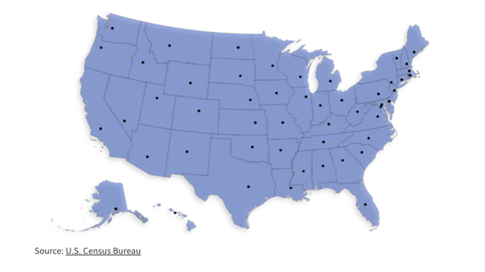
Each state's population center, visualized
There isn't much in Hartville, Mo., a small town of just 613 residents on the Gasconade River. A few restaurants sit on Main Street, a super market and a Dollar General on West Rolla Street - and, a few miles away, a point that just happens to be the population center of the United States.
Every decade, the Census Bureau calculates that point, both for the nation and for each state. The population center represents the point at which each state would balance perfectly on a point, assuming everyone who lives there weighed exactly the same amount.

The population centers give a sense of how people are distributed around a state. In states dominated by a big city, the center will be heavily influenced by that major urban area - Nevada's population center is just outside of Las Vegas. In a state without a dominant urban core, the center is just that, closer to the center, as in Alabama, where it sits just about halfway between Birmingham and Montgomery.
Now, after another decennial census found 331 million residents living in the United States, the Bureau has recalculated each state's population center. Here's where to find that point in every state:
ALABAMA: Chilton County

Alabama's population center sits just off Interstate 65, which connects the state's four largest cities - Huntsville on the Tennessee border, Birmingham and Montgomery in the center of the state, and Mobile on the Gulf Coast. The exact point is about two miles north of Jemison in Minoka Park, and about 22 miles east of the aptly named Centerville.
ALASKA: Chugach State Park

Alaska is the home of about three-quarters of a million residents, more than a third of whom live in Anchorage. The second- and third-largest cities in the state, Fairbanks and Juneau, have only about 32,000 residents, so Anchorage's influence pulls the population center to a point in Chugach State Park, about 30 miles from the city. The exact point sits atop a mountain about halfway between the Knik River and Eklutna Lake.
ARIZONA: Mesa

There is something poetic in the fact that Arizona's center of population sits in a housing development in Mesa, down the street from a golf course and across from a neighborhood called Optimist Park. Mesa sits in Phoenix's southeastern suburbs, abutting Gilbert and Chandler, some of the fastest-growing cities in America. It's cliche to talk about people leaving California and moving to Texas, but in the last decade, virtually an entire congressional district has left Los Angeles for the Phoenix metro area, known as the Valley of the Sun, home to more than half of Arizona's 7.3 million residents.
ARKANSAS: Lake Overcup

Here's an example of people shifting from one urban center to another: The population center in Arkansas sits on the shores of Lake Overcup, just outside of Morrilton and about 10 miles northeast of Conway along Interstate 40. At the turn of this century, the population center was due east of Conway, closer to the town of Perryville. Its movement, north and west away from Little Rock, has happened as Northwest Arkansas has grown. At the turn of the century, Fayetteville and Bentonville had combined populations of about 78,000 residents; today, those two cities have 147,000 residents, and they're exerting a much greater pull on the population center as a result.
CALIFORNIA: Shafter

California's two big population centers in Los Angeles and the San Francisco Bay Area are seemingly always in competition - for economic power, for political influence, for cultural import. The state's population center leans toward Los Angeles; it's about a third of the way north toward San Francisco along Interstate 5, just outside of Bakersfield in the agricultural town of Shafter and surrounded by dairies. And while House Minority Leader Kevin McCarthy (R) represents most of Kern County, the population center is in a corner of the county that sits in Rep. David Valadao's (R) district.
COLORADO: Pyramid Peak

The ultimate badge of pride for a Coloradan is to have climbed what they call the 14ers, the 58 mountains around the state that summit at more than 14,000 feet above sea level. One of those mountains is Pyramid Peak, south and west of the growing Denver suburbs, which just so happens to be the population center of the state. Denver is the state's most substantial metropolitan area, and its growth in the last few decades is actually drawing the center of population even closer to the city; two decades ago, the center was a few miles southwest of Pyramid Peak.
CONNECTICUT: Cheshire

The center of Connecticut's population sits in a residential neighborhood in the small town of Cheshire, about halfway between Hartford and New Haven just off Interstates 91 and 84. Settled in 1694, it's home to about 28,000 residents - among them Sen. Chris Murphy (D), former Rep. Elizabeth Esty (D), legendary ESPN announcer Chris Berman and, at one point, James Van Der Beek, a product of the elite Cheshire Academy boarding school.
DELAWARE: Smyrna

Most of Delaware's 989,000 residents live in the northern third of the state, in and around Wilmington, Newark and New Castle. But enough of the population is in Dover and south to the beach communities of Lewes, Rehoboth and Bethany that the population center sits about halfway between Wilmington and Dover, just outside of the city of Smyrna and near the Cedar Swamp Wildlife Area. Stop by Boondocks Restaurant and Package Store on your way there; it's the closest business to the exact midpoint.
DISTRICT OF COLUMBIA: Dunbar High School

The center of Washington's population sits in a residential neighborhood about two blocks west of North Capitol Street and a block north of Dunbar High School, sandwiched between Eckington in the east and Shaw and Mount Vernon Square in the west. In the last 20 years, as Washington's population has boomed, the midpoint has barely moved - as in, it's stayed more or less in the same house on Bates Street. That's a remarkable reflection of a city that's growing just as fast in its Northwest quadrant as it is in Southeast.
FLORIDA: Lake Wales

It is said that presidential elections are won along the Interstate 4 corridor between Tampa and Orlando, a stretch that passes through some of the fastest-growing areas in the state. Lake Wales, firmly within that corridor, is a good example of that growth: At the turn of the century, just 10,000 residents called it home; the last census showed its population had swelled to more than 16,000. Some of those residents live in Green Acres Mobile Home Park - they're the closest to the population center, just off Alturas Babson Park Cut-Off Road.
GEORGIA: Newton County

Between the banks of the South River in the west and the Yellow River in the east sits Rocky Plains Elementary School, about 30 miles outside of Atlanta. And just south of the school, before the two rivers empty into Jackson Lake, lies the population center of Georgia. The center of population 20 years ago was about six miles farther south and east, on the lake's southern shores. That's a sign that the Atlanta metro area is growing faster than the rest of the state's population centers in Augusta, Savannah, Macon or Columbus.
HAWAII: The Pacific Ocean

Sometimes a state's population center sits in an area where no one actually lives. Such is the case in a state made of islands, where the fulcrum point sits between the islands of Oahu and Molokai. Oahu is the big magnet here: Of the state's 1.4 million residents, about a million live in and around Honolulu. The second-largest island by population, the island of Hawaii, has about 200,000 residents. You might just be able to see the population center from the top of the ridge at Hanauma Bay Nature Preserve, a state park that's home to an excellent - and very affordable - snorkeling experience on Oahu's southeast shore. Say hello to the moray eels if you visit.
IDAHO: Mt. Zumwalt

The center of the Gem State's population sits at the base of Mt. Zumwalt, along the Ponderosa Pine Scenic Route in the Boise National Forest, just outside of the state's largest city. Boise is certainly the anchor of the state's population, but the actual center is northeast of the city because of twin pulls from, well, the north and the east. Coeur d'Alene in the Idaho Panhandle is growing quickly, and so too are areas like Twin Falls, Pocatello and Idaho Falls.
ILLINOIS: Wauponsee Township

Drive southwest out of Chicago along either Interstate 55 or Interstate 80 and you'll pass through Grundy County, home of Wauponsee Township and its 2,423 residents. The population center of the state is a few yards away from a bend in the Mazon River; it's a rural area, but one still well within Chicago's zone of influence. The town is currently within Rep. Bill Foster's (D) congressional district, but its residents will get a new member of Congress next year; district lines adopted by the legislature a few months ago would put the residents of Wauponsee in Rep. Lauren Underwood's (D) purview.
INDIANA: Sheridan

The center of Indiana's population sits in a wheat field about 30 miles north of Indianapolis, on the way to either Lafayette in the northwest or Kokomo due north. It's a mile or so outside of Sheridan, a town that doesn't quite know when or by whom it was founded; the records were lost in a fire about a century ago. Indiana hasn't had a lot of massive population shifts in the last few decades; the population center 20 years ago sat in the neighboring wheat field.
IOWA: Van Cleve

The center of Iowa's population lies in a corn field in an unincorporated community in Marshall County, along the road from Des Moines to Marshalltown. It's one of the so-called pivot counties - areas that voted twice for Barack Obama, and then twice for Donald Trump. Obama scored almost 54 percent of the vote in Marshall County in both of his campaigns; Trump won almost 53 percent there in 2020, 2 points better than his 2016 performance.
KANSAS: Chase County

The population center of Kansas looks like the actual center of a straight line you might draw between Wichita and Topeka, the state's largest and fifth-largest cities. There's a substantial pull east from cities number two through four - Overland Park, Kansas City and Olathe, all of which abut each other on the border with Missouri. And there's not much of a pull from the west, where farm communities dot the sparsely populated counties on the way to Colorado.
KENTUCKY: Long Lick Farm

A working winery halfway between Lexington and Elizabethtown is near the center of Kentucky's population, just off Beech Fork and close to the small town of Maud. Long Lick Farm sits in the heart of Bourbon Country, southeast of Louisville in Washington County. It's near the site where Thomas Lincoln married Nancy Hanks, about three years before their son Abraham was born.
LOUISIANA: New Roads

It is appropriate that the population center of Louisiana lies between a seafood joint and a Southern restaurant that advertises its daiquiris. The center is in New Roads, northwest of Baton Rouge and near a bend in the Mississippi River. In spite of its name, there's nothing new about it: It's the seat of Ponte Coupee Parish, a trading post founded by French settlers in the 1720s. New Roads is also the home of the oldest Mardi Gras celebration in Louisiana outside of New Orleans, according to local historian Brian Costello.
MAINE: Chelsea

Sitting on the Kennebec River halfway between a Montessori preschool and an Indian restaurant, Maine's center of population is just a stone's throw away from Augusta and the Blaine House, where Gov. Janet Mills (D) lives. The center of population is pretty close to Portland, the state's largest city, and a long day's drive from the sparsely populated north, where some communities still speak French.
MARYLAND: Jessup

The population center of Maryland has been moving slowly south, away from Baltimore and toward fast-growing Washington suburbs in Montgomery and Prince George's County, trapped between Interstate 95 and the Baltimore-Washington Parkway. In the last decade, it landed in a parking lot outside a row of auto repair shops, less than a mile away from the headquarters of the National Security Agency. By next decade, it's likely to jump the Patuxent Freeway as the Washington region keeps growing.
MASSACHUSETTS: Natick

The Boston area is growing faster than the rest of Massachusetts, so the center of population is migrating east toward the city. Today, it sits in a residential neighborhood in Natick, east of Framingham and about ten miles west of Bean Town. Natick was home to luminaries like the writer Horatio Alger and Henry Wilson, Ulysses S. Grant's vice president, but the locals probably care more that the town also produced Boston College hero Doug Flutie.
MICHIGAN: Looking Glass River

All five of Michigan's largest cities sit near Interstate 96, which runs east from Detroit (the largest), Warren (third largest) and Sterling Heights (fourth largest) to Lansing (fifth) and Grand Rapids (second). The center of Michigan's population sits just east of Lansing, and just north of the Interstate to reflect the hundreds of thousands of Michiganders who live in the more sparsely populated northern part of the state and the Upper Peninsula. The exact spot sits near the banks of the Looking Glass River, known as a great place to hunt and fish.
MINNESOTA: Rogers

More than half of Minnesota residents live in the Minneapolis-St. Paul metropolitan area, and the center of population sits in exurban Rogers, northwest of the Twin Cities. The town itself grew around an old Great Northern Railroad depot built in the late 19th century. And in a state that's become increasingly competitive in recent presidential elections, it's at the heart of a classic swing district. The incumbent, Rep. Dean Phillips (D), ousted Republican Erik Paulsen in 2018, becoming the first Democrat to hold the seat since 1960.
MISSISSIPPI: Leake County

The population center of Mississippi might be mistaken for the geographic center - it sits in rural Leake County, north of Interstate 20 that connects Jackson and Meridian and east of Interstate 55 that runs from Memphis, Tenn., to New Orleans. The exact point is a few miles east of Lena, home of just 167 residents. In 1968, nearly three in four Leake County voters cast their ballots for Alabama Gov. George Wallace, who carried Mississippi and four other Southern states.
MISSOURI: The Osage River

Jefferson City is the only state capital in America that does not sit on an interstate. It's closer to the population center of the state, a point just off a bend in the Osage River east of the town of Brazito, than it is to Interstate 70, which runs through Columbia on its way between Kansas City and St. Louis. The river is named for the Osage Nation, which made the area their home before European settlers arrived.
MONTANA: Lingshire Road

Nothing is in the middle of nowhere, but Montana's population of just over a million residents has a lot of room to spread out. So the population center lies off a rural road east of Helena and just south of the boundaries of the Helena-Lewis and Clark National Forest. The closest town is White Sulphur Springs, the seat of Meagher County and home to 955 residents. The town gets about 36 inches of snow a year, according to National Oceanic and Atmospheric Administration data.
NEBRASKA: Surprise

The center of Nebraska's population lies off Route 92, due west of Omaha and northwest of Lincoln, a few miles from the tiny hamlet of Surprise, population 43. The University of Nebraska-Lincoln says the town was named by George Miller, who in the 1880s built a dam on a small spring near the Big Blue River. He was surprised that he got enough power from the dam to run a grist mill.
NEVADA: Tippipah Point

Las Vegas is such a huge population base for Nevada's 3.1 million residents that the center of population sits only about 50 miles north-northwest of the city, close to Tippipah Point. The lone Google review of the site, left by a local guide about a year ago, isn't too flattering: "If you look to the East, we'll get a good view of our old nuclear testing sites," wrote Todd Johnson. "We really aren't sure why cancer rates have increased since the '50s."
NEW HAMPSHIRE: Pembroke

The center of New Hampshire's population sits on a residential street in Pembroke, halfway between the capital in Concord and the state's largest city, Manchester. Pembroke started its life as a mill town that produced print cloth, and later the city got into brick making using the clay from the nearby Merrimack River.
NEW JERSEY: East Brunswick

Residents meeting for the first time will describe where they live or where they grew up by the closest exit off the New Jersey Turnpike. So it's appropriate that the center of population is just about 1,200 feet off the Turnpike, on a residential street in East Brunswick, commuting distance from New York City. The exact spot is also a few blocks away from a couple of greasy spoon diners - and New Jersey, as any self-respecting local will brag, is home to more diners than any other state in America.
NEW MEXICO: Manzano Mountains State Park

Most New Mexicans live in the northern third of the state, in and around Albuquerque, Santa Fe and the Navajo Nation. Growing southern cities like Las Cruces, Roswell and Hobbs pull the center of population south and east of Albuquerque, to a point near the entrance of Manzano Mountains State Park, a great place for bird watching. A stone's throw away is the Salinas Pueblo Missions National Monument, a set of three mission buildings constructed in the 1620s.
NEW YORK: Cuddebackville

New York City's 8 million residents pull the Empire State's center of population to Route 209, just west of Middletown in Orange County. The hamlet of Cuddebackville, the closest organized town, is home to the Falun Gong movement. Orange County voted for the winner of every presidential contest since 1996, until it backed former President Trump by a narrow margin in 2020.
NORTH CAROLINA: Erect

The cities of Charlotte, Greensboro, Raleigh and Fayetteville make a rough rhombus across Central North Carolina. Smack-dab in the middle is the state's center of population, just east of Interstate 74. The closest town is the unincorporated community of Erect, founded in the 18th century by German settlers who made a name for themselves in the pottery business.
NORTH DAKOTA: Stutsman County

In a big city, the intersection of 5th Street Southeast and 52nd Avenue Southeast might be a bustling commercial or residential hub. In sparsely populated North Dakota, which at 779,000 residents is smaller than America's 17 largest cities, it's a pretty remote road in Stutsman County, population 21,593, located about halfway between Bismarck and Grand Forks, north of Interstate 94. Stutsman County hasn't voted for a Democratic presidential candidate since Lyndon Johnson in 1964; Trump won 70.2 percent there in 2020, the highest share any Republican candidate has won since Warren Harding in 1920.
OHIO: Harmony Township

Ohio's three largest cities, Cleveland, Columbus and Cincinnati, are connected by Interstate 71, which bisects the state diagonally from the northeast to the southwest. The center of population is about a third of the way northeast from Columbus to Cleveland, just a few feet off the freeway. Over the last 20 years, the center has moved about four miles toward Columbus, a reflection of Cleveland's slow drop in population.
OKLAHOMA: Sparks

The center of Oklahoma's population sits between the state's two urban hubs, Oklahoma City and Tulsa, just south of the Interstate 44 that connects them. The closest town, Sparks, is home to just 171 people. But it was once a booming metropolis of 503, before the Depression and the Dust Bowl sent residents searching for work and life elsewhere. In the last few decades, it's growing once again - in 2000, the population was just 137.
OREGON: Lyons

Most of Oregon's population lives along Interstate 5, which connects Portland with Salem, the college towns of Corvallis and Eugene, and Medford to the south. The center of population sits just outside of Lyons, east of the capital in Salem and in the foothills of the Cascade Mountains. It's on the way to Bend, a growing city that Bay Area residents have turned into a booming retirement community. A Democratic-passed redistricting measure puts Bend, a liberal town in the heart of conservative eastern Oregon, into the same district as some of Portland, one of the most liberal cities in America.
PENNSYLVANIA: The Susquehanna River

Pennsylvania has three cities with populations greater than 100,000 - Philadelphia, Pittsburgh, and State College when Penn State has a home game on fall Saturdays. The center of population sits on the Susquehanna River a few miles north of the capital in Harrisburg, closer to Philly than the 'Burgh and pulled north and east by Scranton, Allentown and Wilkes-Barre.
RHODE ISLAND: Cranston

This one takes the prize for the center of population closest to an international airport. The residential street in Cranston is less than two miles from T.F. Green International, your destination when you fly into Providence. The vast majority of the 1.1 million residents there live in the greater Providence area, so it's little wonder that the epicenter of population is sandwiched between the borders of Providence and Warwick.
SOUTH CAROLINA: Columbia

The center of South Carolina's population is the only one in America that is physically located within the state capital, Columbia. It's about 2 1/2 miles from the Capitol building itself. Columbia sits at the midpoint between the state's two other major population centers, Greenville-Spartanburg in the northwest and Charleston on the Coast.
SOUTH DAKOTA: Pheasant Crest Lodge

If you're making the long trek west between Sioux Falls and Rapid City, take the exit off Interstate 90 at Kimball to the Pheasant Crest Lodge, near the tiny towns of Gann Valley and Lyonville. They offer full-service hunting packages and cigars after each day's outing. Kimball, in Brule County, was once a key stop on the Chicago, Milwaukee and St. Paul Railroad.
TENNESSEE: Rutherford County

Middle Tennessee State University is surprisingly close to the middle of Tennessee, just outside of Murfreesboro southeast of Nashville. The three stars on Tennessee's flag represent the three distinct regions of a very divided state, and Nashville is one of the few Democratic bastions in what's otherwise a Republican stronghold. That may change this year, as Republican legislators consider carving the city among different districts to give the GOP a better chance of ousting Rep. Jim Cooper (D).
TEXAS: Sparks

This one is interesting: A huge share of Texas's 29 million residents live in the triangle between Dallas-Fort Worth, Houston and San Antonio. The actual center of population is in a small town on Interstate 35, between Austin and Waco, right in the heart of that triangle - but farther west than one might expect. That might reflect the pull of the millions of residents who live outside the triangle, in the Panhandle to the north or in El Paso to the west. In the last 20 years, the population center has shifted a few miles to the east, a reflection of Houston's rapid growth.
UTAH: Saratoga Springs

Like Rhode Island - or even Texas - a huge share of Utah's population lives in one core area, the Salt Lake City metroplex. The center of population is at the southern end of that hub, between the city itself and the Orem and Provo areas. Saratoga Springs only became a city in 2001, and it's already at 40,000 residents. That makes it one of the fastest-growing areas in the fastest-growing state in America.
VERMONT: Warren

There aren't many people in the Green Mountain State to pull the center of population one way or another, but the actual point sits southwest of Montpelier, southeast of Burlington and almost due east of Middlebury, near the town of Warren, population 1,705. A stone's throw away is Subarbush, one of Vermont's well-known ski resorts.
VIRGINIA: James Madison's House

The center of Virginia's population isn't exactly in Montpelier, where James Madison built his mansion, but it's not too far away up U.S. Route 33. Madison lived in Orange County, and the very first gerrymander in American history was orchestrated by Patrick Henry, who tried to draw Madison into a strongly Anti-Federalist district that wouldn't send him to Congress. Henry failed, Madison won, and because of it we have a Bill of Rights.
WASHINGTON: Chester Morse Lake

For a city known for its rain, some are surprised how close Seattle is to a decent ski area. You might be able to see Washington's center of population from the slopes of Snoqualmie Pass, or at least neighboring Alpental. The point itself is six miles off Interstate 90, and about two miles from the nearest passable road. But the fact that it sits in King County, home of Seattle, illustrates just how much of a pull the Emerald City is on the rest of the state it anchors.
WEST VIRGINIA: Burnsville

Interstate 79 connects Morgantown and West Virginia University with Charleston, the state capital. About halfway between the two cities is Burnsville, on the Little Kanawha River. It's just west of the Burnsville Lake Wildlife Management Area, and just south of Orlando, though there aren't any theme parks to be found nearby.
WISCONSIN: Green Lake County

The center of Wisconsin's population is north of Interstate 94, which connects Milwaukee and Madison, the state's two Democratic centers. It's due west of Fond du Lac, and just southwest of Ripon, one of the three or four towns that claims to be the ancestral home of the Republican Party. The closest town, Markesan, is home to about 1,500 residents.
WYOMING: Natrona County

Wyoming's largest city is Cheyenne, but at just 65,000 residents, it doesn't exert a huge pull on the center of population, which sits just west of Casper in rural Natrona County. Wyoming's 576,000 residents don't have many urban cores to pull the center one way or another, so it's relatively close to the middle of the state.
Updated Dec. 31, 4:00 p.m.

