A geographic profiling tool used to catch serial criminals could help reduce the casualties of human-tiger conflict, according to scientists who collaborated on an innovative conservation research study.
The results of their research, published in the journal Nature Communications, help explain how villagers in Sumatra coexist with tigers. If used pre-emptively, the tool could have helped cut attacks by half, saving tigers from poaching and retaliation killings, according to the University of Kent in Britain.
Dr Matthew Struebig, from the university's Durrell Institute of Conservation and Ecology at the School of Anthropology and Conservation, and Dr Freya St John from Bangor University led a collaboration between spatial ecologists and social scientists to help predict where human-tiger conflict interventions could be most effective.
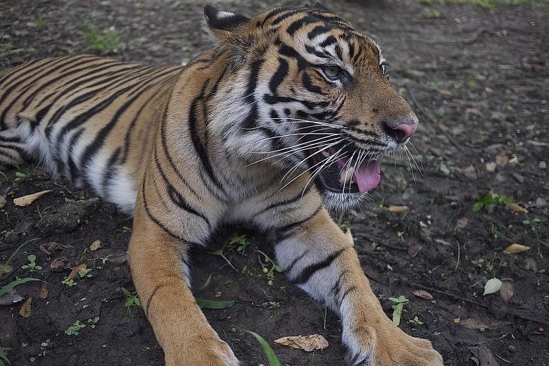
Tigers are on the brink of extinction. They are highly threatened and pose a public threat, but Sumatra tigers continue to coexist with people, offering insights for managing dangerous wildlife elsewhere, the university said in a statement.
To reveal the drivers of human-tiger conflict, the team coupled spatial analyses of tiger-encounter risk with information from 2,386 Sumatrans who were asked about their tolerance of wildlife. To map risk, the study used 13 years of human-tiger encounter records to generate a geographic profile - a sophisticated statistical technique previously used throughout the world to predict the whereabouts of serial criminals based on where their crimes have been committed.
Although the risk of encountering a tiger was generally greater around populated villages near forests or rivers, the geographic profile revealed three places where risk was particularly high. At the same time, questionnaires revealed that people's tolerance of tigers was related to their underlying attitudes, emotions, norms and spiritual beliefs.
By combining this information, the team was able to highlight villages where risk was adversely high and tolerance was unusually low - valuable guidance for organisations such as international conservation charity Fauna & Flora International, helping them to prioritise conflict interventions, the university said.
The techniques used in this study are highly significant and open up new possibilities for more targeted actions that will not only boost efficiency but, more importantly, ensure that fewer people and tigers come to harm as a result of their interactions, it noted. This research has shown, for example, that had this information been available at the time, pre-emptive interventions using these predictions could have averted up to 51 per cent of attacks on livestock and people, potentially saving 15 tigers.
Said Dr Struebig: "Understanding people's tolerance is key to managing dangerous species and is particularly urgent for tigers. When combined with our maps of encounter risk, information on people's tolerance of wildlife helps us direct conservation resources to where they are needed most.
"This could amount to significant cost savings in terms of animals lost or funding spent, and so could be very useful in conservation."