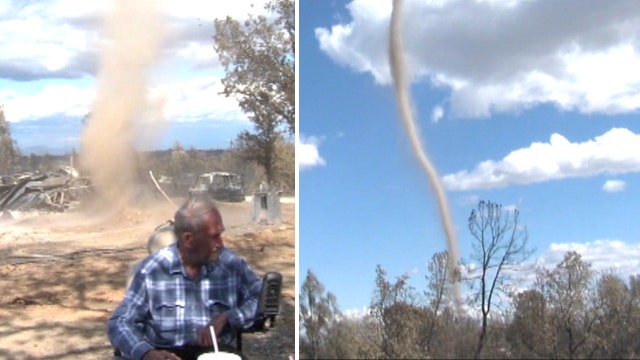
Coal dust twister wreaks havoc near West Virginia mine
Rural West Virginia haunted by massive ‘coalnados’
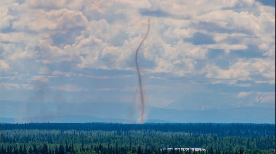
A dark, towering column of air appeared in Alaska Monday after a wildfire south of Fairbanks generated smoke that was whipped up into a "smokenado."
The National Weather Service (NWS) office in Fairbanks said thunderstorms that moved through interior Alaska Sunday sparked a wildfire 10 to 20 miles south-southeast of the Fairbanks airport.
Conditions "are certainly not helping the situation," the NWS said.
'COALNADO' DUST DEVIL SPOTTED NEAR MINE IN WEST VIRGINIA
On Monday, forecasters said that "active weather" was once again present in the Fairbanks area, with some thunderstorms reported.
"In addition to the thunderstorms, one of our forecasters captured this impressive photo of a smokenado from the wildfire just south of town!" the NWS said.
There were more than 2,900 lightning strikes over the weekend from thunderstorms across interior Alaska, said the Bureau of Land Management Alaska Fire Service.
10 DEADLIEST US TORNADOES ON RECORD
Lightning is suspected of causing 15 new wildfires in the state, according to the agency.
The smokenado on Monday was similar to that of a dust devil. Dust devils are a small, "rapidly rotating wind" made visible by the dust, dirt or debris it picks up, according to the NWS. They are typically harmless and weaker than tornadoes.
CLICK HERE FOR THE FOX NEWS APP
According to the American Meteorological Society, well-developed dust devils are occasionally strong enough to cause minor damage with an average height of around 650 feet, but a few have been observed as high as half-a-mile or more.
"Dust devils are best developed on a hot, calm afternoon with clear skies, in a dry region when intense surface heating causes a very steep lapse rate of temperature in the lowest 100m (328 feet) of the atmosphere," according to AMS.

The hottest stories ripped from the headlines, from crime to courts, legal and scandal.
