
B.C.: Only a six-hour break in the storm parade this weekend

After a soggy week, British Columbians will get a brief chance to dry off Saturday before the parade of low pressure systems slamming into the coast resumes. Freezing levels creeping low over the next few days may also make for tricky travel through mountain passes as the snow starts to pile up. We take a look at the timing of these storms, and when sunnier skies return, below.
Visit our Complete Guide to Fall 2019 for an in-depth look at the Fall Forecast, tips to plan for it and a sneak peek at the winter ahead
WEATHER HIGHLIGHTS:
Another weak front pushes in through early Saturday
After brief late-Saturday lull, rain returns for Sunday afternoon with another round expected Monday
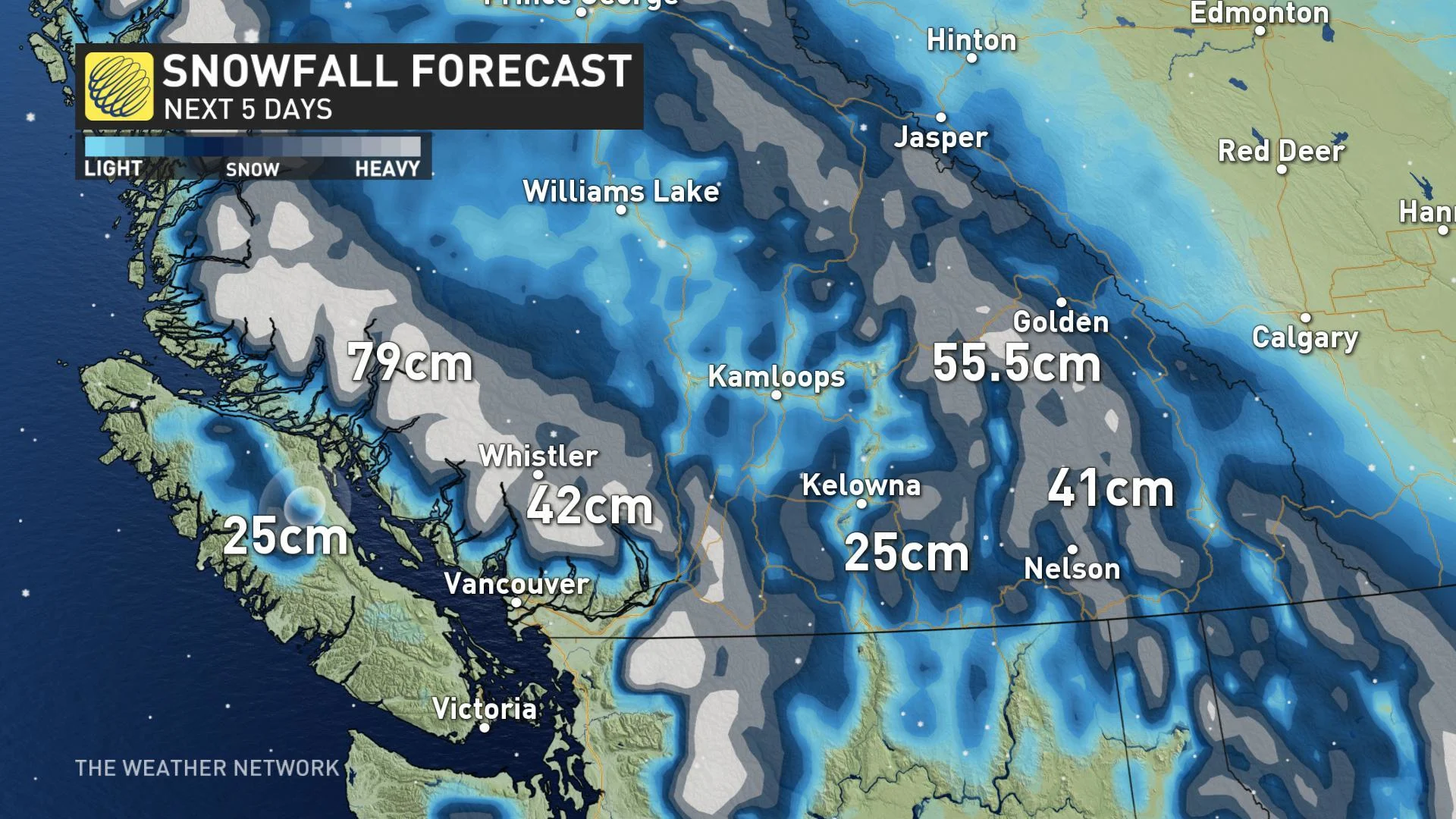
Snow is possible for some of the highway passes as freezing levels drop to 1400 metres through the weekend
Stay aware of weather ALERTS in your area
WATCH BELOW: WAVE AFTER WAVE OF MOISTURE HITS B.C.
The rainy season has been living up to its name along the B.C. coast this week, as an upper-level system directs storm after storm into the coast. While early-Saturday showers will give way to a break in the soggy weather, it won't be a long one.
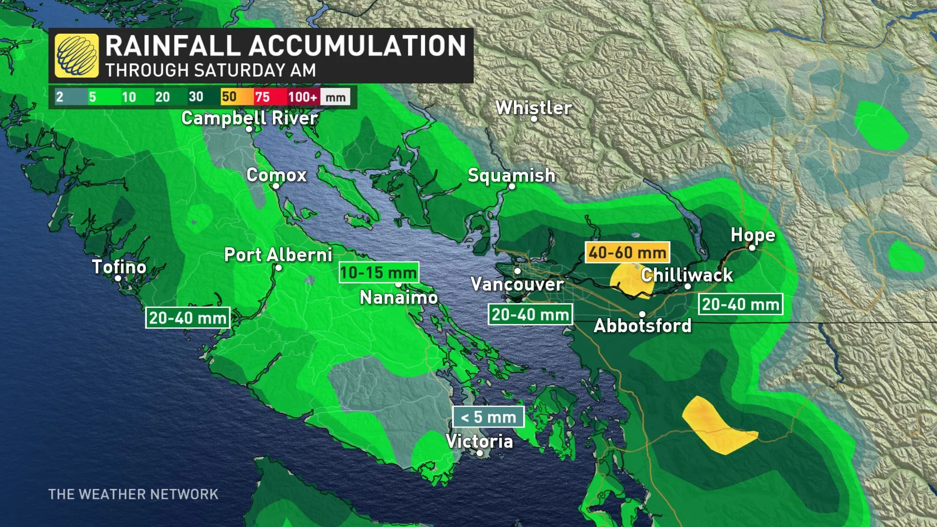
"It's the time of year where we can get excited about little six-hour windows of dry weather," says Weather Network meteorologist Tyler Hamilton. "And we'll see that on Saturday evening before more rounds of rain move in on Sunday and Monday."
The next pair of lows take aim at the coast for late Sunday and Monday, bringing renewed bouts of heavy rain to the province, along with some additional mountain snow.
As much as 100 mm of rain could fall over parts of the North Shore and West Vancouver Island by next Tuesday.
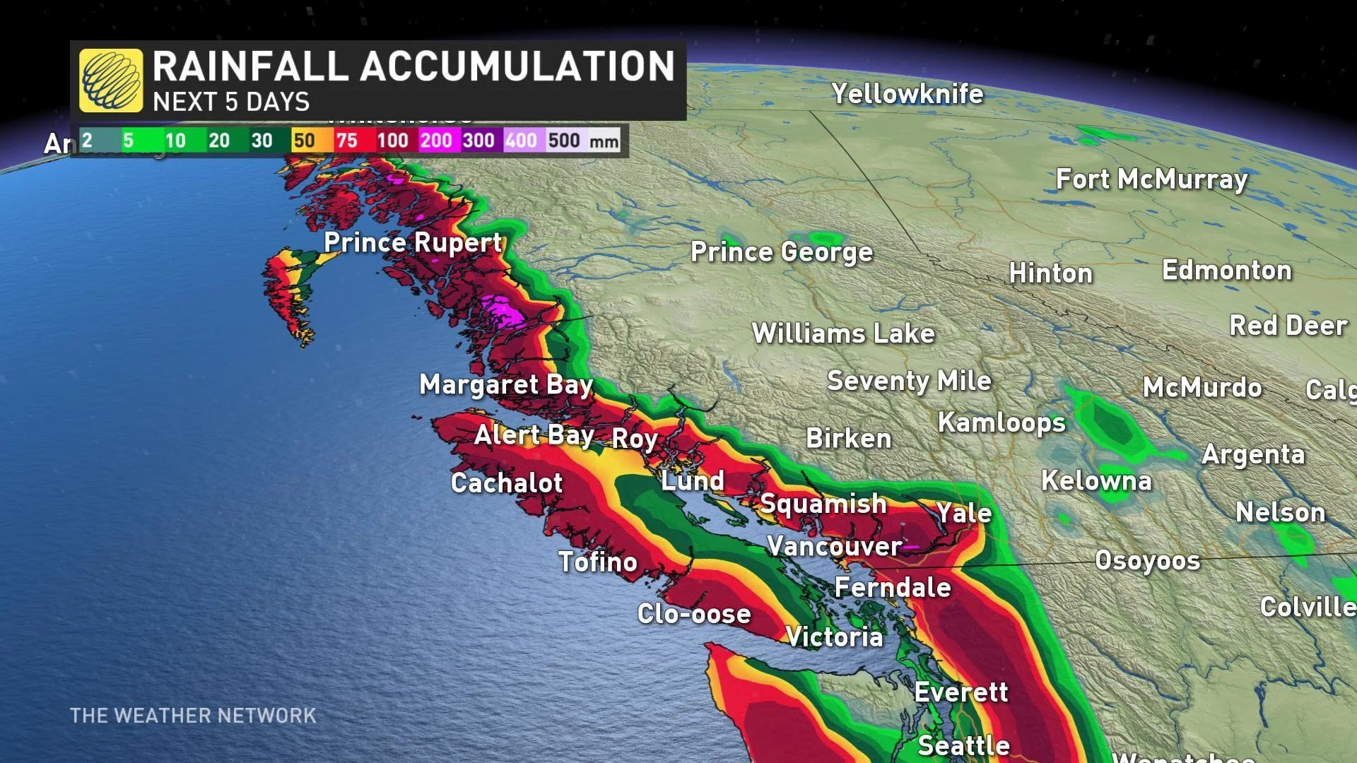
This series of systems have also dragged cooler air down from the north, and that will mean freezing levels dipping lower as we move through the weekend -- below 1400 metres in some cases. Travellers with plans that take them through the mountain passes should be mindful of deteriorating conditions.
A more extended break from the rain is on the doorstep, however, as the upper-level pattern shifts and cuts off the flow of moisture -- at least for now. A milder, drier spell is expected to move in for the second half of next week, and take us through the last week of October and into November.


