
SEATTLE — We're already tracking the next weather maker arriving Saturday night into Sunday morning. This will bring another round of lowland rain and mountain snow.
Most of Saturday was a breather and a day of recovery after a wild day of weather Friday.
Timeline
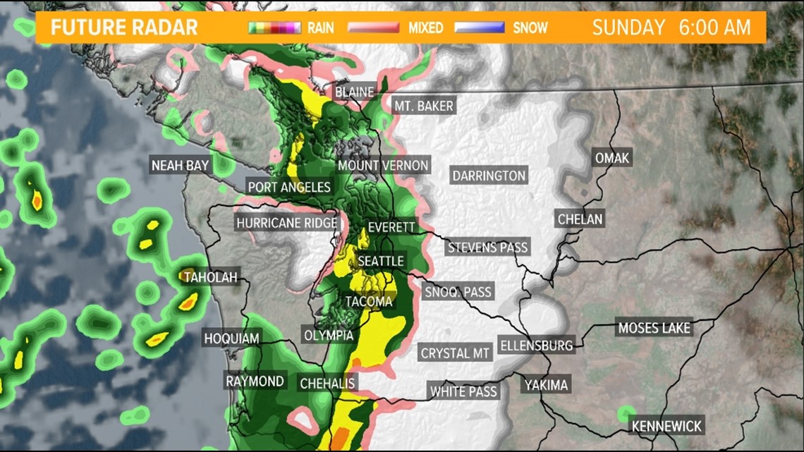
The rain sticks around Sunday morning, especially for the Interstate 5 communities, with snow for the Cascades.
A gradual downward tick in coverage and intensity is expected throughout late Sunday morning into the early afternoon hours Sunday from west to east.
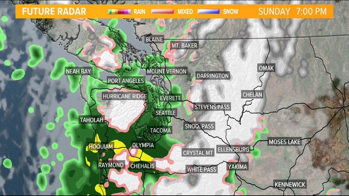
The next wave of lowland rain and mountain snow arrives Sunday evening.
The second round of precipitation builds in from the Southwest Interior and South Sound, north into the rest of western Washington throughout the nighttime hours Sunday.
Sunday morning radar

Sunday evening radar

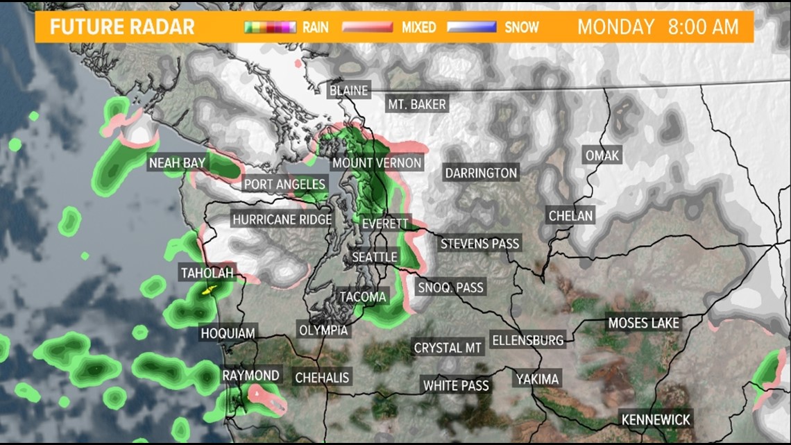
Once the cold front departs the area, our weather is influenced by an upper area of low pressure. This will help drive some chilly air into western Washington Sunday night into Monday morning.
At this point, it will be a race between the cold air and moisture, and the forecast challenge will be whether or not the two overlap.
Right now it does appear some lowland snow down to around 500 feet or potentially lower is possible Sunday night into Monday morning with whatever moisture remains.
Favored areas to see lowland snow are the northern tip of the Olympic Peninsula along Highway 101 and north of Mount Vernon to Blaine where snow is possible along Interstate 5.
Monday morning radar

Beyond Monday morning
The snow levels drop to near sea level later Monday into Tuesday but it appears moisture will be minimal or nonexistent, which would limit the snow potential for other lowland areas. This includes Seattle and Everett. Right now, it appears a rain/snow mixture stays away from these two urban areas but this will continue to be monitored closely so stay tuned as this could change.
Rain, snow and wind forecast
Moisture will be less with this system compared to what we saw on Friday so additional flooding isn't a big concern. The wind will also be significantly lighter meaning additional power outages aren't a big concern over the coming days.
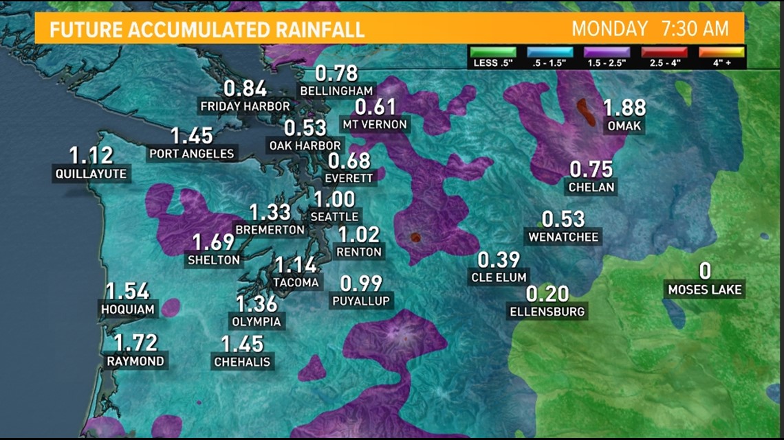
Most areas see around one inch of rain or less from Saturday night through Monday morning.
Rain accumulation forecast

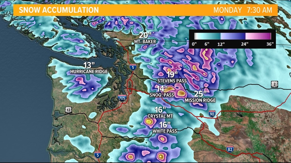
Heavy snow is possible for the Cascades and Olympics. 3-18 inches is expected above 2,000 feet from Saturday into Monday morning.
This will impact Snoqualmie Pass and Stevens Pass where a foot or more of fresh snow is possible.
Snow accumulation forecast

Check pass conditions