David’s Evening Forecast - Mild to ring in the New Year
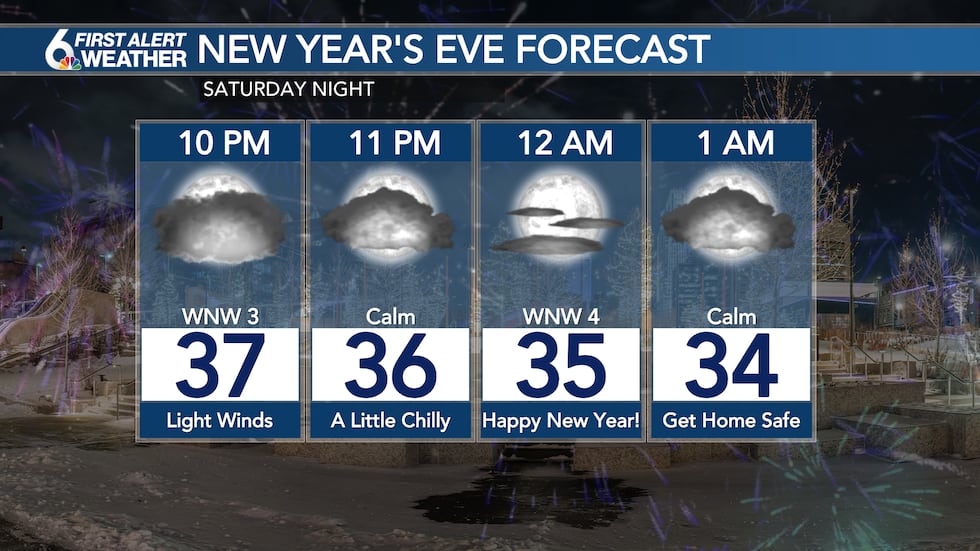
OMAHA, Neb. (WOWT) - Partly sunny skies and a south breeze helped us to end the year on a mild note, temperatures in the mid-40s across the metro this evening. That’s about 10 degrees above average for the end of December. Partly to mostly cloudy skies will stick around this evening along with light winds a dry conditions. Looking quiet weather-wise as we ring in the New Year! A touch chilly, but not bad compared to years past. Temperatures should be in the mid-30s as we cross into 2023. Overnight lows fall to around 30 in the metro with a little patchy fog.
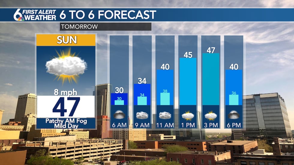
Partly to mostly cloudy skies are expected once again on Sunday. However, the quiet and mild weather will continue with temperatures warming into the 40s by the lunch hour. Afternoon highs should top out in the middle 40s, with some areas close to 50 degrees near and south of Highway 2.
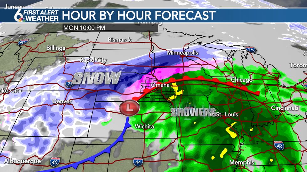
A strong storm system will push into the Midwest on Monday, ending our streak of quiet weather. The storm will intensify across western Kansas and Nebraska, initially ending a surge of somewhat mild air and moisture our direction. This will keep temperatures above freezing in the metro on Monday, with scattered showers developing by the afternoon and evening. More significant winter weather is expected on the cold side of this system, with heavy snow likely in western and northern Nebraska into South Dakota and Minnesota. A wintry mix with some freezing rain and snow is possible in the Norfolk and Tekamah areas, but that wintry mess likely stays north of Omaha.
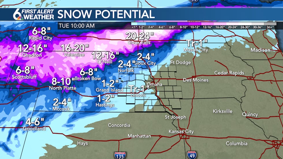
Eventually we should see some light snow wrap around the storm by Tuesday morning, but accumulations look limited for the metro with only minor impacts, if any. The biggest impact will be some breezy conditions and colder weather as temperatures fall into the 30s for Tuesday, dropping into the teens Tuesday night. The more significant impacts will be to our north and west where once again snow totals over a foot could impact portions of I-80 and I-90 potentially creating travel headaches on Monday and Tuesday. After a cold snap Tuesday and Wednesday, temperatures quickly rebound into the 40s for the metro by the end of the week.
Copyright 2022 WOWT. All rights reserved.


