Seattle weather: Dry conditions this week, then a rainy and gusty weekend
SEATTLE - What fantastic conditions Wednesday brought to us.
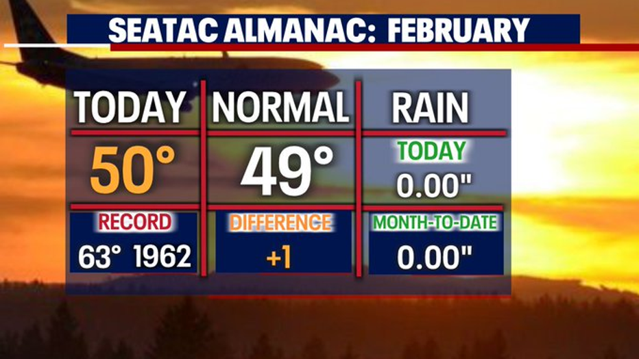
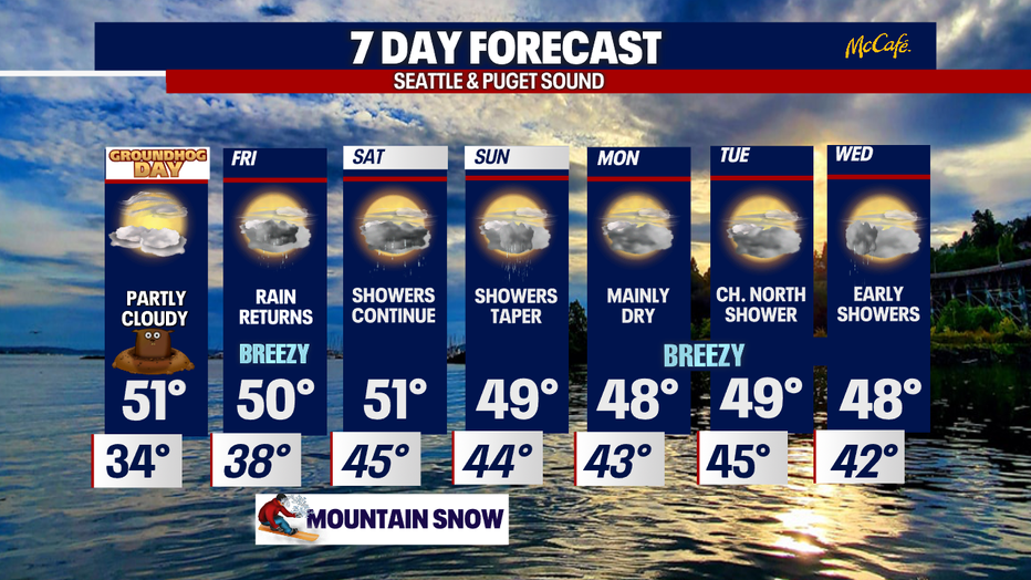
For those of you who suffer from a lack of sunshine you were in luck today! Skies were partly sunny with highs in the upper 40s.
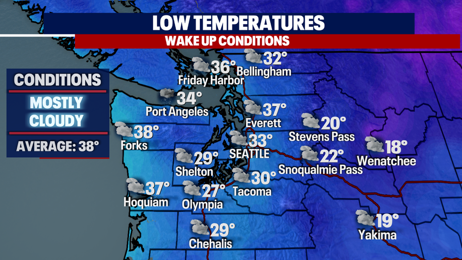
Overnight temperatures are cool to chilly for most with lows dropping into the upper 20s to mid 30s. Look for partly to mostly cloudy skies.
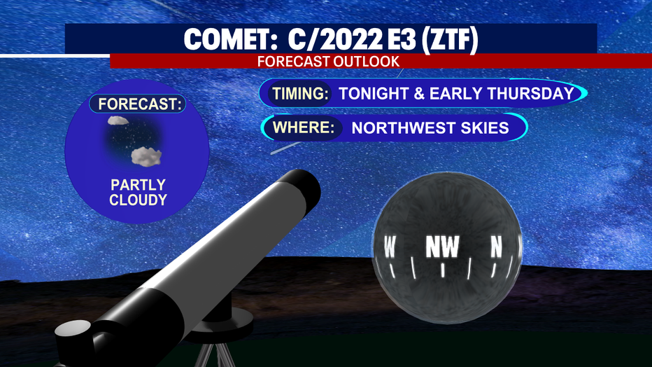
And don't forget about the rare opportunity passing earth overnight—a bright green comet.
Look up to our northwest skies late tonight and very early before sunrise tomorrow for the best chance to spot the comet.
For the record, this light in the sky hasn't been near Earth in 50,000 years, since Neanderthals roamed the world!
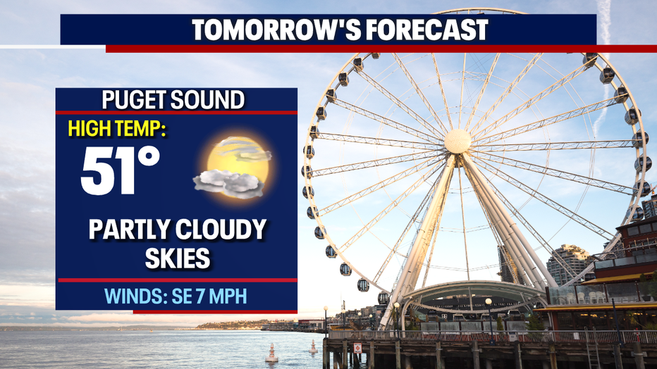
Here's a peek at your Thursday morning commute. Skies are partly cloudy with dry conditions.
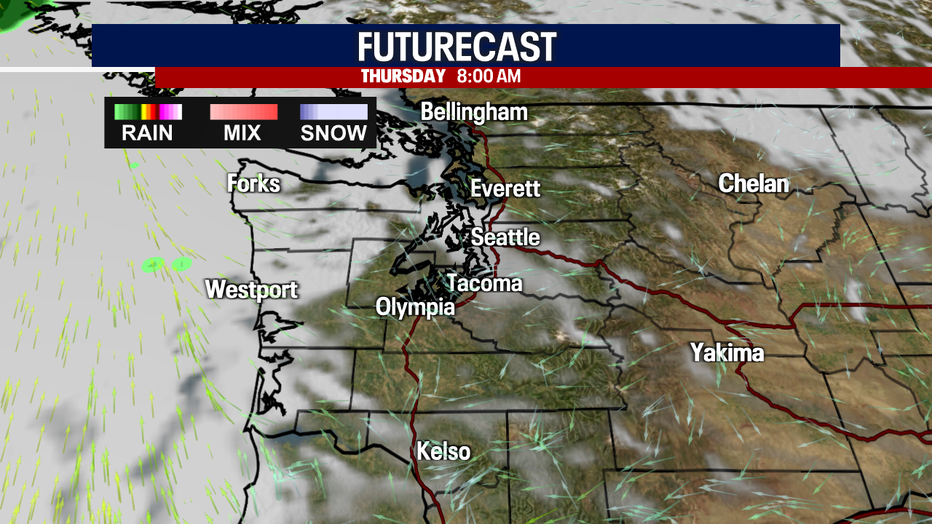
The clearer skies will hang with us through about mid-afternoon before clouding up again. Highs land near average with 51 forecast for Seattle.
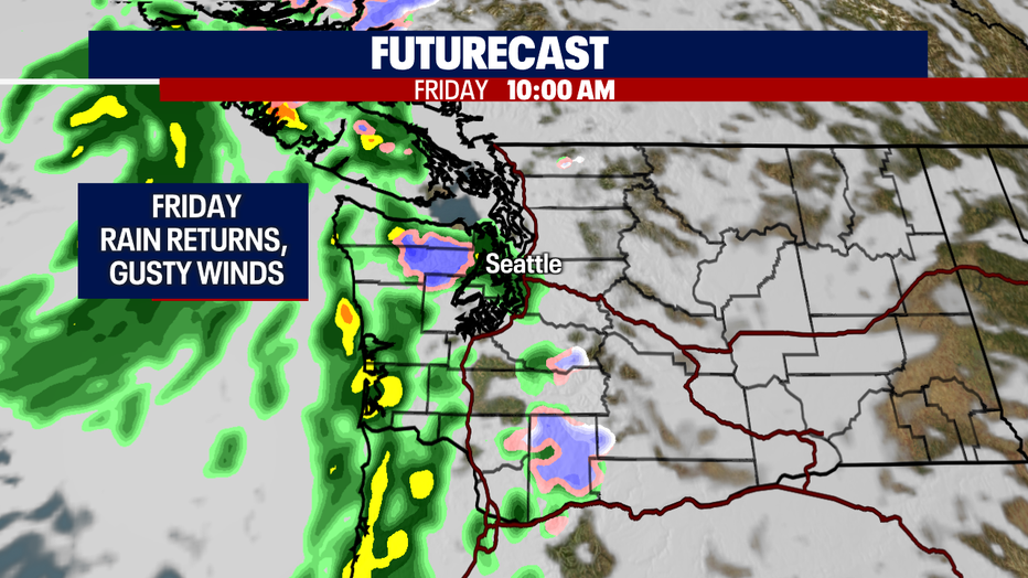
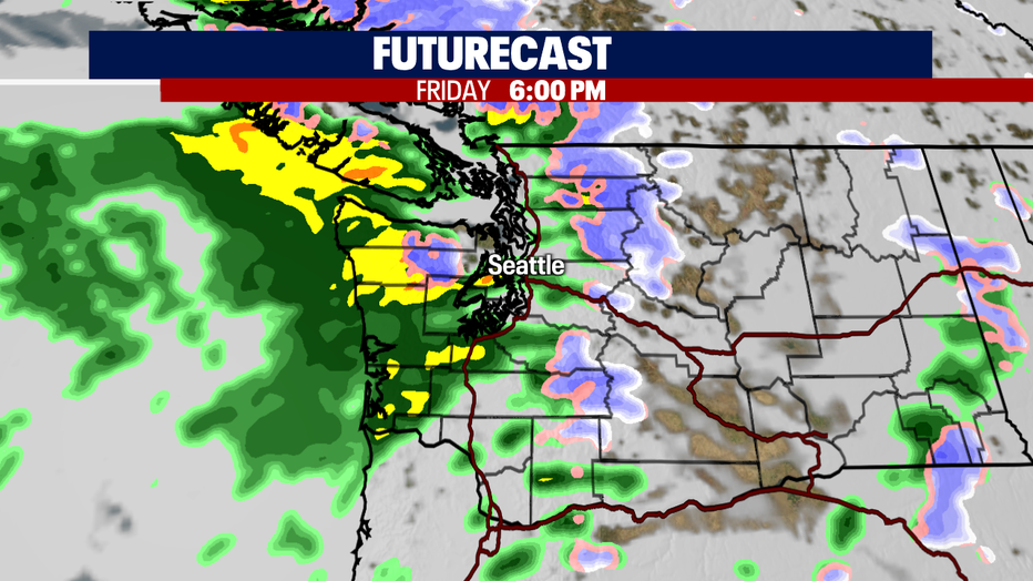
Our dry weather ends as a front approaches Western WA Friday morning. This system will bring an unsettled pattern into the region.
We're forecasting rain just after the morning commute Friday.
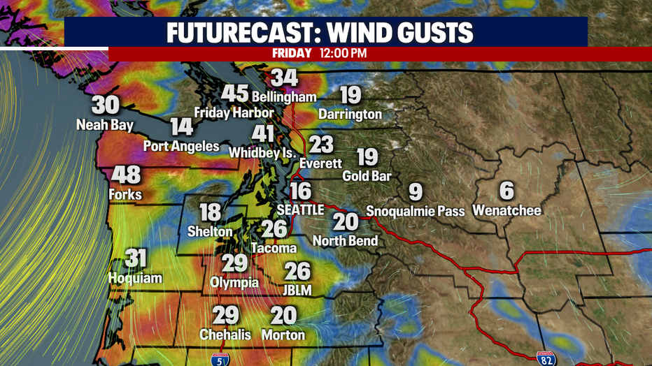
Winds will also start to pick up out of the south as we move through the day. We expect the Coast, Islands, Foothills, and South Sound to experience the strongest winds sustained 15-25mph, gusting to near 30-40mph.
Forecast rain totals Friday land between 0.10" - 0.25" for the lowlands with coastal areas seeing 0.50" - 1.00".
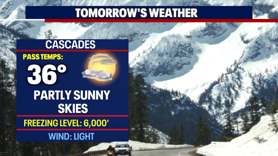
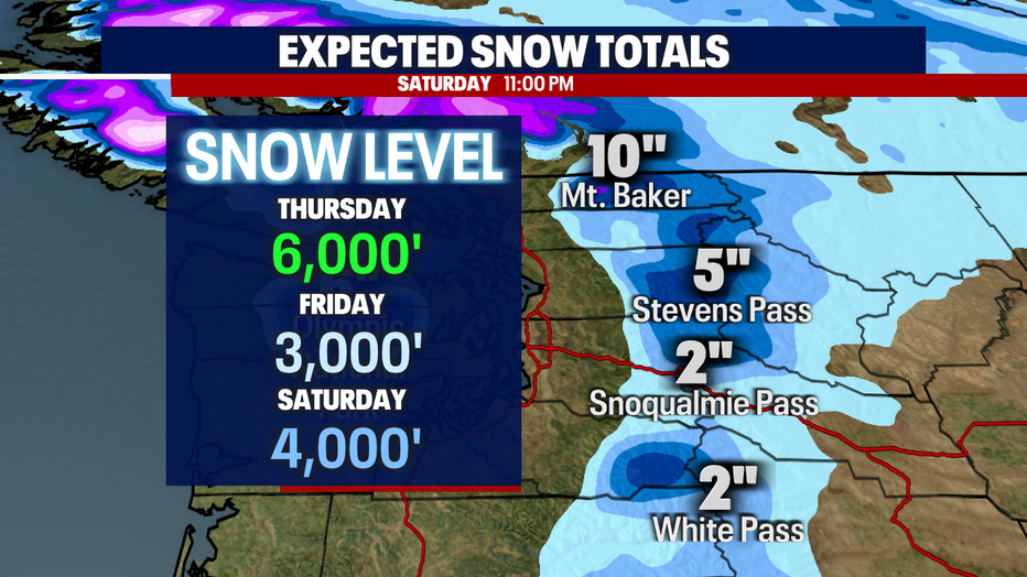
We do expect a nice refresher of snow on the slopes Friday - Sunday. Look for heavier totals to the north (maybe up to 10") with less for the central and southern mountains (2-6").
Next week starts out mainly dry with breezy winds. Highs warm into the upper 40s.
A chance for showers returns late Tuesday into early Wednesday. Enjoy!
Have a great week everyone! ~Erin Mayovsky, FOX 13 Forecaster
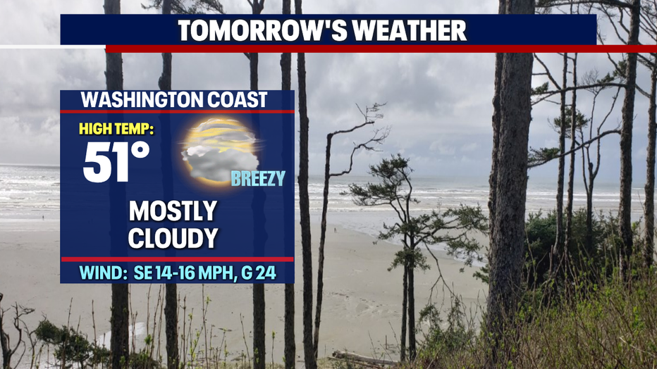
*Coast Forecast
*Mountain Forecast