Live updates: Second wave of storms, tornado threat moves through Oklahoma
Severe thunderstorms and hail developed in Oklahoma Monday evening, spawning several tornado warnings along a line of storms moving across the state.
The National Weather Service in Norman expected severe weather to develop along a dryline and cold front with a maximum windspeed of 60-80 mph and hail up to baseball sizes.
More: What will the weather be like during the solar eclipse? Oklahoma viewers may have trouble
Multiple tornadoes in Oklahoma last night damage Barnsdall, Osage County
At least two tornadoes touched down in northeastern Oklahoma Monday night causing damage in parts of Osage County, according to the National Weather Service.
A spokesperson for the NWS in Tulsa said they've received reports of damage in Barnsdall and Hominy along with areas near Bartlesville.
Many homes and the Barnsdall school building are left without power, causing Barnsdall Public Schools to cancel Tuesday classes.
A crew from NWS will survey the damage on Tuesday to determine an official track and tornado rating.
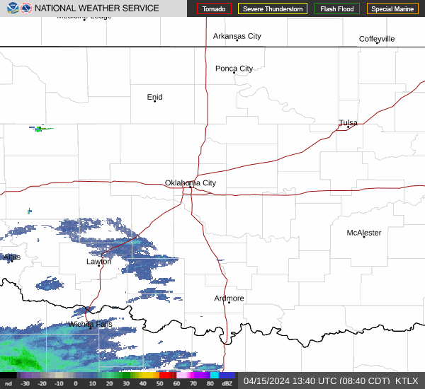
Second wave of storms moving tonight through Lawton, OKC
A second line of thunderstorms has formed ahead of the cold front in southwestern Oklahoma, which could lead to strong wind and hail late into the evening, with a low possibility of tornadoes.
A tornado watch for a section of central Oklahoma from OKC to Ardmore will continue until at least midnight.
Looking ahead this week, the next opportunity for showers and storms (a 50% chance) happens Saturday evening, according to the National Weather Service in Norman.
-Dale Denwalt
Tornado warning in Osage County, north of Tulsa
Local meteorologists are reporting strong circulation from a storm near Barnsdall, which is north of Tulsa and southwest of Bartlesville.
The National Weather Service issued a tornado warning for Osage County until 8 p.m.
Tornado Warning continues for Barnsdall OK, Avant OK and Nelagoney OK until 8:00 PM CDT pic.twitter.com/K4G0YGHDJi
— NWS Tornado (@NWStornado) April 2, 2024
A second round of storms are expected to form in southwest Oklahoma later this evening.
-Dale Denwalt
Tornado warning expires, severe storms still churning
A tornado warning issued for Morrison has expired, according to the National Weather Service in Norman. Several severe storms along and behind the cold front continue moving northeast.
The main threats with these storms are hail and wind.
The NWS office in Tulsa issued a new severe thunderstorm warning for the cells that have moved into central Osage County and Pawnee County. The warning expires at 8 p.m. tonight. The storm is expected to contain 60 mph winds and quarter-size hail.
7:05PM Radar Update: A line of thunderstorms extends along the cold front from Stillwater to Kingfisher to Weatherford. This activity will gradually move into the metro over the next few hours. Stay vigilent!#okwx #texomawx pic.twitter.com/WR1MXJkZUB
— NWS Norman (@NWSNorman) April 2, 2024
-Dale Denwalt
Tornado warning issued north of Stillwater
The NWS has issued a tornado warning near Morrison, north of Stillwater. Monitor live weather broadcasts for the latest information.
-Dale Denwalt
Severe storm spotted west of El Reno moving northeast
A severe-warned thunderstorm has formed west of the Oklahoma City metro, heading northeast at 30 mph.
The storm was spotted near Ft. Cobb Lake, and contains 60 mph wind gusts and half dollar-size hail. The warning is scheduled to expire at 7:15 p.m.
Severe Thunderstorm Warning including Hinton OK, Carnegie OK and Binger OK until 7:15 PM CDT pic.twitter.com/uvxTABWSR5
— NWS Severe Tstorm (@NWSSevereTstorm) April 1, 2024
-Dale Denwalt
Weather alerts: Tornado watch, tornado warnings issued
Live radar Oklahoma weather
Southwest Oklahoma severe storm warning has expired
The National Weather Service has allowed a severe thunderstorm warning for southwestern Oklahoma to expire. A line of storms is forming in western Oklahoma and will be moving across central Oklahoma this evening.
Much of Oklahoma remains under a tornado watch, which means that severe storms can spawn a tornado without much notice.
A severe thunderstorm warning remains active for Noble, Logan, Payne and Garfield County. Wind gusts of 70 miles per hour expected.
-Dale Denwalt
NWS issues severe thunderstorm warning in western Oklahoma
The first of likely several severe storms has formed in northwest of Oklahoma City. The National Weather Service issued a severe thunderstorm warning for Kingfisher and Logan Counties until 6:15 p.m.
The storm is moving northeast at 45 miles per hour and contains hail.
Severe Thunderstorm Warning including Kingfisher OK, Crescent OK and Lovell OK until 6:15 PM CDT pic.twitter.com/2hTAqRt1eE
— NWS Severe Tstorm (@NWSSevereTstorm) April 1, 2024
News9's David Payne is reporting a funnel cloud and possible weak tornado.
-Dale Denwalt
Severe thunderstorm crossing into SW Oklahoma
A severe thunderstorm has crossed the Red River into Oklahoma.
As of 5:20 p.m., the storm is south of Altus moving northeast. The National Weather Service issued a severe thunderstorm warning in advance of the storm.
Additional storms are expected to form in western Oklahoma this evening.
-Dale Denwalt
Tornado watch for OKC, Oklahoma, Texas, Kansas, Missouri
The National Weather Service has issued a tornado watch for much of Oklahoma and parts of northern Texas.
This watch expires at 9:15 p.m.
Another tornado watch for western Missouri and eastern Kansas is in effect until 11 p.m.
Keep an eye out for specific tornado warnings as storms form throughout the afternoon and evening hours.
A tornado watch is issued when conditions are favorable for the development of tornadoes. Watches are usually issued well in advance of the actual occurrence of severe weather.
A tornado watch has been issued for parts of Oklahoma and Texas until 9 PM CDT pic.twitter.com/wt0lQcNeFA
— NWS Tornado (@NWStornado) April 1, 2024
Tornado watch: When a tornado could develop. Watches are usually issued for 4 to 8 hours and typically well in advance of the actual occurrence of severe weather.
Tornado warning: When a tornado is indicated by the weather service radar or sighted by spotters. People in the affected area should seek safe shelter immediately.
More: Tornado watch or tornado warning: Which is worse? What to know about taking shelter
-Dale Denwalt
Are there public tornado shelters in OKC?
No, there are no public tornado shelters in Oklahoma City.
According to the City, this is because of the danger that comes with driving to a shelter during severe weather.
"Many deaths attributable to tornadoes are attributed to being in a vehicle," according to the City of Oklahoma City. "Traffic congestion from hundreds or thousands of other residents trying to get to public shelters could have tragic consequences."
Instead, residents are encouraged to shelter in place.
-Jana Hayes
What is 'gorilla hail?'
You might have seen a new term pop up on social media: gorilla hail.
What does it mean?
Gorilla hail is an imprecise term coined by severe weather storm chaser Reed Timmer to describe very large hailstones. This kind of hail is generated during powerful storms, like the ones forecast for Oklahoma today.
Timmer posted on X, formerly known as Twitter, describing the risk of hail over Oklahoma City and Tulsa, along with other parts of the state.
UPGRADE TO MODERATE RISK for gorilla hail across much of central and northern Oklahoma including OKC and Tulsa. There is also a threat of a strong #tornado or two with this southern mode. A threat of tornadoes still includes much of MO into IL pic.twitter.com/FqigdqkL1d
— Reed Timmer, PhD (@ReedTimmerUSA) April 1, 2024
The National Weather Service forecasted hail up to softball size today.
We sure hope nobody needs to know this today, but just in case... pic.twitter.com/GRNPxY2qRH
— NWS Norman (@NWSNorman) April 1, 2024
-Dale Denwalt
Tornado, severe storm potential increases for central Oklahoma
According to the latest information from NWS Norman, the potential for tornadoes Monday has gone from "low" to "medium," and central Oklahoma's risk of severe storms has increased from enhanced to moderate.
"Now is the time to prepare for possible severe weather this afternoon and evening," the weather service said.
I know it is April Fool's Day but this is no joke. Severe storms will be likely late this afternoon and evening with very large hail, damaging winds, and tornadoes possible. Stay weather aware today, have a plan, and be safe! #okwx #texomawx pic.twitter.com/rrwG2ycfGH
— NWS Norman (@NWSNorman) April 1, 2024
Besides tornadoes, very large hail and damaging winds are possible.
Storms will be moving northeast at 45 to 55 miles per hour, NWS said, and will most likely enter the Oklahoma City area around 5 p.m.
-Jana Hayes
When will severe weather start today in Oklahoma?
The Oklahoma City area is in an enhanced risk zone for severe weather, which is most likely to start from 5-10 p.m.
Areas west of the metro are in a slight or marginal risk with severe weather starting at 4-8 p.m., according to NWS Norman.
Earlier Monday morning, showers and isolated thunderstorms were moving across parts of southwestern Oklahoma, according to NWS.
Showers and isolated thunderstorms are moving across parts of southwestern Oklahoma early this morning. A thunderstorm or two may produce small hail over the next few hours. #okwx #texomawx pic.twitter.com/4c5jGFicPj
— NWS Norman (@NWSNorman) April 1, 2024
More: What will summer weather be like in Oklahoma this year? Here's what Farmers' Almanac predicts
Live Oklahoma power outages map
See live updates on how weather is impacting OGE power.
Closings due to the weather
Keep up with school, church and event closings using the link below.
This article originally appeared on Oklahoman: Live updates: Second tornado threat moving through central Oklahoma
