Oregon Dept. of Forestry sets August 10 meeting in Redmond on new wildfire risk map
SALEM, Ore. (KTVZ) — The Oregon Department of Forestry is holding a series of community information sessions on the new wildfire risk mapping project in Eastern and Central Oregon on Aug. 2, 3 and 10.
Each session will include a presentation about the map’s function and purpose, how wildfire risk is assessed, and how property owners may appeal their assigned risk class. Time will be available to address questions from community members.
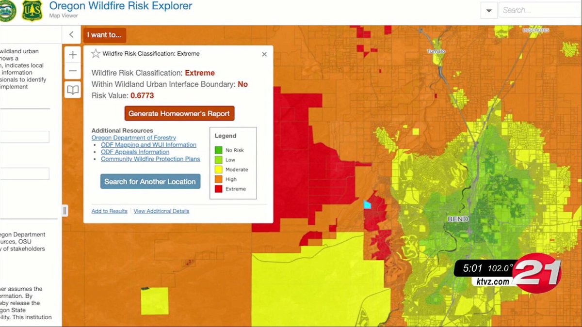
The wildland-urban interface (WUI) and statewide wildfire risk map available through the Oregon Explorer is a tool to help inform decision-making and planning related to mitigating wildfire risk for communities throughout Oregon.
Representatives from Oregon State University who produced the map based on rules adopted by the Board of Forestry will also attend the sessions.
All meetings will start at 7 p.m. Dates and locations for each community meeting are:
- Aug. 2, La Grande— Eastern Oregon University, Lewis Auditorium-Zabel Room 101, One University Blvd.
- Aug. 3, The Dalles—Columbia Gorge Discovery Center, 5000 Discovery Drive
- Aug. 10, Redmond—Deschutes County Fairgrounds, 3800 SW Airport Way
Visit the resources below for more information about the wildfire risk map, the defensible space and building codes currently under development, and wildfire insurance in Oregon:
- ODF Wildfire Risk Map webpage
- Risk assessment appeals information
- Wildfire Risk Map
- OSU Explanation of Wildfire Risk Assessment
- Oregon State Fire Marshal Defensible Space Code
- Division of Financial Regulation (DFR) Wildfire Insurance Resources
- DFR One-Pager on Risk Map and Insurance
- Building Codes Division Wildfire Hazards Information