
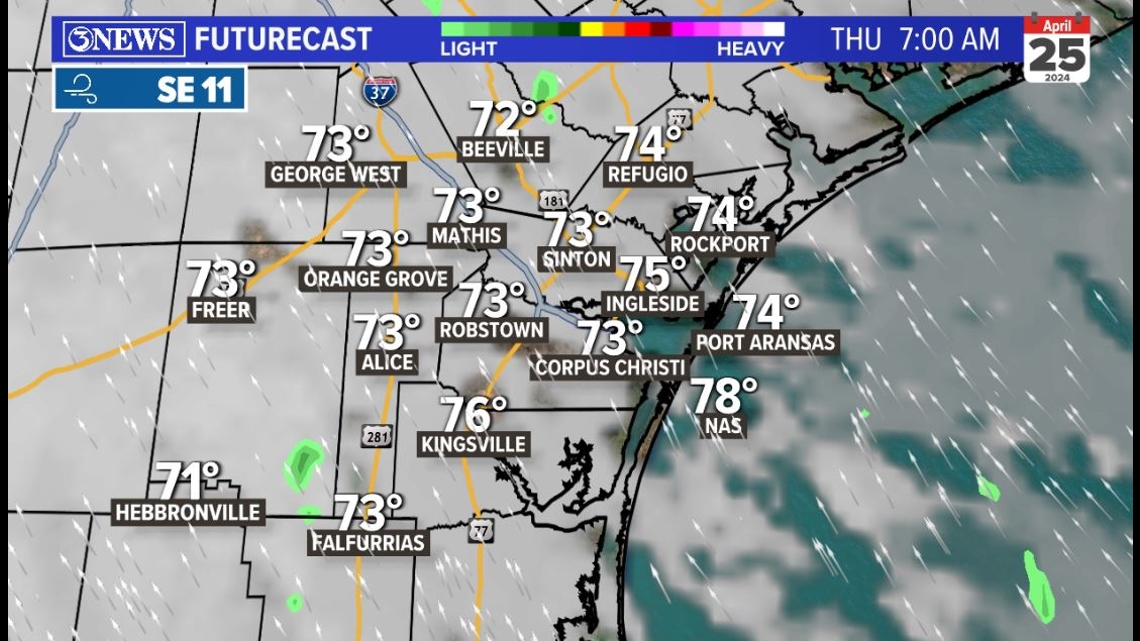
WEDNESDAY NIGHT: Passing clouds with overnight lows in the middle to lower 70s throughout the region. Humidity levels will be sky high with a steady southeasterly breeze at 10-15 mph in place. A stray sprinkle possible.

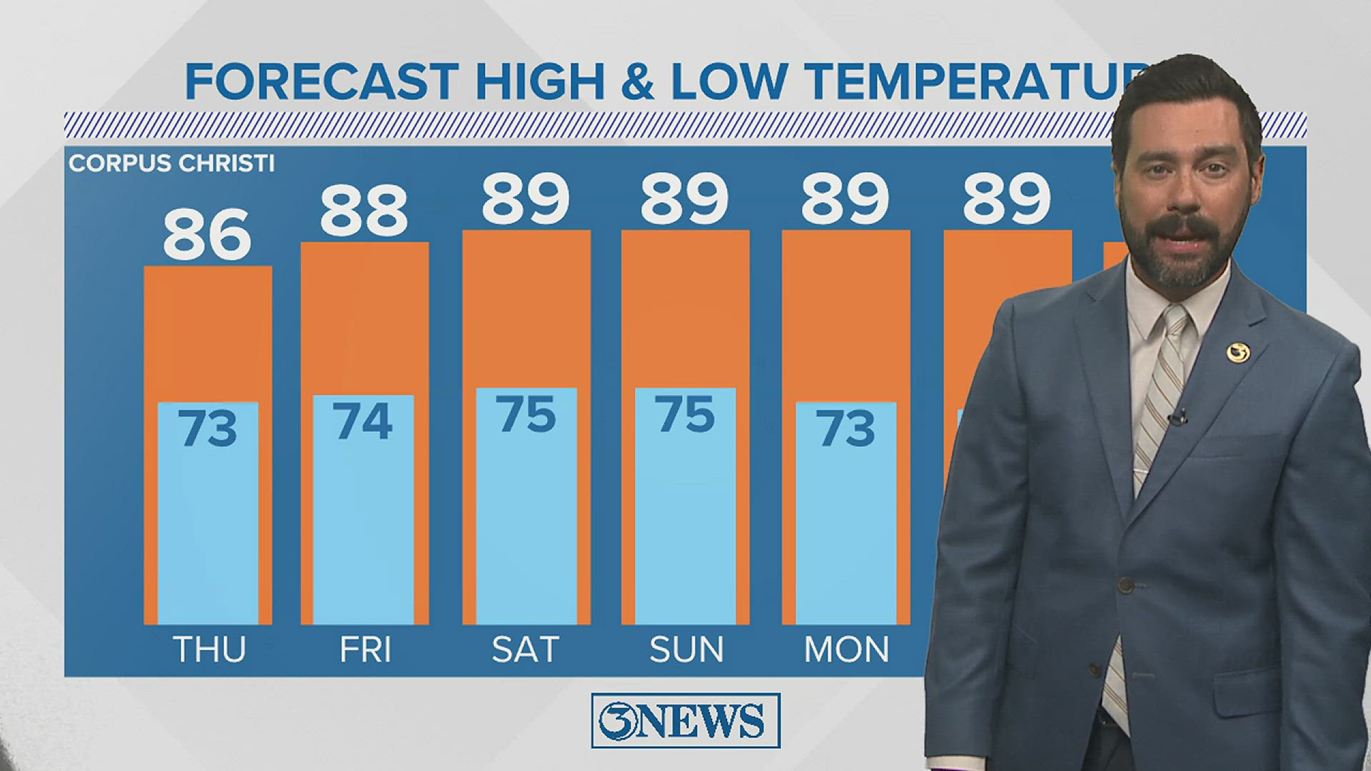
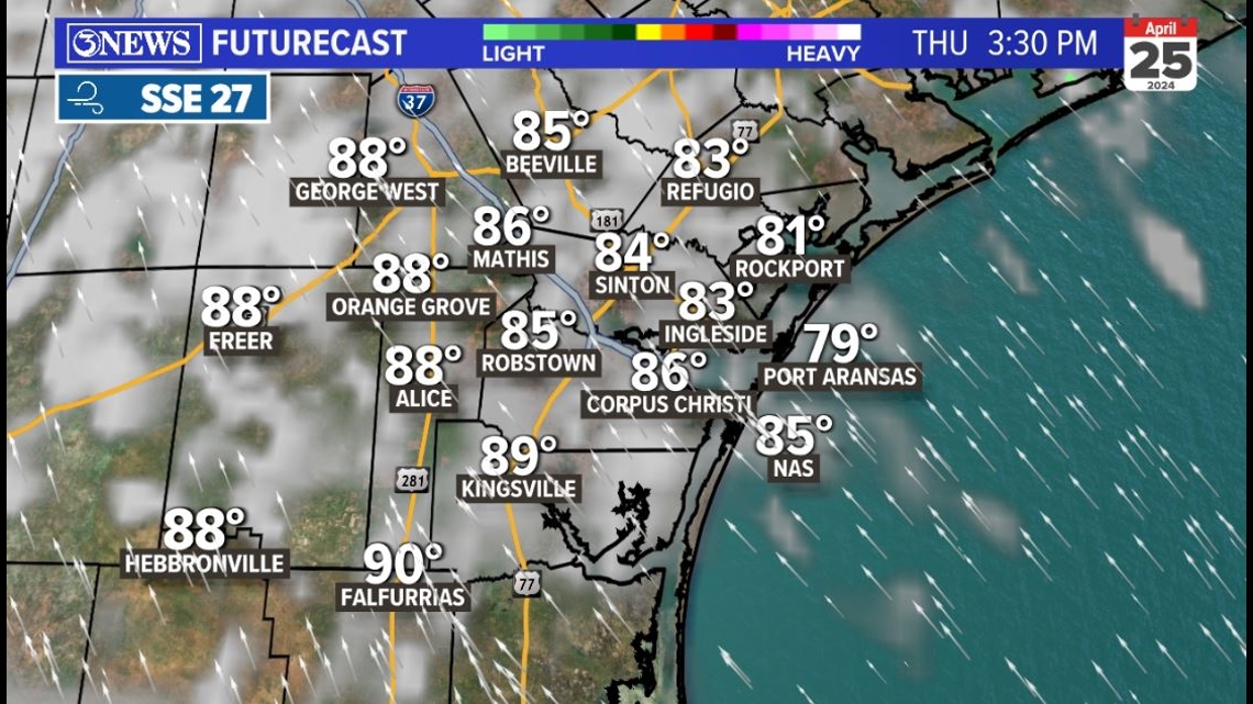
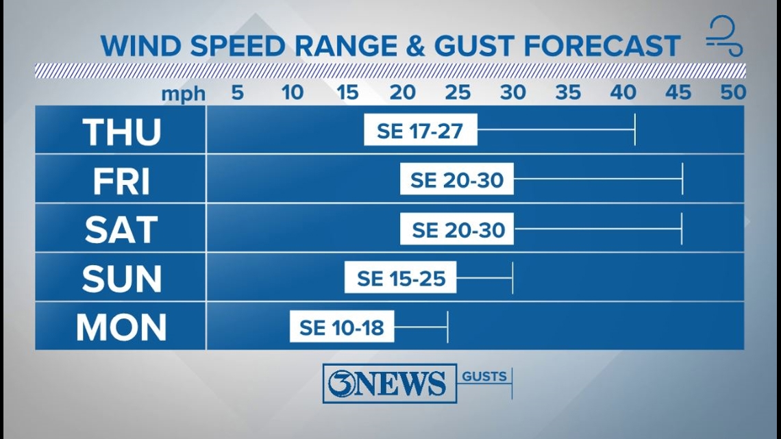
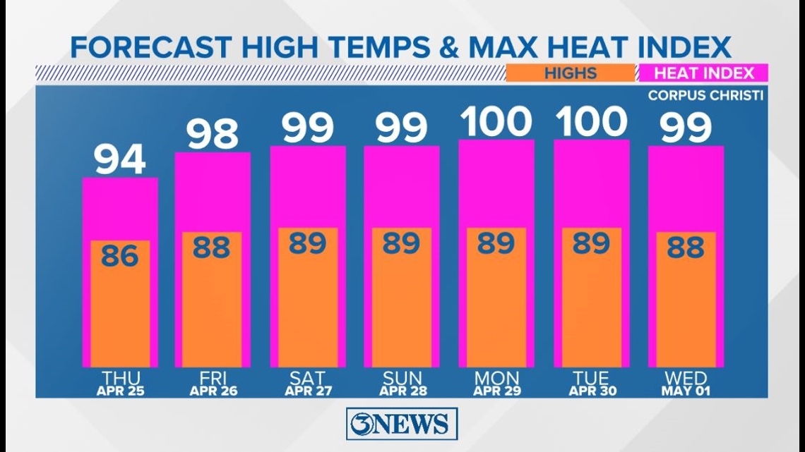
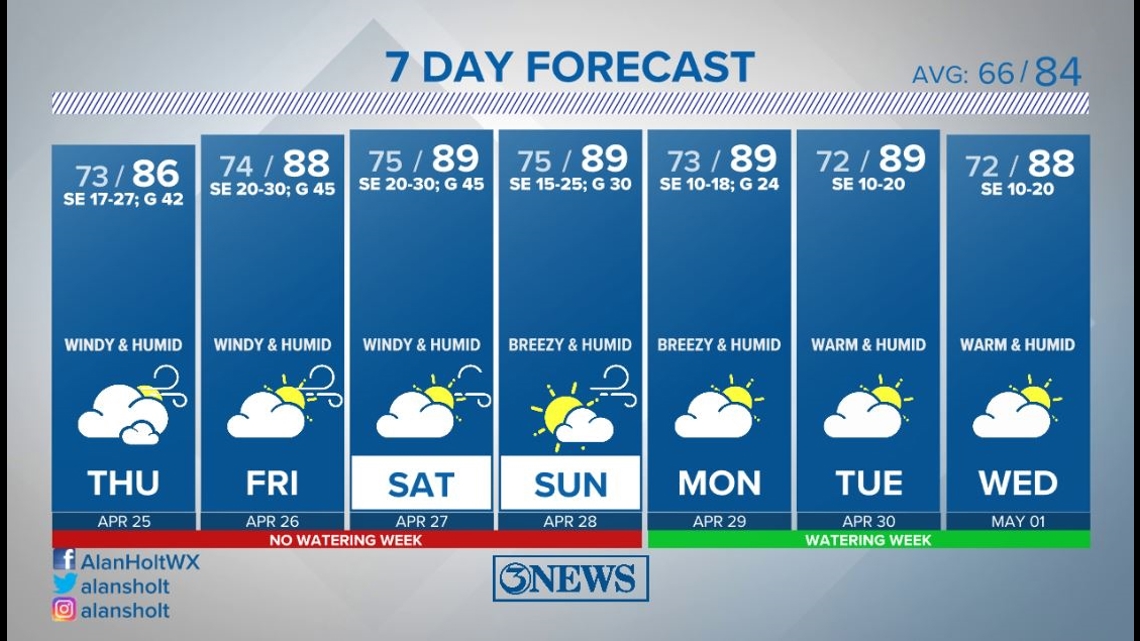
THURSDAY: Southeasterly winds will become stronger at at 17-27 mph with gusts up to around 42 mph. Partly to mostly cloudy skies with high temperatures reaching the middle to upper 80s. Heat index values into the 90s. Humidity levels will resemble early summertime levels.

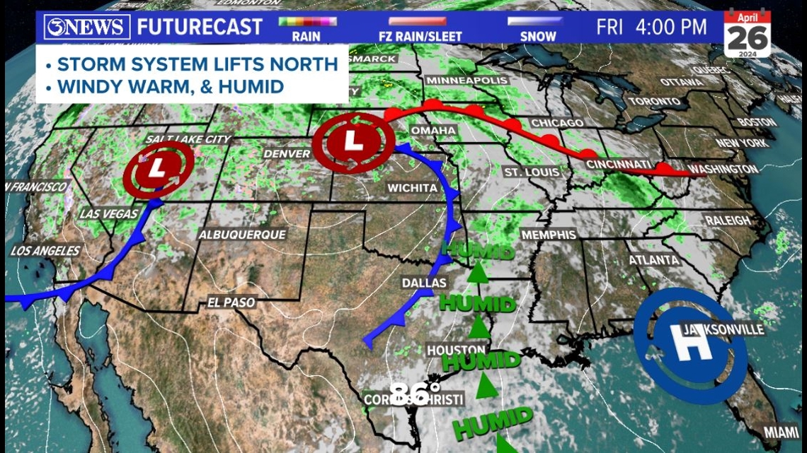
LOOKING AHEAD: Winds will remain strong into Friday and Saturday with gusts continuing to top out between 40 and 45 mph. The strong winds are thanks to storm systems coming off the Rockies, drawing in air from the south. The moisture these systems bring north is the fuel the storms they produce use.

In the Coastal Bend, we will not be receiving any of the cold fronts or storm chances from these systems as they will be tracking to far to the north of here. With that, it'll remain quite humid and warm.

High temperatures will be approaching 90 as we head into the weekend. With the high humidity levels in place, heat index values will likely be in the upper 90s to around 100 for the weekend and early next week. I hope I'm wrong, but we have likely already had our coolest days of weather until after summer ☹


Holt out