
Surely the ghost of John Wesley Powell is out there somewhere, shouting a hurrah for his two new companions in the annals of heroic one-armed geology. When Powell led a three-boat expedition through the Grand Canyon more than a century ago, planets were but fuzzy dots in telescopes and space travel rarely even a dream. But the Civil War veteran, who lost half his right arm at the Battle of Shiloh, would grasp exactly what two NASA rovers and their earthbound handlers have done since January 2004, when the machines alighted on Mars to hunt for signs of ancient water.
In Powell's day geologists puzzled over how water sculpted the pink-hued Colorado Plateau into a canyon maze; their counterparts today wonder about water's role in carving landforms on red-hued Mars. Just as Powell's ragtag company defied expectations in 1869 by surviving nearly a hundred days of savage rapids, the rovers, expected to conk out well before the end of last year, were going strong months later. Powell was a field geologist, cracking rocks and taking notes with his single arm. So too each rover uses its three-jointed arm to wield equipment including a camera and a tool for grinding into Mars rocks.
Rock-breaking brings up the essential reason to muse over these robots and old-timer Powell: ground truth. This is not a casual term among geologists. It evokes the dust-on-boots conclusions that arise from personally grabbing samples of rock, walking formations, and exposing fresh stone. Generations of geologists have placed their literal, bedrock faith in ground truth.
Ground truth gives scientists the confidence to interpret wide stretches of geography seen from afar. Powell climbed mile-high (1.6-kilometer-high) cliffs while scrutinizing their colorfully layered limestone, sandstone, marble, chert, volcanic rock, and gneiss. Once on top he could gaze across tens of miles of canyonland, sketch maps in his notebook, and knowingly label distant strata from their colors and continuities. Similarly, thanks to reports from the six-wheeled rovers exploring two small patches of Mars, researchers can make sense of the sometimes ambiguous images from satellites orbiting high above.
Take the sinuous channels visible on Mars's parched countenance. They so resemble huge, dry riverbeds that flowing water in some long-ago epoch seemed a very good bet. But proof was lacking. Some scientists argued that frigid surges of liquid carbon dioxide might have carved the channels. Others said Mars was never warm enough for more than the briefest pulses of water because it seems to lack the extensive limestone and other carbonate minerals that a warm, carbon-dioxide-rich atmosphere would have left behind. "I spent my career describing water on Mars," says Mike Carr, a geologist at the U.S. Geological Survey in Menlo Park, California. "But we just couldn't find the carbonate. I was starting to tell people my whole career maybe was ashes."
No longer. The rovers, Spirit and Opportunity, have found direct and convincing evidence that water sometimes sloshed across Mars, almost certainly during the planet's earliest epoch well over three billion years ago. Perhaps only puddles, streams, and flash floods came and went, drying repeatedly. But it's looking more and more likely that liquid water was once abundant, though short-lived. Even oceans, however ephemeral, remain a possibility, and on a planet once warmer and wet, life—past or present—is a tantalizing prospect.
The solar-powered robot explorers that have provided this ground truth rarely cover more than the length of a football field between sunrise and sunset. A flesh-and-blood geologist in a spacesuit (sent to Mars at a cost of untold billions) could do in a week what either machine has managed in more than a year. But the rovers are the best stand-ins yet for people on an alien planet. "From the start, we wanted a view with human visual resolution," says Jim Bell, a Cornell University astronomer and lead scientist on each rover's panoramic camera, or Pancam. The Pancam has stereo vision, like people, and its lenses ride at about human height: five feet (1.5 meters) up on a mast rising above a deck of solar panels.
For Larry Soderblom, a geophysicist and planetary specialist with the USGS in Flagstaff, Arizona, the view through those lenses triggers what he calls an enchantment. The detailed images of alien vistas, after one pores over them for days or weeks, commandeer the imagination. In one corner of the brain, says Soderblom, "you start to think and believe that you are actually there."
The scientists who send the rovers their daily marching orders often sound as if they're personally crunching across the red planet's surface, taking pictures, eyeballing sediments, and grinding holes.
"Oh wow, look at that!" exclaimed Steve Squyres as a Mars vista unfolded before him one evening late last year. Squyres, the lean and hyperkinetic planetary geologist at Cornell who heads the brain trust behind Spirit and Opportunity, has been saying wow a lot these days, or, more precisely, these "sols," to use the term for the 24 hour, 39 minute Martian day-night cycles. He wears a watch altered to Mars time. He and fellow rover handlers say things like "yestersol." For the first months of the mission Squyres and dozens of other rover scientists even worked on Mars time in round-the-clock shifts at the mission's headquarters, NASA's Jet Propulsion Laboratory in Pasadena, California.
This evening, ten months after the rovers got down to business, Squyres was back in the Cornell Space Sciences building in Ithaca, New York. About once a day the rovers radio a report home, including digital snapshots and instrument data. Squyres goggled at that day's harvest from Opportunity on an oversize video screen on the wall.
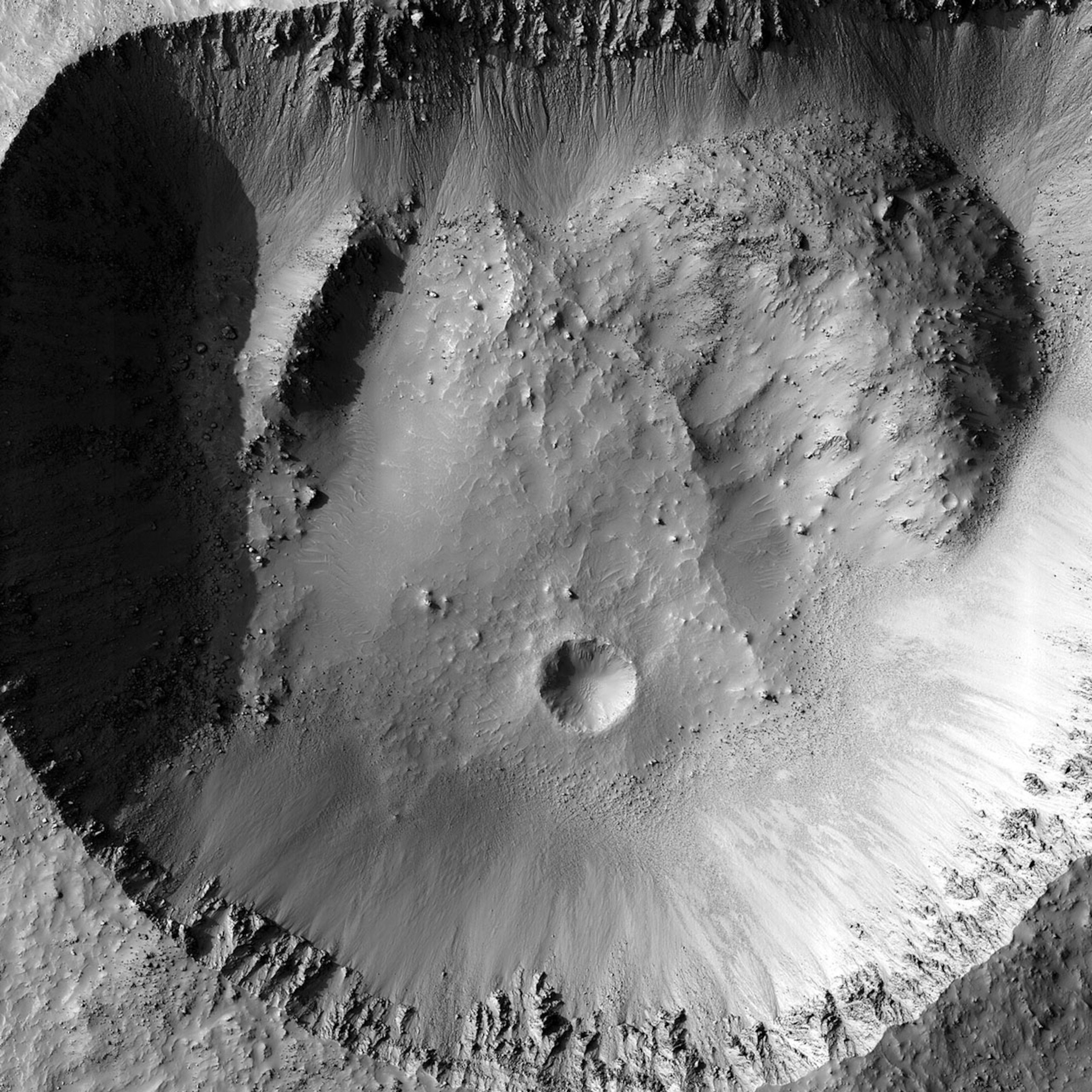
It showed a perfectly framed view from just inside the south lip of Endurance crater, a 430-foot-wide (131-meter-wide) meteorite scar in a vast equatorial plain. The foreground sloped steeply down to the left. To the right the crater's steep rim of blocky, fractured, pale rock curved into the distance. Mission scientists had named it Burns Cliff to honor the late mineralogist Roger Burns, who proposed that water on Mars might have left deposits like those lining the crater rim. A slice of Martian sky arced above.
Squyres couldn't contain himself at the view—a planetary geologist's dream. "Here we are in a crater formed in water-laid sediments, navigating sand drifts. We're there. We're rolling on Mars, and we just keep going. It's way, way beyond what we expected."
The rovers are the fruit of a 16-year quest by Squyres—pursued for the past six years with his deputy principal investigator, Ray Arvidson of Washington University in St. Louis—to put a mobile geological instrument package on Mars. The two men spent endless hours testing prototypes in the deserts of the Southwest. They negotiated bureaucratic labyrinths to convince NASA and its paymasters in Congress to fund the mission. In the end NASA decided to send two rovers instead of one, improving the odds of success and raising the total cost to 850 million dollars.
Finally, at the start of 2004, the rovers reached Mars, along with a small armada of other probes, most taking advantage of an unusual orbital alignment that allowed a short, six-month voyage. Some failed, but a European orbiter called Mars Express arrived safely. So did Spirit and then, three weeks later, Opportunity. After slamming into the atmosphere and descending by parachute, each rover inflated a cushion of air bags, fired a retro-rocket, and free-fell the last 25 feet (7.6 meters) or so to a bouncing, rolling landing. They touched down on opposite sides of Mars, at two very different sites.
From space, Spirit's landing spot in Gusev crater looked like a perfect place to find old lake sediments. The 95-mile-wide (152.9-kilometer-wide) bowl lies 15 degrees south of the equator at the edge of the planet's southern hemisphere highlands. An immense channel empties into it. It has all the signs of being an ancient lake bed.
But after Spirit's January 4 landing, the water hunters' hopes—for example, that Gusev might hold a sea of ancient dried mud—evaporated. The probe gazed upon a rugged, rock-strewn plain. "It was just massive, hard, crisp, basaltic lava," Squyres says. Any lake bed was buried long ago by the lava flows. Spirit's first close look at nearby rocks found only traces of waterborne minerals, hinting that the rocks got damp from time to time but were never steeped in water.
The rover sent home a beguiling but frustrating panorama showing a line of low hills to the southeast. Some 300 feet high, the hills clearly predated the lava flows, which had only lapped against their flank. They might have had a different, wetter history, but they were two miles (three kilometers) off, several times farther than Spirit's expected range. A few days after the landing, Jim Bell looked wistfully at the image of the hills and wondered whether the rover could reach them.
After Spirit checked out a nearby crater named Bonneville, also encrusted in basalt, her bosses sent her across the wilderness. She—the scientists regard both rovers as female—beelined toward the distant range, named the Columbia Hills after the fallen space shuttle. Spirit had a vexing early stumble when a computer memory kept overflowing (fixed when mission control in Pasadena radioed a new program), but now she did not flag. Operators tweaked computerized marching and hazard-avoidance routines to speed the rover across the rocky flat. Some sols she went more than 400 feet (121.9 meters). "We were roaring across the plains as fast as we could go," says Doug Ming of NASA's Johnson Space Center.
On sol 156—in mid-June on Earth—Spirit reached the hills. "It was like another continent," says science team member Larry Crumpler, a geologist at the New Mexico Museum of Natural History and Science. Just short of the hills lay a boulder that the team named Plymouth Rock, marking Spirit's arrival at a promising land.
The Columbia Hills appeared to be built of volcanic ash or meteorite impact debris. But unlike the hard stone of the volcanic plain, these rocks were often soft, almost chalky, yielding easily when Spirit bored into them. Some seemed to be rotting. The texture alone implied that water once percolated through the rock, a conclusion that deepened when Spirit discovered telltale minerals. First she detected gray crystalline hematite, an iron oxide that is often—but not always—the handiwork of water. Then, in December 2004, came the clincher: an iron mineral called goethite, a sure sign of past water. Long ago, these hills were clearly soaking wet.


It was a triumphant find, but Opportunity had trumped it months before. Mission scientists had chosen Opportunity's landing site on a dead-flat equatorial plain known as Meridiani Planum because orbiting spacecraft had detected the infrared signature of gray hematite on a patch of ground hundreds of miles across. While hematite was a surprise at Gusev, here it was the lure all along. On arrival, Opportunity had bounced 220 yards (201.2 meters) across the nearly featureless terrain, then plopped—by pure chance—into an isolated little crater about 65 feet (19.8 meters) wide.
It was a shot celebrated as a 300-million-mile (483-million-kilometer) hole in one almost from the moment the rover turned on its cameras. About 30 feet (9.1 meters) away along the rim of what came to be called Eagle crater was an exposure of pale bedrock. After trundling over to the outcrop, the rover "ratted" into its surfaces (using its diamond-toothed grinder called the RAT, or rock abrasion tool), scanned the freshly exposed rock to identify its minerals and chemical makeup, and scrutinized it with multiple cameras including a microscopic imager. The result is a treasure-house of evidence that this corner of Mars was once drenched.
The porous rock is rich in water-deposited minerals: magnesium sulfates similar to ordinary Epsom salts, bromides, chlorides, and iron-rich compounds. Strewn over the ground or eroding from the rock were gray spheres, from smaller than peppercorns to the size of peas, which soon came to be called "blueberries." The hematite-rich blueberries explain the gray layer seen from orbit, which had attracted the mission planners to Meridiani Planum in the first place. The scientists concluded that all these minerals were left behind when salty groundwater seeped through sand and porous stone.
Best of all, a foot-long (0.3-meter) section of bedrock called Last Chance bore distinctively curved layers. Sedimentologists on the team immediately and jubilantly exclaimed: "Crossbedding!" This can form when running water pushes trains of ripples across a sandy bottom, creating a pattern that is buried and preserved by later sediments. "You can go out to your nearest beach or creek and take a shovel and dig in and see some of these same kinds of structures," says Dave Rubin, a USGS sedimentologist. Another scientist compared the undulations to smiles. And smiles are what they evoked.
In the following months Opportunity found sediments formed or altered by water all around its landing site, particularly in Endurance crater, where they stack up in deposits up to 30 feet (9.1 meters) thick. Nobody can be sure what the ancient water bodies at Meridiani were like. But, inspired by the ground truth from the rovers, scientists are finding clues in images of Mars from orbit and even in odd corners of our own planet.
Satellite images, for example, show that light-colored outcrops extend well beyond the hematite zone that drew mission planners to Meridiani. Before the landings, Brian Hynek of the University of Colorado had doubts about any ancient lake. The outcrops and even the hematite, he thought, could have formed from piles of volcanic ash untouched by water. But then, at Eagle crater, Opportunity found the same pale stuff as in the distant outcrops, along with abundant evidence that water was responsible. If the entire pale expanse is the legacy of water, Hynek now calculates, the wet region could have been as big as Earth's Baltic Sea.
Deep gorges seen from orbit suggest that this bedrock may be 500 yards (457.2 meters) thick in places. Did Meridiani once hold an actual sea, with open water? "You can't tell," says Hynek. "But water was not a local exception, and there was a lot of it."
Marjorie Chan drew a connection all the way from Opportunity's landing site to the canyonlands of southern Utah. Chan, a geologist at the University of Utah, studies the little round rocks that curio shops out West sell as "moqui marbles," after the Hopi Indian belief that they are playthings for the spirits of their ancestors, the moqui. Her group has found that the marbles, strewn by the millions across the Utah red rock, are made of sandstone cemented with ironrich minerals that precipitated from groundwater, such as hematite and goethite.
In 2003, when Chan's team heard that a Mars rover was headed for a hematite-rich landing site, the scientists predicted it might find such marbles there. Their paper still had not appeared when, bingo, the blueberry photos from Mars arrived. "I shrieked," says Brenda Beitler, a grad student. Chan says her first thought was, "Oh my gosh, this stuff we've been thinking about is really true."
They quickly wrote a new paper on the Utah connection to Martian blueberries, which raised an alluring long-shot possibility. Underground bacteria may speed the formation of the Utah marbles, leading to speculation that ancient Martian microbes might have helped cement the blueberries of Meridiani. More important, the years of science Chan's group put in to understand how moqui marbles grow could help Mars experts calculate how much water it took to nurture the blueberries in Meridiani's hollows.
News that the Meridiani minerals include a sulfate compound called jarosite triggered other aha! moments. On Earth, jarosite forms only in wet, acidic settings—in runoff from mines, for example. Johan Varekamp of Wesleyan University in Connecticut realized that the Mars minerals closely match those of a volcanic region he has studied on the Chile-Argentina border, where streams colored bright red by fresh hematite run into an acid lake below a volcano. That setting may not sound friendly to life, but Varekamp notes that despite their high acidity "these terrestrial river and lake fluids are teeming with microbial life."
Acid streams and lakes on Mars would clear a long-standing obstacle to the theory that it had a warm, wet past: the lack of the carbonate minerals that should be left if the planet had a warming blanket of carbon dioxide. Water made acid by sulfur from volcanoes seething on early Mars would explain the puzzle, because acid suppresses carbonate formation.
Jarosite, the mineral that points to an acid environment, also implies that the wet times came to a quick end. If the climate had remained humid for long after the jarosite formed, the mineral would have broken down and would not be found today. The layered sediments at Meridiani may be hundreds of yards thick, but if each layer formed in a cycle of wetting and drying, they could have built up in less than half a million years. That's a mere instant in the 4.5-billion-year history of Mars.
How could the water have disappeared so fast? Where did it go? Maybe some was lost for good when it evaporated and rose high in the atmosphere, where radiation split it into atoms that escaped to space. Some of it remains on Mars, frozen at the poles. And much may be hiding underground, possibly in glaciers buried beneath the dust. Confirmation may come from Europe's Mars Express orbiter. It carries a 130-foot (39.6-meter) antenna that will probe the terrain with radar, looking for water or ice buried up to a mile (1.6 kilometers) beneath the planet's crust.
Mars Express may already have sniffed out indirect evidence for subsurface moisture on Mars: tantalizing hints that methane gas is wafting into the atmosphere. A comet impact or hidden volcanic activity could have released the gas. But methane—called swamp gas on Earth—could conceivably be a sign that Martian microbes survive underground in damp pockets of subsoil.
The rovers themselves have soldiered on, to the surprise of their handlers back on Earth. After an exhausting eight months at JPL, the first four on sleep-disrupting Martian time, the science team had reached its limit. Squyres and the others went home, coordinating their work by phone, computer, and videoconferencing. The rovers were well beyond their anticipated life span by then, and engineer Eddie Tunstel of JPL's Robotic Vehicles Group marveled, "I thought by now something would just lock up."
After a year a few signs of age had set in. The motor in Spirit's right front wheel began to malfunction, then seemed to recover. One instrument on Opportunity succumbed after a winter of extreme cold, down to 170 degrees or so below zero F some nights last October. But both rovers defied predictions that dust buildup on the solar panels would fatally sap power. In fact the rovers got unexpected power boosts when passing Martian whirlwinds dusted off their solar panels. While Spirit continued to follow the story of water in the ridges and dales of the Columbia Hills, Opportunity set out to roam as far as her aging mechanisms could take her.
In December Opportunity left Endurance crater and headed south. Within 200 yards she encountered the wreckage of her own heat shield, which had smacked into the ground after the spacecraft shed it high in the atmosphere. Nearby was another Martian surprise: a metallic, pitted rock the size of a basketball. It was a meteorite, the first to be seen on another planet. "I've told the team we shouldn't linger here long," Squyres joked. "This is clearly the place where large metal objects fall from the sky."
By April Opportunity had ventured two miles (three kilometers) farther south, toward rugged country dubbed the "etched terrain" and thought to consist of sulfate deposits heavily eroded by wind. "Imagine, billions of years of wind eroding the landscape," Squyres says. He wants to explore the exposed bedrock layers and any history of water they preserve.
In the years ahead, even more ambitious missions will follow Spirit and Opportunity. NASA's plans include a new, sharper-eyed orbiter to arrive in 2006, a lander that would dig for near-surface ice close to the north pole in 2008, and another rover mission, the Mars Science Laboratory, in 2009 or later. Likely to be nuclear-powered so that it could operate around the clock, cover long distances, and send a torrent of data almost continuously, this rover (or rovers) would carry an onboard lab that could search for clues to life. The European Space Agency also hopes to add to the traffic on Mars with its own rover, called ExoMars, as early as 2011.
After that things get fuzzier, but in ten years or so both NASA and the Europeans have tentative plans to bring chunks of Martian rock back to Earth. In one NASA concept, an advance party of several rovers would gather samples and load them onto a cargo craft that would bring them back to labs on Earth. And eventually, if society ever decides the cost of a human mission is worth it, people will tread the reddish dust of Mars and search for signs of life with their own hands and eyes.
As for John Wesley Powell, sooner or later his legacy as conqueror of the Grand Canyon will be fully realized on the red planet. Mars has its own canyon, far grander than ours: Valles Marineris, as long as the United States is wide, hundreds of miles across, and six miles (9.7 kilometers) deep. Someday, machines or people—the heirs of the robot geologists now on Mars—will march into that great gorge to gather more ground truth.
Related Topics
You May Also Like


Go Further
Animals
- Octopuses have a lot of secrets. Can you guess 8 of them?
- Animals
- Feature
Octopuses have a lot of secrets. Can you guess 8 of them? - This biologist and her rescue dog help protect bears in the AndesThis biologist and her rescue dog help protect bears in the Andes
- An octopus invited this writer into her tank—and her secret worldAn octopus invited this writer into her tank—and her secret world
- Peace-loving bonobos are more aggressive than we thoughtPeace-loving bonobos are more aggressive than we thought
Environment
- Listen to 30 years of climate change transformed into haunting musicListen to 30 years of climate change transformed into haunting music
- This ancient society tried to stop El Niño—with child sacrificeThis ancient society tried to stop El Niño—with child sacrifice
- U.S. plans to clean its drinking water. What does that mean?U.S. plans to clean its drinking water. What does that mean?
- Food systems: supporting the triangle of food security, Video Story
- Paid Content
Food systems: supporting the triangle of food security - Will we ever solve the mystery of the Mima mounds?Will we ever solve the mystery of the Mima mounds?
History & Culture
- Strange clues in a Maya temple reveal a fiery political dramaStrange clues in a Maya temple reveal a fiery political drama
- How technology is revealing secrets in these ancient scrollsHow technology is revealing secrets in these ancient scrolls
- Pilgrimages aren’t just spiritual anymore. They’re a workout.Pilgrimages aren’t just spiritual anymore. They’re a workout.
- This ancient society tried to stop El Niño—with child sacrificeThis ancient society tried to stop El Niño—with child sacrifice
- This ancient cure was just revived in a lab. Does it work?This ancient cure was just revived in a lab. Does it work?
Science
- The unexpected health benefits of Ozempic and MounjaroThe unexpected health benefits of Ozempic and Mounjaro
- Do you have an inner monologue? Here’s what it reveals about you.Do you have an inner monologue? Here’s what it reveals about you.
- Jupiter’s volcanic moon Io has been erupting for billions of yearsJupiter’s volcanic moon Io has been erupting for billions of years
- This 80-foot-long sea monster was the killer whale of its timeThis 80-foot-long sea monster was the killer whale of its time
Travel
- How to plan an epic summer trip to a national parkHow to plan an epic summer trip to a national park
- This town is the Alps' first European Capital of CultureThis town is the Alps' first European Capital of Culture
- This royal city lies in the shadow of Kuala LumpurThis royal city lies in the shadow of Kuala Lumpur
- This author tells the story of crypto-trading Mongolian nomadsThis author tells the story of crypto-trading Mongolian nomads
