


Over the past two weeks, much of the region has had less than a half-inch of rain. But in just two days, many will get more than double that amount.
The extended time of mild and dry weather ends thanks to a low pressure system running up the coast.
Is this a nor’easter? Yes. That said, “nor’easter” usually conjures up images of blinding snow and whipping winds. This one won’t look like that, although it’ll still bring messy weather.
The main push of moisture takes over during the day Thursday. Plan on a steady, soaking rain by afternoon, lasting into the evening.
As the low moves past Thursday night, it’ll drag in cooler air. Spring snow situations are always tricky, but it appears rain will mix with or change to snow Thursday night across the Capital Region into western Massachusetts. New York City and the Hudson Valley stay warm enough to remain all rain.
Precipitation will gradually taper off Friday night into early Saturday.
Yes, it does snow in April–although we've had little accumulation this month. Amounts have been under an inch except in higher terrain.
Where snow falls, most of the noteworthy accumulation of at least an inch will be in higher elevations, mainly over 1,500 feet. The Berkshires and southern Vermont have the best shot at getting the heaviest snow over six inches, although parts of the Catskills and Adirondacks could pick up a few inches.
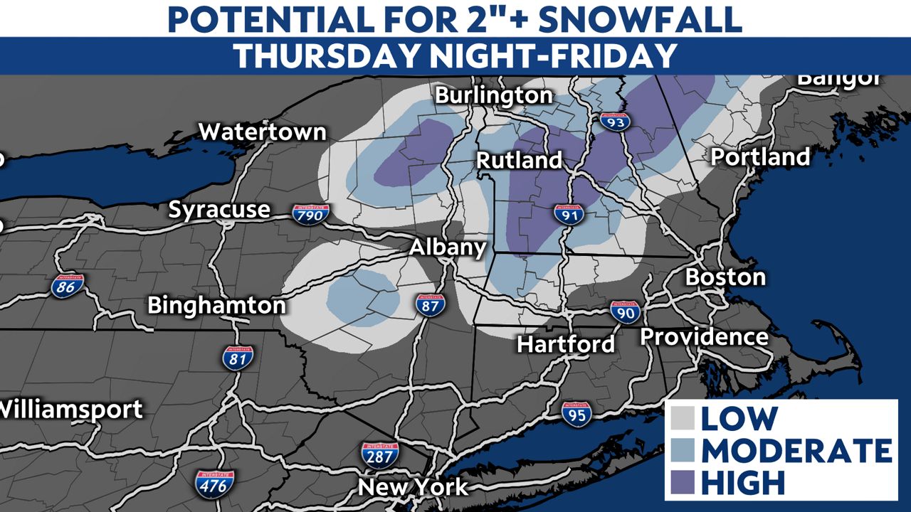
Elsewhere, we'll see a coating at most from the snowfall, mainly on grassy and elevated surfaces. Be mindful that some bridges and overpasses could become slick, even if the main roadways are just wet.
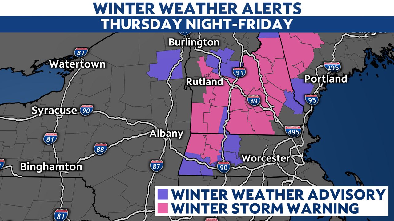
A Winter Storm Warning is in effect for parts of the Berkshires west of I-91 in Massachusetts, along with parts of central and southern Vermont. That's buffered on either side by a Winter Weather Advisory, including western Essex County in New York and areas just west of Worcester in Massachusetts.
Most of us have had less than a half-inch of rain in the past couple of weeks. This system alone will produce widespread rainfall amounts near or over an inch. Much of that falls during the day Thursday.
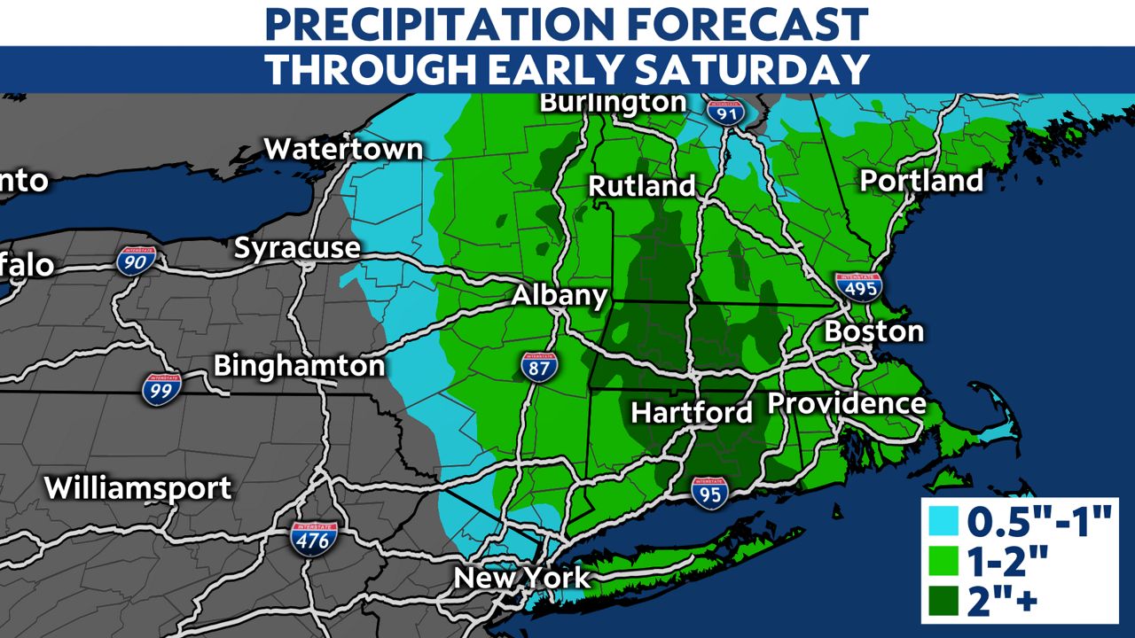
Dry soil will let this seasonably significant rain soak into the ground well. However, plan for ponding on the usual streets and roads. In places where little rain has fallen recently, watch for a hydroplaning risk as the rain begins, since it’ll make the accumulated road grime slick before washing it away.
We’ve gotten used to relatively mild temperatures lately. The past six weeks have featured mostly above-normal temperatures.
This system will bring us a reality check.
High temperatures will drop about 20 degrees from Wednesday to Thursday. Friday will be the coolest day with widespread highs in the 40s, although New York City should make it into the lower 50s.
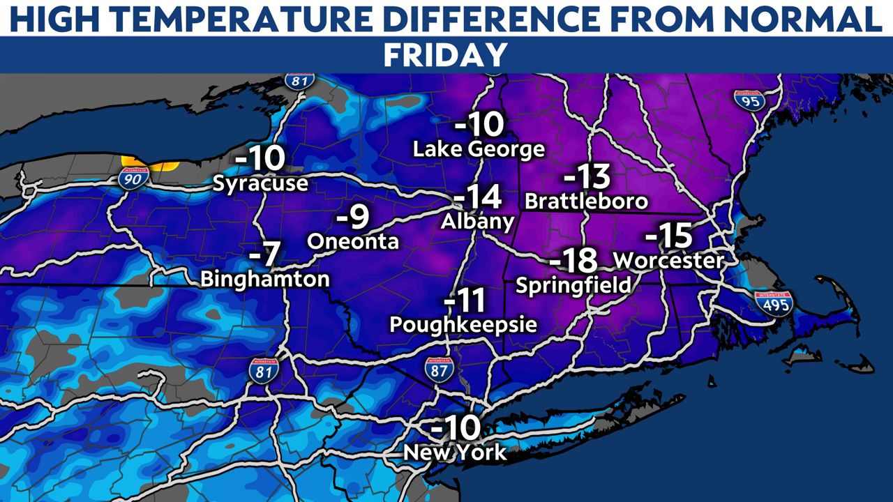
Temperatures that are 5 to 15 degrees below normal last through Saturday, then start to recover on Sunday. 60s return as early as Monday.