LRAPA moves air quality monitor to Oakridge to assess effects of wildfire, stove smoke
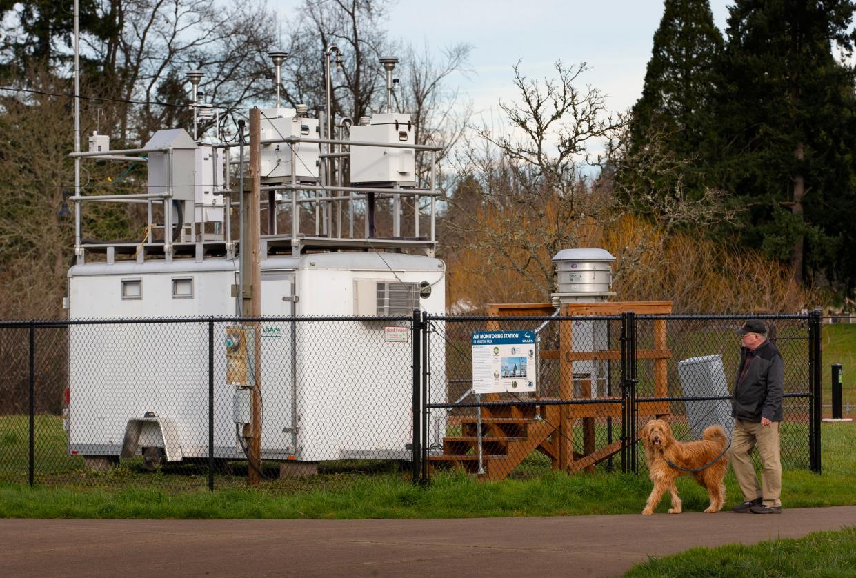
The Lane Regional Air Protection Agency has moved its air quality monitor previously stationed at Amazon Park in Eugene to Oakridge, where it will be used to gather data on pollutants from wildfire and wood-burning stove smoke.
Oregon Department of Environmental Quality funding has allowed LRAPA to operate two air toxics monitoring sites since 2018, one in west Eugene and the other at Amazon Park. LRAPA has decided the Amazon Park monitor can be moved every few years so as to provide short-term air toxics data in areas of interest, it announced in a news release.
Oakridge for years has suffered from air quality issues due to smoke, especially during winter when residents light their wood-burning stoves, which are popular heat sources in the area because it lacks natural gas infrastructure. Oakridge is located in a valley, and smoke from wildfires and stoves has a tendency to accumulate and reduce the area's air quality.
LRAPA and local partners have made strides in correcting the issue. The Oakridge area is soon expected to be removed from the U.S. Environmental Protection Agency's list of areas not in attainment of air quality goals, according to LRAPA.
Read more:Oakridge seeking EPA recognition of improved air quality, but delays may hamper efforts
Air toxic monitoring of smoke sources in Oakridge will create a dataset uninfluenced by industrial emissions seen in more urbanized areas, according to the release. The data will be shared with public partners, such as the Oregon Health Authority and Oregon State University, who will use it to better understand the health impacts of exposure.
“The placement of an air toxics monitor in Oakridge is very good news,” OHA's Environmental Public Health Sector manager Gabriela Goldfarb said in the release. “This monitor will help OHA and researchers better understand how smoke from different sources impacts the community and what actions are needed to protect public health.”
Air toxics are hazardous air pollutants associated with serious health effects such as increased risk of cancer.
“There are multiple locations throughout Lane County we would like to have air toxics data for,” Lance Giles, LRAPA’s air monitoring and data quality coordinator said in a news release. “Oakridge is high on the list, as well as Springfield.”
The specialized air toxic samplers were installed at LRAPA’s already-established monitoring site near the Willamette Activity Center in Oakridge. Sampling occurs on a six-day schedule with Oakridge’s first sample taken July 4.
Sampling will continue in Oakridge through December 2023 before being moved to Springfield. LRAPA will use this time to determine a feasible location in Springfield and prepare a site where the air toxics samplers will be installed.

When choosing a sampling site, LRAPA considers population density, relative toxicity of nearby sources, environmental justice concerns in the community, local topography and the availability of a suitable space for the air quality monitor.
“Finding a multi-year location for our trailer and monitoring equipment is one of our biggest challenges when it comes to setting up a new site,” Giles said in the release. “We place these monitors strategically, but they require basic items like reliable power and adequate security. We also need to enter into an agreement with the landowner to use the space.”
LRAPA publishes all air monitoring data on its website. Visit LRAPA’s air toxics monitoring webpage's yearly data summary webpage and annual reports webpage to learn more about monitoring in Lane County.
Contact reporter Adam Duvernay at aduvernay@registerguard.com. Follow on Twitter @DuvernayOR.
This article originally appeared on Register-Guard: Air quality monitor moves to Oakridge to assess wildfire, stove smoke

