Weather
Snow Possible As NJ Takes More Heat For Weather Response (UPDATE)
UPDATE: NJ officials plan to apply salt to the state's roadways – even as they've taken heat for how they've been reacting to snowfalls.


A quick-hitting storm that will primarily impact the Great Lakes could drop some snow on New Jersey Thursday, according to forecasters. And state officials plan to apply salt to New Jersey roadways – even as they've taken heat lately for how they've been reacting to snowfalls.
The Murphy administration has been criticized recently for what some consider an "overreaction" to snow treatment – and ever since the state Department Transportation's widely regarded lackluster response to a nor'easter last month.
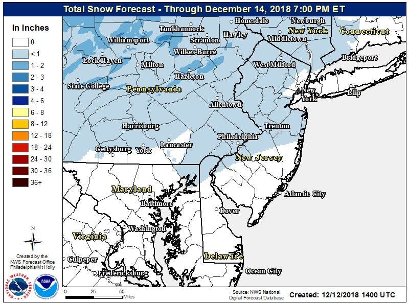
Thursday's precipitation could change to a blend of rain and snow on Thursday morning, and it's expected to impact mainly North Jersey, or anything north of Interstate 195. More rain and snow could impact the evening commute, according to the NWS.
Find out what's happening in Morristownwith free, real-time updates from Patch.
Mairin Bellack of the NJDOT released this statement:
The New Jersey Department of Transportation has received a storm alert forecast for the north and central regions of the state. NJDOT’s forecast calls for a up to a 1 inch accumulation in the north region and ½” to 1” in the central region.
Find out what's happening in Morristownwith free, real-time updates from Patch.
"In addition to its forecast, NJDOT is monitoring other forecasts, and is coordinating with other state and regional transportation agencies to ensure a smooth morning and afternoon commute. This is a clipper storm that should move quickly but will be active during drive times.
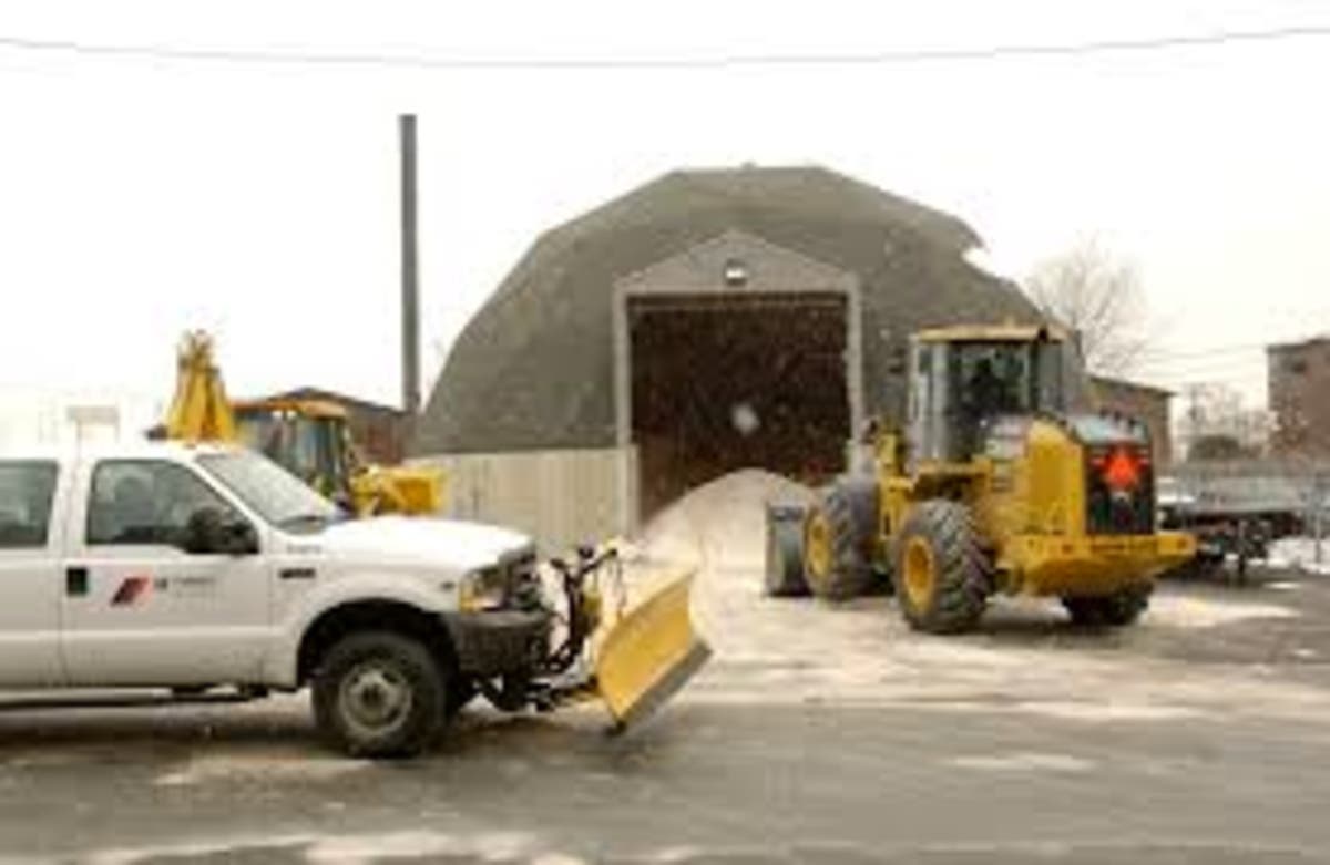
"NJDOT salting equipment will be in use to address any accumulation or slippery road conditions."
Even predictions of light snow from the National Weather Service – much like the forecast for overnight Thursday – have prompted the DOT to salt and brine roads when it may not be necessary. Lawmakers noted that the snow in these cases hasn't even stuck.
Sen. Declan O’Scanlon, R-Monmouth, cautioned the DOT to not overreact to this and other light snow showers, saying the answer is "not to waste obscene amounts of taxpayer money by over-brining roads every time the temperature dips below 40 degrees."
“Now, whenever you go outside on a chilly day, you see government trucks dumping thousands of dollars of resources unnecessarily onto the roads," he said. "Increasing the use of brine wastes funds and exacerbates our already deteriorated roadways.
"It could also adversely impact the environment by increasing salinity. Over-brining could also potentially cause lead to leach into our waterways. Taxpayers are rightfully baffled and furious."
Forecasters were even heckling the state after a recent forecast because the National Weather Service only predicted a very light dusting in Sussex County on that day. No other rain – freezing or otherwise – was predicted in the state.
Read more: NJ Got Big-Time Ready For Snow – Even Though It Barely Snowed
If it does snow, not much will accumulate. Current predictions say there's a chance less than a half inch could accumulate. Drivers should be mindful of icy patches, AccuWeather warns.
No watches or warnings have been issued yet by the National Weather Service, but keep an eye out on the forecast.
Expect a warmup by Friday, when temperatures will hit 50. Then more rain is likely Saturday, with daytime temperatures remaining in the 50s.
-1544635607-4716.jpg)
Here is the forecast:
- Wednesday afternoon: Sunny, with a high near 40. Northwest wind 3 to 6 mph.
- Wednesday night: A slight chance of light snow after 4am. Mostly cloudy, with a low around 27. Calm wind becoming east around 5 mph after midnight. Chance of precipitation is 20%.
- Thursday: A slight chance of rain or snow showers before 1pm, then a chance of rain showers between 1pm and 5pm, then a chance of rain and snow showers after 5pm. Mostly cloudy, with a high near 39. East wind 5 to 7 mph. Chance of precipitation is 30%. New snow accumulation of less than a half inch possible.
- Thursday night: A chance of snow or rain showers before 7pm. Mostly cloudy, with a low around 34. East wind 3 to 5 mph. Chance of precipitation is 30%. Little or no snow accumulation expected.
- Friday: A chance of rain after 1pm. Mostly cloudy, with a high near 49. East wind 3 to 5 mph. Chance of precipitation is 30%. New precipitation amounts of less than a tenth of an inch possible.
- Friday NightRain. Low around 43. Chance of precipitation is 80%. New precipitation amounts between a half and three quarters of an inch possible.
With reporting by Kara Seymour
NJ Transit and NJDOT photos
Get more local news delivered straight to your inbox. Sign up for free Patch newsletters and alerts.


