
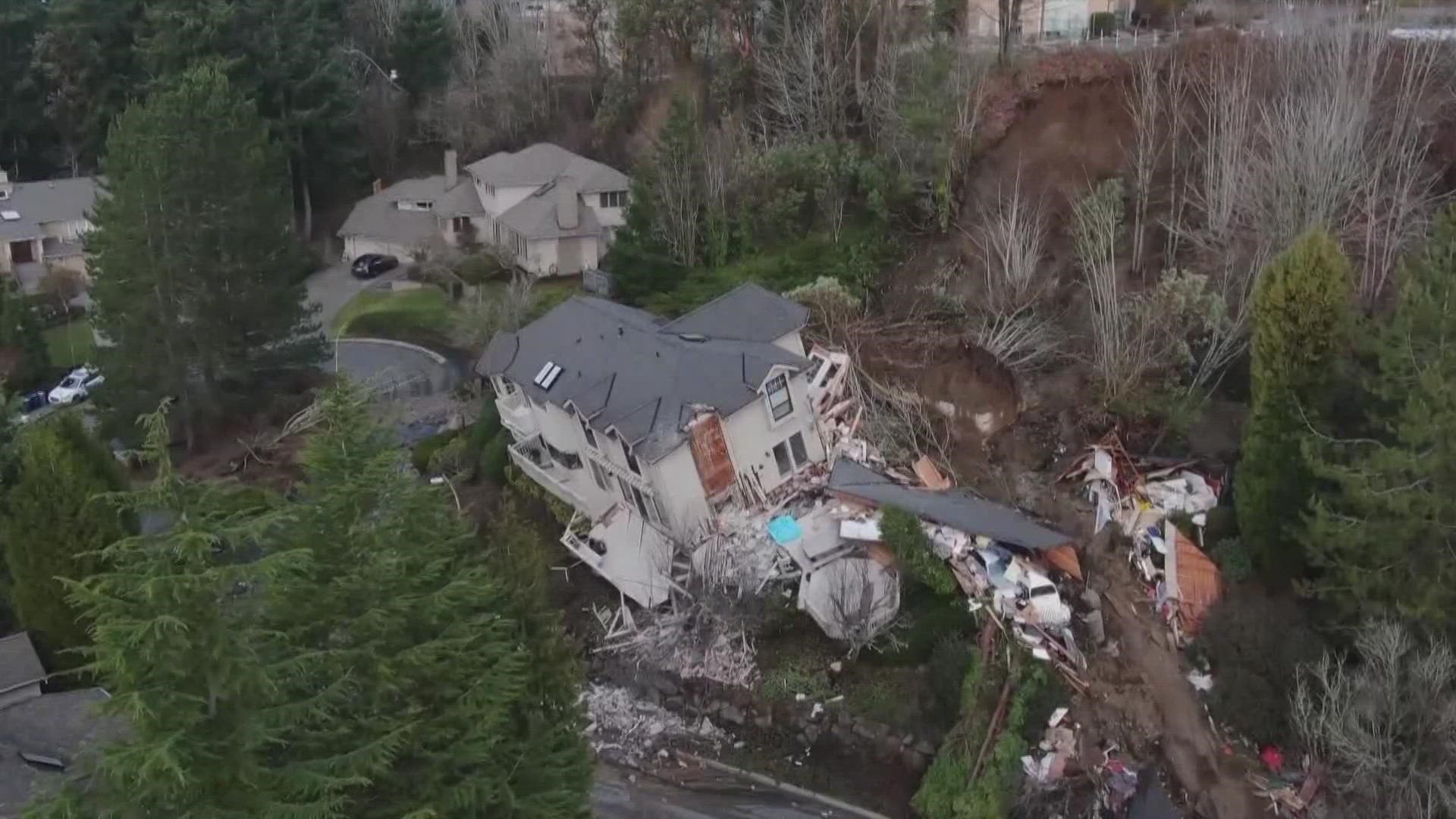
SEATTLE — After two homes recently slid off their foundation, one taking a direct hit from a landslide in Seattle’s Magnolia neighborhood, some residents may be wondering if their home is at risk.
While there’s no telling if a slide will happen, when it will happen or how severe it will be, there are some tools and tips that can tell residents whether or not there’s a chance they could be impacted.
The Washington Department of Natural Resources (DNR) developed a map through the Geologic Information Portal that gives residents an idea of which areas around the state could be susceptible to landslides. Click here to look at the map.
While Pierce County and areas of southwest Washington are the only parts of the region rated for landslide susceptibility, areas typically at the highest risk for landslides are ones that have seen slides in the past.
Looking at the DNR’s map, residents can see even urban areas have experienced landslides in the past, including parts of West Seattle above Alki Beach, areas of Seattle’s Beacon Hill that run along Interstate 5 and parts of Bellevue between Wilburton and Norwood Village, putting them at increased risk.
To the south, Tacoma has many areas that are considered highly susceptible to either deep or shallow slides, including parts of Northeast Tacoma along the Hylebos Waterway and near downtown Tacoma along Commencement Bay.
There are typically hundreds, sometimes thousands, of landslides across Washington state every year, and many of them are not in areas that have experienced slides in the past.
Although it is all but impossible to predict a landslide, there are some warning signs to look out for, including saturated ground, cracks or bulges in the ground and sunken roadbeds.
The U.S. Geological Survey said that the safest areas from landslides are hard, non-jointed bedrock and relatively flat areas.
Homes and structures near sudden slope changes or at the top of ridges can be at an especially high risk of slides.
There are actions people living in landslide-prone areas can take during a slide that could help save their life. Here’s what to do if you’re caught in a landslide:
- Listen for loud or unusual sounds that could indicate an imminent landslide and quickly evacuate or move away from the origin of the slide
- Move inside of a smaller interior area like a bathroom or closet where you can be safely barricaded in
- Open any downhill windows or doors to allow any debris that gets caught inside the building or home to escape
- Avoid any heavy objects or furniture that could move and injure you
- Try to get to a second floor or elevated area to avoid being carried away by the shifting debris