


 TOM LISI | Staff Writer
 Another heavy rain inundated Lancaster County on Thursday, causing the familiar sights of downed trees and flooded roads not even three weeks after the remnants of Hurricane Ida had passed through.
National Weather Service data showed the eastern half of the county got it the worst: Quarryville (3.7 inches), Elizabethtown (3.5 inches) and Columbia (3.3 inches) topped readings in the county. Lancaster Airport saw the least amount of rain, 1.6 inches.
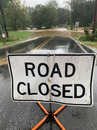
Fallen trees caused road closures in Manor and Elizabeth townships, according to state traffic reports, and at least nine roads were closed Thursday afternoon due to flooding in nearly every corner of the county. Flooding also interrupted evening commutes on Route 501 just north of the Lancaster city limits.
The slow-moving cold front easily soaked the county, where creeks and soil were still recovering from the historic rain three weeks prior. Forecasts from the weather service expected the Conestoga River to crest at 8.3 feet Friday morning. On Sept. 2, following Ida, the river reached 18.5 feet.
A flood advisory remained in effect past 1 p.m.
“The soils in this area still remain saturated, so that's why once we saw this cold front and how slow-moving it was, we were concerned there could be flooding in this area,” said Kristin Kline, hydrologist at the National Weather Service in State College.
Earlier Thursday morning, multiple incidents of minor crashes and disabled vehicles were reported on Lancaster County-Wide Communication's live incident list. Most were minor in scale, according to dispatch reports.
The year’s rain totals have surged past normal levels, but only since the last half of the summer, said Amanda Wagner, meteorologist with the weather service.
In Middletown, where precipitation records date to 1888, that area has seen more than 40 inches of rain so far in 2021, about 7 inches above normal. Lancaster Airport, by comparison, saw a record high of 47 inches of rain in 2018, the most since 1999, when rainfall records started there, Wagner said.
The Conestoga and other waterways in the area will likely remain above normal levels for at least another week, Kline said.
In that same time frame, however, “we should be going into a dryer stretch of weather, giving things a chance to dry out a little bit,” Kline said.


