
Severe risk lessens in Quebec and Ontario to start the week

Tornado-warned storms swept through southwestern Ontario Saturday, and severe storm risk shifted to Quebec for Saturday. As the new week gets started, storm risk remains largely focussed on Quebec and eastern Ontario, though it all presently looks non-severe. Temperature-wise, Ontario's heat and humidity spill over into Quebec to start the week. More details, and a look at the last days of June, below.
MONDAY: STORM THREAT ENCOMPASSES QUEBEC, SPOTTY POTENTIAL IN ONTARIO
The warm, humid weather will continue for southern Ontario, extending into southern Quebec on Monday. Temperatures in the latter will rise slightly, inching closer to the 30-degree mark. The humidity will be sticking around in the aforementioned provinces, with feels-like readings in the low- to mid-30s.
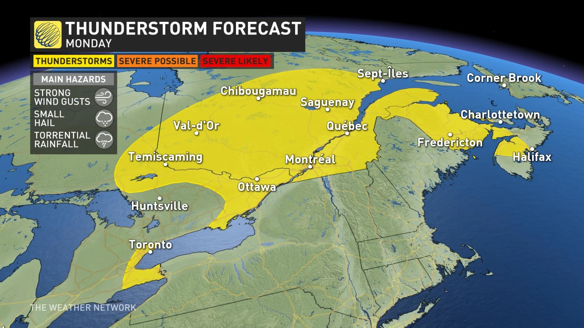
Weather-wise, the heat and humidity fuels some thunderstorm risk in Ontario, but quite sporadic across the province. Pockets in northeastern and eastern sections, and the GTA and Niagara region could see them fire up on Monday afternoon. Any that do generate should remain non-severe, however.
The non-severe risk will be much more widespread in Quebec, encompassing most of the province, extending into the Maritimes, as well. The main hazards with the storms will be torrential rainfall, small hail and strong wind gusts.
LOOK AHEAD: WARM AND FAIR TO START, WITH RAIN CHANCES RETURNING BY TUESDAY
The last week of July would typically see a seasonal high of about 27°C in Toronto. Highs next week for the city should climb into the upper 20s for the start of it, with humidex values well into the 30s during the afternoon hours. However, the warmth will be short-lived.
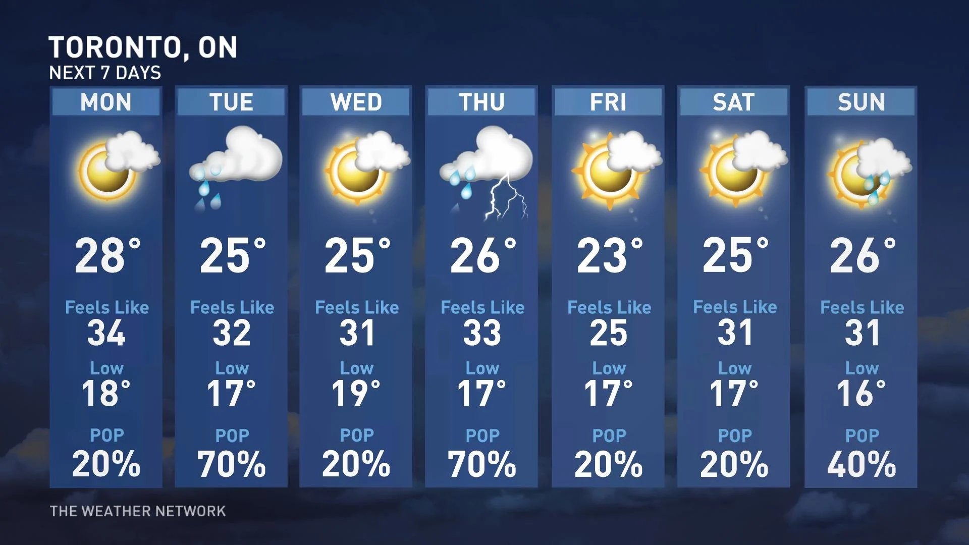
Temperatures are expected to be on the cool side of seasonal late next week and for the Civic Holiday long weekend.
The next widespread chance for widespread showers and storms will return Tuesday night as a cold front approaches and moves across the region. There’s a potential for more storms later in the week.
The comfortable pattern will continue through early August, so we do not expect any prolonged periods of hot weather over the next couple of weeks.
Thumbnail courtesy of Cathy Hynna, taken in Lappe, Ont.
Stay with The Weather Network for the latest forecast across Ontario.