


After five years of gathering geospatial data, officials now have an interactive digital atlas of the main islands of the Federated States of Micronesia.
This atlas makes the FSM states more easily researched than any other islands in the Pacific, including Hawaii, Guam and Fiji, according to a press release from the University of Guam.
The Digital Atlas of Micronesia launched Nov. 1 and is a free and available resource for anyone to use at https://islandatlas.org. It currently includes Yap proper, Chuuk Lagoon, Pohnpei and Kosrae.
The atlas is a collaborative project among the Island Research & Education Initiative, or iREi, a nonprofit organization based in Pohnpei; the FSM Department of Environment, Climate Change, and Emergency Management; and the Water and Environmental Research Institute at the University of Guam, and was funded by the U.S. Geological Survey and the FSM National Government.
"We have gone way above and beyond the initial vision, and we now have, by far, the most comprehensive and versatile 'national' geospatial data repository anywhere in the Pacific islands," said Danko Taboroši, chief editor of the atlas and director of the Island Research & Education Initiative. "IREi and WERI created our first digital atlas for Guam in 2009. What we did for the FSM benefited from that experience and loads of new data and improved technologies over the past 10 years."
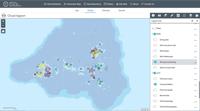
Fishermen wanting to know the boundaries of marine preserves, tourists interested in seeing historical and cultural sites, a contractor needing to bury utility lines, a student needing demographics for a particular set of villages for a project, a diver looking for shipwreck sites, or a biologist wanting to find areas with specific vegetation – it's all searchable on the digital atlas. Users can customize a map for their purposes and then export or print it.
"There's a lot of information contained in this atlas that – if you just have it in text or table form, it's really hard to comprehend, but if you look at these maps and graphics, they really tell a story," said Maria Kottermair, a UOG WERI alumna and geographic information specialist who is co-editor of the atlas. "We discovered and digitized old, hard-to-find maps, information from the population census … we even located and digitized maps from a number of historical documents and master's and Ph.D. theses and produced a range of layers representing the cultural and historical heritage of the FSM."
The digital atlas features nearly 500 predesigned static maps, which can be found in the "Gallery," as well as interactive maps for each island with layers that can be toggled on and off. The optional map layers include:
- cultural sites
- conservation areas
- infrastructure, including quarries, wells and waterlines, and building footprints
- population demographics
- vegetation cover
- rainfall and waterflow
- reef information
- land characteristics, including elevation, slope degree, soil types and geology
"To document this much vetted information in one place – especially for a remote area like Micronesia – is a major feat," said John W. Jenson, director of the Water and Environmental Research Institute at UOG, which helped secure the core funding and provided oversight of the project. "This atlas is an efficient and accessible source of scientifically informed data, and that's the kind of project WERI is always proud to support."
The atlas can be used for a variety of purposes, including sustainable development, effective management of natural resources and infrastructure, emergency response, research, as an education and teaching tool, for general public awareness, and for business. It is designed to be user-friendly and intuitive.
"It's a living project, and we intend to keep updating it as new data become available," Kottermair said. "I encourage everyone to just go to the atlas and explore."
The team will work next on including the outer islands of the FSM in the atlas and to rebuild Guam's digital atlas at hydroguam.net, which Kottermair said has been a popular resource but has become outdated.