Seattle weather: Atmospheric river hits Western Washington Thursday and Friday
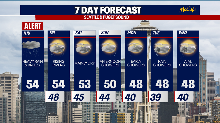
SEATTLE - An atmospheric river is taking aim at the Pacific Northwest Thursday and Friday, bringing heavy rain and gusty wind at times to Western Washington.
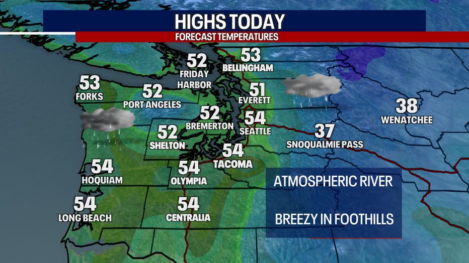
Temperatures will be mild today, making it into the mid 50s. We will be keeping an eye on some of our area rivers prone to flooding during atmospheric river events. The Skokomish River near Potlatch is expected to hit moderate flood stage Thursday afternoon.
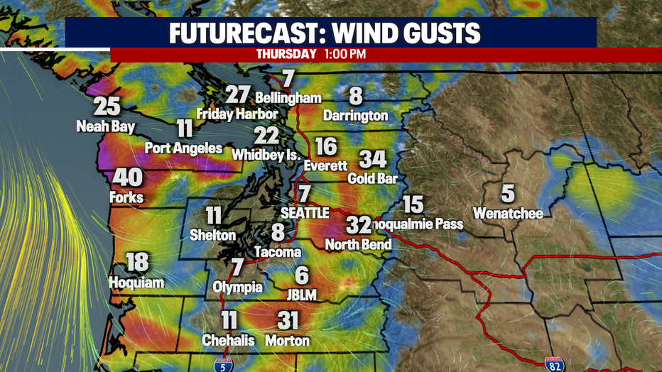
The strongest offshore winds will be on the Washington coast west of the Olympics and in the Cascade gaps. Areas like North Bend and Gold Bar could see gusts between 30-40 mph this afternoon.
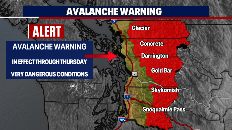
Due to the heavy rainfall, conditions will be unstable in the Cascades. High avalanche danger is expected today from the King County Cascades to the Canadian border.
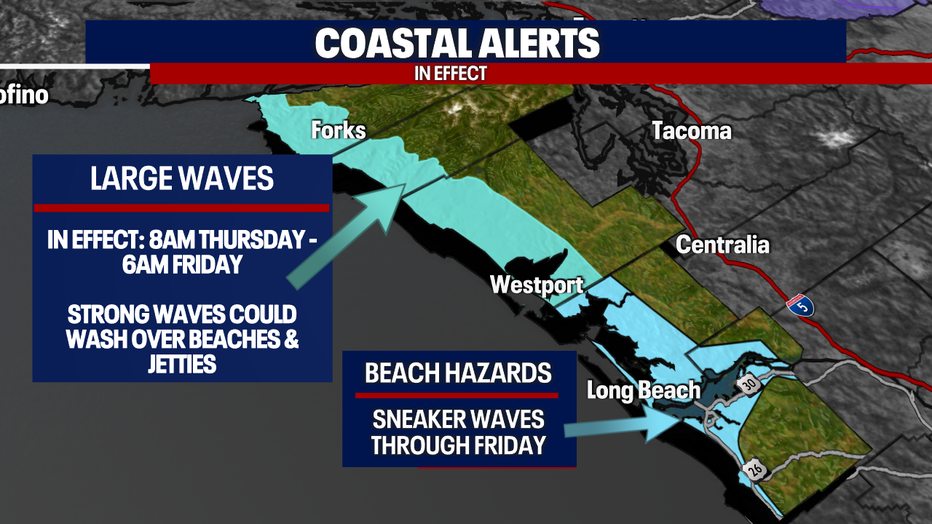
Large waves will also be pounding the Washington Coast Thursday to Friday morning. Today will not be a good day to play on the beach, instead storm watch from a safe distance.
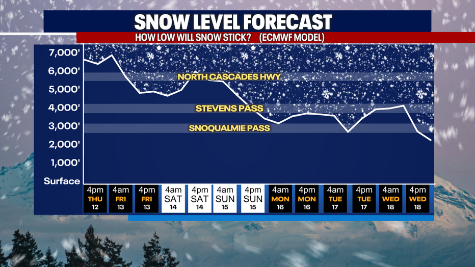
Snow levels will remain above pass levels through the weekend, with a return of pass snow expected early next week.
If you're looking for some dry weather, Saturday looks like our best bet for mainly dry conditions. We will return to a showery pattern starting on Sunday afternoon.