Snow letting us know winter is far from over across Puget Sound
Feb 22, 2023, 7:08 AM | Updated: 11:11 am


If there was any question that it is still winter in our region, this week will make a compelling argument.
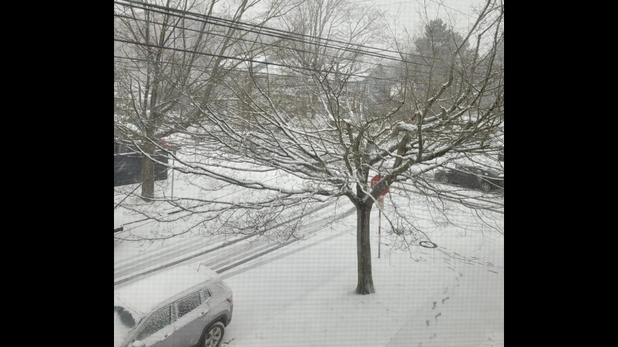
We had a dusting of snow Wednesday morning, especially around northern King and Snohomish counties, according to the National Weather Service in Seattle.
It was just enough to create some problems for people trying to get off suburban hills.
By 8 a.m., downtown Seattle was seeing snow flurries.
In Lake Stevens, they were getting hit with legit snow. Some neighborhoods were reporting an inch or more.
6 AM Radar | A mix of rain and snow showers is over northern King and Snohomish counties for the morning commute. Light accumulations possible. Most roadways (per highway cams) look wet with temperatures in the low to mid 30s. pic.twitter.com/LUPTA0ZtVH
— NWS Seattle (@NWSSeattle) February 22, 2023
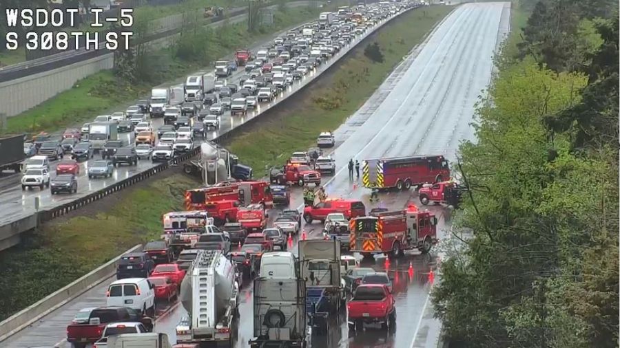
The weather has had an impact on the morning commute.
Jamie Pierce spun out across three lanes of I-5. “I’ll be honest with you, I was pretty panicked,” Jamie told KIRO Newsradio’s Sam Campbell. “I called my friend who lives 20 miles away and I said be my hero and come and get me.”
As for the afternoon commute, KIRO Newsradio meteorologist Ted Buehner said to beware of the dropping temperatures. “With slushy roads and colder temperatures, the highways could ice over this afternoon.”
A part of Pacific Northwest Rail history rolls into Snoqualmie
If you are getting tired of all the cold and wet weather, be thankful you are not in Minnesota this week. They are expected to get hit with one of the worst snowstorms in the state’s history. That’s saying something considering it’s Minnesota.
As for us, KIRO 7 TV meteorologist Nick Allard in the weatherblog:
Cold air is moving in this morning, with strong northeast wind in Whatcom County with gusts around 50 mph. Temps in Bellingham are in the upper-20s with the wind chill reading more like the lower-teens! There is a Wind Advisory for Whatcom and San Juan Counties until early Friday for continued strong northeast wind and gusts around 50 mph. Speaking of the wind, it will help to enhance upslope snow showers in Clallam County and the Olympic Peninsula. We could see around 2-6″ in Port Angeles, at least a few inches at the coast and around 6-10″ of snow in the Olympics. Those areas have a Winter Weather Advisory until tomorrow morning.
The rest of the area will see scattered snow/wet snow or even cold rain showers throughout the day. There could be some minor and spotty very light accumulation, especially Snohomish County and in the Foothills. I really don’t expect much if any accumulation, but since the showers are spotty in nature there could be a brief heavy shower producing a half inch to an inch or so. Highs will warm into the upper-30s and lower-40s for most of the area, but staying around freezing around and closer to Whatcom County. We will see sunbreaks today with some increasing showers later today over areas especially west of Puget Sound. Highs today will be in the mid to upper-30s and lower-40s.
There will be some lingering snow showers overnight, with some flurries tomorrow morning. Thursday will be dry and sunny but breezy, with highs only barely breaking freezing for Seattle, with lows in the teens to low 20s. Friday also looks dry and cold.
Temperatures start to moderate over the weekend as moisture returns, mainly later Saturday and Saturday night. There could be some wet snow and mainly minor accumulation over the weekend before it turns to all rain in the lowlands by Sunday afternoon. Chances of morning wintry mix with later-day rain continue Monday and Tuesday though temperatures moderate with highs in the 40s and lows in the 30s.
KIRO 7 TV meteorologist Nick Allard contributed to this report.