
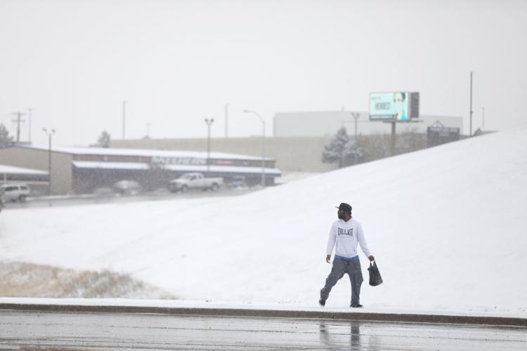
A cold front that began dropping snow over Wyoming on Thursday could bring record-low temperatures this weekend to the Equality State.
The National Weather Service is forecasting that temperatures will plunge into the single digits on Sunday in many parts of Wyoming. If those forecasts hold, they would break record lows.
Thermometers in Casper, for example, are expected to bottom out at minus 4 degrees on Sunday night. The record low for Oct. 25 in Casper is 13 degrees, set in 1997.
Similar record lows could happen in Buffalo (6 degrees), Jackson Hole (6 degrees), Riverton (7 degrees), Lander (6 degrees) and Rock Springs (8 degrees), according to the National Weather Service office in Riverton.
Record cold temperatures are likely Sunday morning and afternoon. #wywx. pic.twitter.com/2nEMdalWwf
— NWS Riverton (@NWSRiverton) October 22, 2020
Even colder conditions were forecast for Monday. The low in Casper could plunge to minus 3, which would break the record of 12 degree set in 2002. Parts of Yellowstone could fall to minus 10 degrees.
People are also reading…
Temperatures this time of year normally rise into the mid 50s and bottom out in the high 20s or low 30s at night.
The winter-like weather began overnight Wednesday, when a cold front moved into northern Wyoming. By Thursday, snow was beginning to pile up in Casper and other cities. Black ice was reported in places along Interstate 25 in central Wyoming, according to the Wyoming Department of Transportation.
More snow is forecast for Saturday, with the largest accumulations expected in northwest Wyoming. Yellowstone and Jackson could get a half foot of snow, the weather service reported.